Distance:  12.6 miles

Start/finish:  Cuffley Station, Station Approach; Parliament Square, Hertford.

Map(s):   Ordnance Survey Explorer maps 174 and 182

Public transport:  Cuffley, Bayford and North Hertford stations are conveniently on the Hertford Line, a 24 mile looped branch line of the East Coast Main Line. www.thetrainline.com > Train Times > Hertford North to Cuffley There are surprisingly regular services throughout the day – even off peak –but check timetable. Centrebus 308 and 380 are very limited daytime services linking Hertford bus station with Bayford, Little Berkhamstead, Newgate Street and Cuffley. Check timetables.  Buses appear to be few and far between..

Pubs/restaurants:

Hertford is home to McMullen brewery so there are plenty of pubs and a large range of restaurants, cafes, tea rooms and shops.

Route description: As the American poet Henry Wadsworth Longfellow wrote: “Into each life some rain must fall.” Perhaps unfair pessimism– or cautious expectation – but this leg is a makeweight let-down, compromised by far too much road walking, a succession of uninspiring woods and few true highlights. Whichever member of the Friends of the Hertfordshire Way who was selected to walk and research this route must have had their work cut out trying to link footpaths, avoid tarmac and blaze a trail across country exploiting the most captivating parts of the largely pastoral and arable landscape – which at times is sporadic though grudgingly picturesque.  However, you do reach more than 300 feet in altitude. The view back from Essendon Cricket Club is clear proof.   Once again the Hertfordshire Way follows a meandering and circuitous route clocking up the 12.6 miles by heading north-west, east, and then north-east en route to Hertford which – as the crow flies – is only six miles from Cuffley!  Walking on a weekday my companion and I met only two dog-owners and a runner, apart from the villages and the golf club.  This leg has the feel of filling the gap between A and B but it has its moments. Emerging from the shadows and a perimeter field path into the garden of the delightful Candlestick pub in the hamlet of West End, the wild grass fields and meadows beyond Little Berkhamsted and the cool and easy walking of the native deciduous woodland just before Bayford. Not a classic but another curate’s egg. Tick it off and you’ll be rewarded by better things to come.

From Cuffley station car park turn right and then first right into Tolmers Road.  (There is a shortcut via the station concourse and a tunnel). If you want to discover where the monied City hedge fund managers come home to, Tolmers Road is an eye-opener.  Stunning, bespoke designed, super-sized homes and mansions line the road – many architecturally striking and most of them palatial examples of “how the other half live.” The properties are a fascinating backdrop to what is otherwise a dreary mile long walk until the long-awaited entrance to Home Wood (below left). On the right is the 70 acre Tolmers Scout Camp and Activity Centre with room for 5,000 pitches. It was formerly part of Tolmers Park, a Grade II listed mansion and estate, the conspicuous white-painted landmark on the hill overlooking Cuffley.

With a fence on your right walk through Home Wood (below left) to reach a metal gate.  Turn right and walk half a mile up Carbone Hill – there are no pavements and it is an uncomfortably busy road – to the T-junction at Newgate Street with the Coach and Horses inn (below right) in front of you.

Turn left at the mini roundabout and pass in front of the church of St Mary Ponsbourne.

The church, although it hints at an ancient past, was built in 1848 from Bath stone. It was originally known as St Mary’s Tolmers.  The churche was enlarged in 1858 when the present Walker pip organ and the tower with the steeple were added.

At a fork in the road take the left hand turning into New Park Road. Opposite is the equally attractive pub The Crown (below). For a village of around 400 residents to have two traditional historic inns seems a little greedy!  Unless you live there of course.

Follow New Park Road, past the football ground, until you reach a wide track at New Park Farm (below left). Continue for two thirds of a mile alongside huge fields of arable crops that stretch into the distance (see below right).  The track veers right to emerge in Tylers Causeway. Turn left, cross the road and then almost immediately right into the wonderfully named Cucumber Lane.

After a third of a mile a bridleway appears on the left leading you into Nine Acre Wood (below left) which is scarred by an ugly metal fence providing wider access to native deciduous woodland (below left).  Continue walking on a clear path amid trees, bushes and shrubs as the wood narrows.  The path – which is named on maps as Hornbeam Lane – continues through a narrowing stretch of woodland to emerge between the impressive Warrenwood Park manor and the neighbouring stud.  Having complained about the route being devalued by too much tarmac and road walking the 250 yards down Hornbeam Lane is a novelty.  As it is entirely block paving!!!!  Some diligent and patient soul must have faultlessly laid tens of thousands of blocks.  And at what cost? Never on the Hertfordshire Way will you discover more artistic and pristine ground under foot (below right).

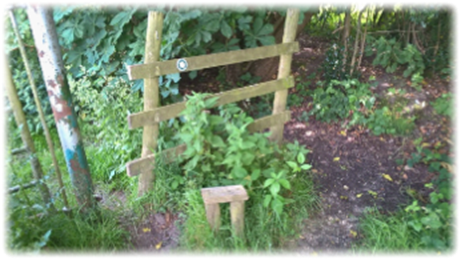
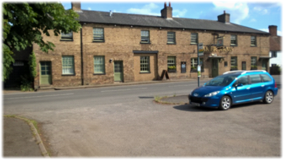
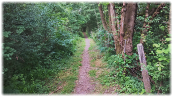
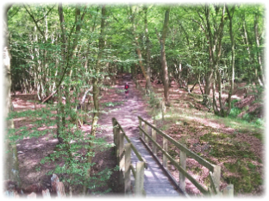
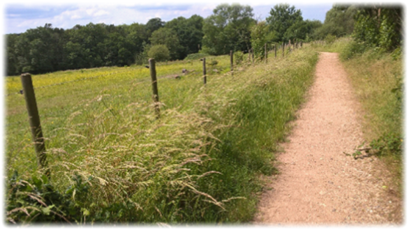
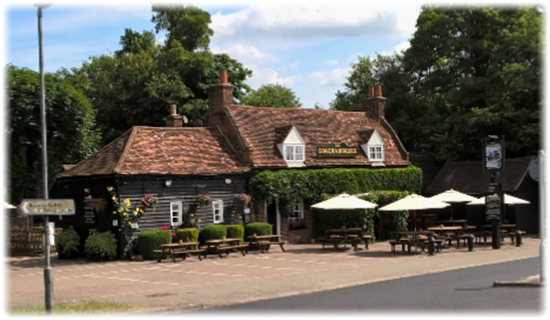
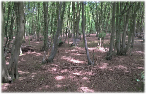
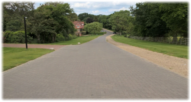
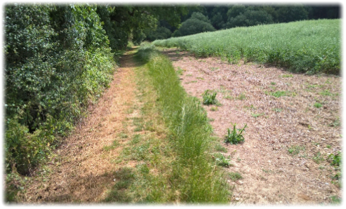
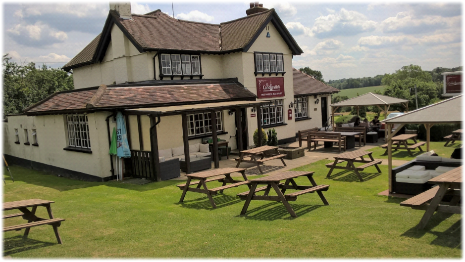
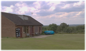
At the end of Hornbeam Lane cross over the bizarrely named Cum Cum Hill into a private drive opposite. Walk past houses to a gate and some farm buildings and turn right behind a shed slowly dropping down through Duncan’s Wood to emerge on an open track.  Continue straight on to a waymark post – watch closely for the tell-tale roundels as the route switches between field and woodland en route to The Candlestick pub – turn left (watch for this turning) and follow the gravelly Essendon Brook through cool woodland.  Cross a bridge and head left as the path climbs with fields on the left and a large hedge on the right (see left) to a kissing gate. Turn right and continue to another waymark post which sends you left through a kissing gate and along another perimeter path skirting arable fields to pop out in the garden of the sublimely secluded pub in the hamlet of West End.  This is the first chance of refreshment since leaving Cuffley – unless you left late and didn’t get any further than Newgate Street – and The Candlestick Inn is the perfect spot to quench your thirst and have a bite to eat.  It is a glorious setting with superb views to the south.  Having eulogised profusely about the charming John Bunyan pub at Coleman Green in Leg 4 – arguing its out-of-the-way location and undisturbed self-assured air made it incomparable on the whole 195 mile journey – The Candlestick, on a sapping sweltering Friday morning when we ambled into its grounds, is a supreme runner-up if not John Bunyan’s equal.

A post on the front lawn includes a Hertfordshire Way sign sending you right along West End Lane for 300 yards until you reach a grass triangle – with another sign – pointing to a byway between two houses.  Continue for about half a mile and pick up a path on the left to drop down alongside another arable field to a bridge.  At this point my walking companion and I were convinced we were retracing our steps down a path which we had already tackled coming the other way en route to The Candlestick.. The map wasn’t helpful.  It all looked the same.  And in the official guide it did indeed seem as if we were completing the third side of a triangle.    If it wasn’t for a group of fellow ramblers en route to the pub who described the way they had just come – clearly a route we yet had to experience – we could still be standing perplexed alongside a vast expanse of crops which we found equally baffling to identify. Cross the bridge in the corner of the field, bear left and follow the track uphill under a canopy of trees.  Ignore a kissing gate and grass trodden footpath across a field on the left. Simply continue on to appear alongside the cricket pavilion and pitch in Essendon (below).

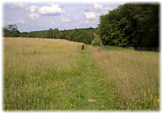
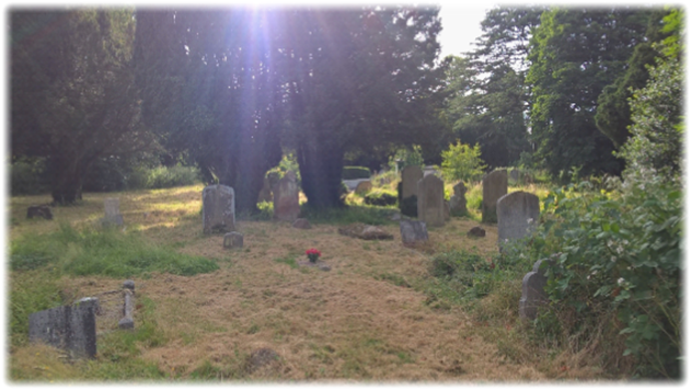
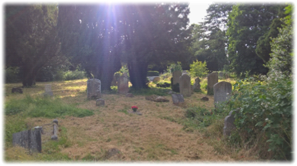
Look back and you’ll see how much height you’ve gained since leaving Cuffley. You’re now at 335 feet above sea level. Hardly an altitude sickness spot but the views have opened up considerably – all for the better.  On our journey so far leading literary figures – Orwell, Shaw and Bunyan – have deep associations with the countryside we have passed through.  Essendon can claim to have close links to latter day writers namely the hugely prolific doyen of romantic fiction Dame Barbara Cartland who died in 2000 aged 98 at her beloved Camfield Place.  She is buried there under an oak tree. Best-selling author Freya North, a writer of so-called chick lit novels, also lives on an estate in the village.

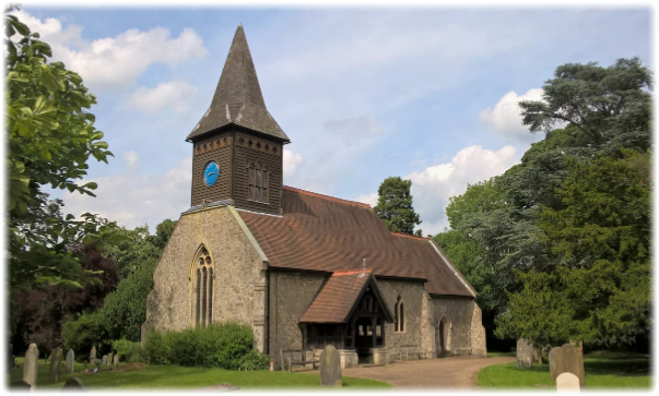
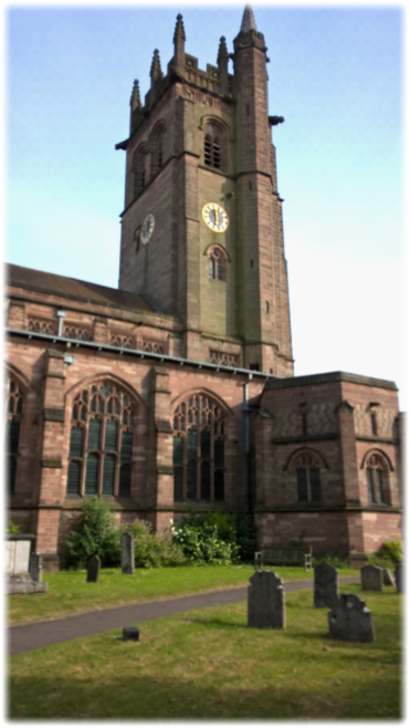
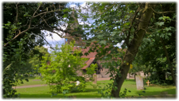
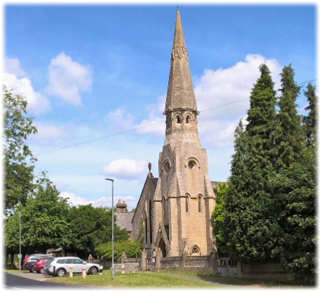
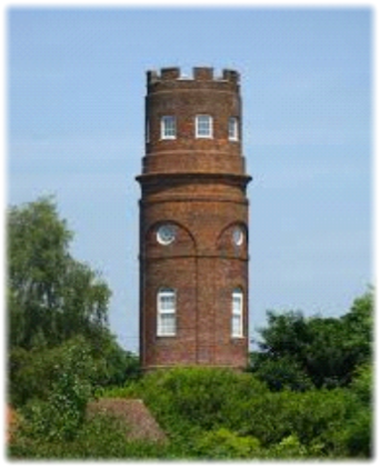
If you’ve no time to explore you’ll miss seeing the part 15th century St Mary’s Church, restored in 1883.  The very rare font is notable for being ceramic, the work of Josiah Wedgewood founder of the eponymous pottery factory.  In 1916 a Zeppelin airship bombed the east end of the church and dropped 15 explosives on Essendon killing two sisters.  One wonders what the target really was.  Barbara Cartland perhaps?  You’ll need to take a detour to visit the now privately owned Strattons Folly at the far end of the village.  The 1789 Georgian tower sits at the top of a hill on the site of a former brewery and has commanding views of the surrounding countryside.  Local legend has it that Admiral John Stratton built it so he could view ships on the Thames.  But as it is only 155 feet high it is more likely it was to admire the landscape or was an astronomical observatory.

Walk across the cricket ground to reach the High Road (B158) – turn left and then immediately right into School Lane. Two thirds of the way down on the right an obvious track (sign posted Little Berkhamsted, one mile) leads on to the crisply cut fairways, elevated tees and immaculate greens of Essendon Country Club, its two golf courses swallowing up a sizeable part of its 400 acres. Join the official golf buggy sized paths and pass in front of the stylish clubhouse dropping down past two ornamental lakes to a collection of buildings. On the right is a path which climbs slowly to an unencumbered track with pastures and wild meadows on the right.  My walking companion pointed out, sadly, there were few if any bees drawn to the tempting, florid acres. There are supposedly many reasons why the bee population is in decline. You can go on to the internet to discover more. But the silence and inactivity of wild meadows and pastures is a plaintive testimony. Continue on the path to Little Berkhamsted Lane, turn left and then walk to an obvious track on the right, with a fence on the right, which – spotting the roundel – will lead you into the grounds of Little Berkhamsted Cricket Club, Head for the Grade II listed Five Horseshoes pub in front of you. By the way, villagers would like it to be known their modest haven is not to be confused with Berkhamsted which walkers passed through on leg 7.

Although it can trace its past back to Saxon times, and perhaps beyond, Little Berkhamsted’s claim to historic fame is that it was where William the Conqueror accepted the surrender of the City of London after the Battle of Hastingswww.littleberkhamsted.org.uk/church.php.

At the Five Horseshoes cross over and turn left.  Just before the churchyard and the graceful Grade II listed Church of St Andrew
– which can trace its origins to the mid-17th century and before (below left) – a wooden kissing gate gives access to a footpath which, after another gate and then a stile, ends in a road called Buck’s Alley.  Turn right and then almost immediately left into a track by a wooden fence.  From this spot over the brick wall you can get a view of Stratton’s Tower.

A lot of the stiles on the trail have been removed or been circumvented. In some cases they are simply not needed, conceivably because field borders and improved access agreements have been achieved. Some stand pitifully redundant.  Stiles, which are being phased out slowly in Hertfordshire, are antiquated relics compared to kissing gates.  As older walkers will testify, they are not especially user-friendly.

After two more stiles the path then cuts diagonally left downhill across two meadows brushing the corner of a wood.  When we passed through, captivating waist high grass and scattered wild flowers seemed to offer clear proof that the quintessential image of undefiled English countryside maybe isn’t a utopian dream (see below left). Cross a bridge into Bayford Wood (below right).  Roundels direct you right and then left as you walk uphill to enter a field.  Stick to the perimeter path with the hedge on the left and locate a stile in the corner.  Follow the path to Ashendene Road and turn left into the centre of Bayford.

Pass the Baker Arms (below)– formerly a row of farm workers’ cottages www.bakerarmsbayford.co.uk – and at a crossroads (the church is up Well Row on your left and the station along Brickendon Lane on your right) continue straight on past the village sign and a signpost to the cricket club into Bayford Green. The obligatory village pond is on your left beneath a huge willow.

Bayford Green, which is a cul-de-sac, goes right and then left between buildings before becoming a track. Look for a footpath (above right) and stile on your right. Continue to the end of the field before a stile leads you into another field and then into a small wood. Identify a stile on your left and enter a large field. The railway line on the right – The Hertford “loop” – will be your companion from now on until you reach the outskirts of the town.  Keep walking – until journey’s end the route becomes somewhat dull and repetitive, but the fleshpots of Hertford beckon and you’ve nearly completed 12 miles – until the end of the field approaches. Take a wooden footbridge on the right and turn left to follow the railway through another characterless stretch of woodland with little interest – apart from a wonderfully pompous sign courtesy of Hertfordshire University’s Bayfordbury campus warning walkers that it is a permitted footpath and unauthorised incursions on to its land will not be tolerated – though sadly it doesn’t declare “trespassers will be shot.”

It is heavy handed and out of tune with the spirit of the walk – but somehow symptomatic of the lacklustre finale to this leg which is restrictive and somewhat joyless. But we’ll forgive its end of day shortcomings as it takes us into Hertford, a town that will be visited twice – assuming you don’t forsake the deliciously varied “loop” to complete legs 10a and 10b.  

Continue on the path to a footbridge over the tracks. Cross it and kept left through fields until a flight of wooden steps takes you down to Brickendon Lane. (There are probably a large variety of ways to get to the centre of Hertford – using pavements most of the way.  As all that matters now is completing the walk it’s arguably best to follow the route outlined in the official guidebook).

Turn left and then right into Mandeville Road. Follow it round to Wilton Crescent. Turn right and then immediately right again where a footpath alongside a school takes you into Queens Road. Just past the junction with Highfield Road a footpath on the opposite side of the road is squeezed between Hampstead Court maze-style hedges to reach a stream at the bottom of the hill.  Turn left alongside it and continue down Valley Close to a T- junction opposite the last highlight of the walk. Go through the churchyard and round the front of the impressive All Saints’ Church.

Grade II listed All Saints is the civic church of the town and the county.  It the largest church in Hertfordshire – apart from St Albans Cathedral – and can seat up to 1,000 people. A church has been present on the site since the Domesday Book before being replaced in the 15th century by a structure with a cruciform plan and a west tower. In December 1891 the church was destroyed by fire. In 1904-05 the new building, with the tower, was completed – nine years after it was consecrated by the Bishop of St Albans. In 1934 the Memorial Chapel was completed in memory of those who died in World War Iwww.allsaintshertford.

Leave by the main gate, take the underpass on the right, walk down Church Street and turn left into Parliament Square

It was a bitty day with few highlights and, because of the amount of road and pavement walking, heavy on the feet. A number of historic and attractive pubs offered sustenance and a myriad of cool woods welcome shade on what was a very hot day.  Nevertheless, if a league table of favourite legs is drawn up after the 195 miles have been completed and one was in a reflective mood, the likelihood is that Leg 10 would be at, or near, the bottom of your list. Or perhaps, with the passage of time, it will elicit fonder memories. My misgivings are not an indictment of its creators – who directed you on a roundabout journey in search of highlights – but because the footpaths, the topography and the piecemeal route compromised through lack of choice proved to be a challenge too far.

Next: Leg 11. Hertford to Widford. Where alliteration comes to the fore as we travel through Waterford, Woodhall Park, Wadesmill, Wareside and Widfordbury.