Distance:  12 miles

Start/finish: Cuffley station, Station Road (pay car park but possible to park in nearby streets); Broxbourne Station, Station Approach (pay car park – during the week virtually impossible after early rush-hour.  There is a pay car park just over the bridge in Nazeing New Road.  All roads in the locality have double yellow lines.)

Map(s): Ordnance Survey Explorer map 174

Public transport:  Trains: Cuffley to Hertford North (Great Northern) then cross town to Hertford East station to Broxbourne on the West Anglia Main Line,  Buses linking Cuffley to Broxbourne and Broxbourne to Cuffley (different routes) 310, 410 and 64

Pubs/Restaurants: 

Route description: Those passionate about dense native woodland – shrouded, eerily quiet and disconcertingly lonely – will be in ecstasy on this leg. A third of the day will be spent in a quintessentially part-ancient landscape of hornbeam and sessile oak, and former wood pastures reclaimed by trees. You will trudge through four tightly knit but separately named woods that comprise Broxbourne Woods National Nature Reserve, the only NNR in the county. Despite my everlasting fondness for native woodland you can arguably have too much of a good thing.  Because the tree canopy is overarching and the forest thick and unrelenting, and surrounding landscapes and skylines relegated to short-lived tantalising glimpses, after three miles the novelty starts to wear off and suddenly a dreary ploughed field can become a godsend.

If more clear-cut proof is needed that the creators of the Hertfordshire Way have a perverse sense of direction then the first near three miles from Cuffley to Goff’s Oak are a testament to the vagaries of route planning.  Goff’s Oak is one mile east of Cuffley on the B156. So when leaving Cuffley the compass bearing the HW takes is – due south!! The footpaths to Goff’s Oak constitute three sides of a rectangle, with the road being the fourth. Curious.  But in keeping with the philosophy behind the walk, which is to avoid roads wherever possible and stick to footpaths. When you finally leave the woods later on, the route becomes an edge of town mish-mash as houses encroach, cul-de-sacs are embraced, traffic lights encountered and noise reluctantly tolerated.  But you do meet the New River for the first time, a gentle waterway that will be your guide and companion for much of Leg 10b from Broxbourne to Hertford.  Lingering memories of this leg will be defined by those miles of forest walking, with the journey to, and from, the nature reserve being interesting but not especially fascinating ‘book ends.’ Another curate’s egg. Cuffley, perhaps unfairly, seems to be my bête noire on the entire journey. Sorry Cuffley. But it does have some claim to fame (see below).

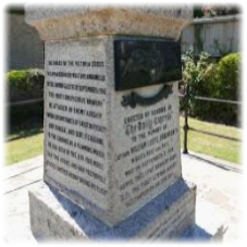
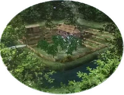
So what is Cuffley’s historic pedigree? In September 1916 the German airship SL11 was shot down and crashed in the village during an aerial bombardment intended for London. Which suggests the pilot’s sense of direction lacked a lot. The incident is commemorated by a memorial on East Ridgeway (right) to Lieutenant W. Leefe Robinson, the pilot who shot the airship down and was awarded the Victoria Cross for his actions. Contrary to many reports at the time the SL 11 was not a Zeppelin but an army Schütte airship, one of 16 which had left bases in Germany for the largest airship raid of the war over England. Robinson was in the air for several hours. After initially spotting the airship he lost it in clouds. Later, he again made contact and attacked at an altitude of 11,500 feet raking the airship with machine-gun fire of incendiary bullets. On his third attack the craft burst into flames and crashed in a field behind the Plough Inn, killing Commander Hauptmann Wilhelm Schramm and his 15-man crew. Although it wasn’t a Zeppelin the local football team is still nicknamed ‘The Zeps’. In 1939 the Scout Association purchased part of the Tolmers Park Estate for a large camp officially opened in 1940.  Today, Tolmers hosts thousands of young people annually from all over the UK and across Europe; not only Scouts and Guides but schools and youth groups as well.

So let’s leave Cuffley – in completely the wrong direction! From the station forecourt turn left and walk just over 300 yards to the entrance of Brook Farm. Cross over to the metal kissing gate and head diagonally right across the field towards trees and bushes. Cross Cuffley Brook by a bridge and pass through two more kissing gates to emerge into a field disfigured by a towering electricity pylon. With the hedge on your right walk the length of the field (below, top left) and at a clear gap ahead turn right and – keeping the hedge on your right – continue to the corner of the field. Turn left alongside the railway embankment as far as a foot tunnel under the imminent viaduct (bottom left). The path, on your left, arcs to the right amid arable fields (below, top right) crossing Northaw Brook towards a wood. At a fork bear left and on reaching the wood keep left and walk half a mile – with the wood on your right – as the track rises amid fields, offering views back to Cuffley viaduct. At a crossroads of paths turn left (Ordnance Survey maps call this track/lane Chain Walk but elsewhere it’s called Burntfarm Ride), past the eponymous farm on your right. The lane now becomes tarmacked. At a bend, when it becomes Jones Road, there are pleasant views on the left of Cuffley across the valley (bottom right). You can see the route you took about 35 minutes ago.

Jones Road ends in a metal gate where you turn right into Silver Street. Continue to Poyndon Farm on the left (below left). Walk down the drive and where it bends right before the house locate a kissing gate on the left where a sinuous path squeezed in between fields, hedges, fences – one electrified! -and back gardens, and a second kissing gate, to emerge in Cuffley Hill. Turn right and walk to the roundabout. At the Goff’s Oak sign cross over towards the Co-op and turn left past the war memorial into Newgatestreet Road.

On your right is the Goffs Oak pub (right).  The village is named after the Goff family, who owned much of the land in the area, symbolised by the original Old Oak, said to be several hundred years old before it fell in the 1950s. Its replacement itself toppled after severe damage during the storm of 1987. A third, still standing, overshadows the pub.

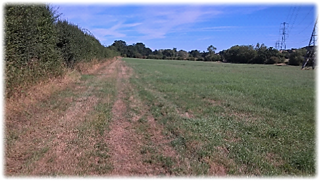
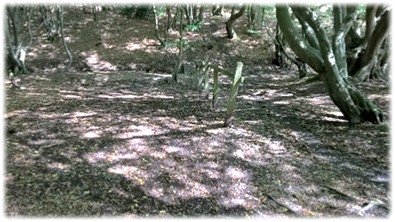
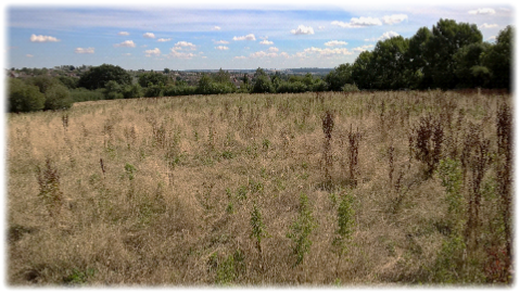
Continue along Newgatestreet Road for five minutes until you reach Crouch Lane, the second road on the right. Follow it as it bends left – there are no pavements – and eventually sharp right at a metal gate. Go through the kissing gate alongside and then immediately right through another one into an overgrown, uneven and bedraggled field with, when I tried to pick my way across it, no clear path (left). Head diagonally downhill to the left of a clump of trees and find a gap in the hedge at the bottom. Stick to the perimeter of the next field – don’t be tempted to drift left, especially if the field is heavily cultivated – in the company of shrubs and a hotchpotch of trees. In the right hand corner of the field cross Rags Brook and climb steps into a field.  Go diagonally across the field to a stile which takes you into a narrow bush lined path. Eventually a kissing gate brings you out on to Hammondstreet Road. Turn right and cross over to a bus stop and into Smiths Lane. Go down the lane.

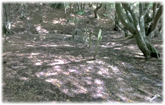
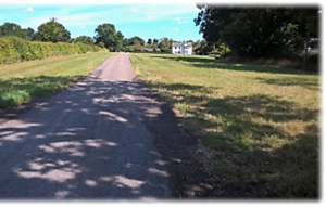
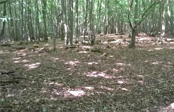
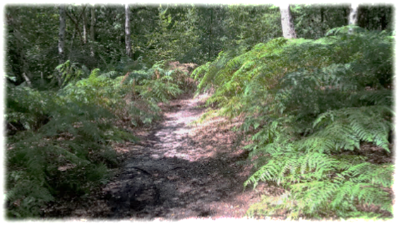
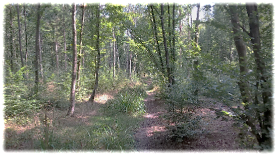
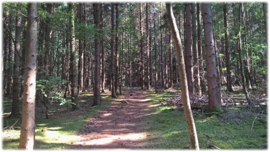
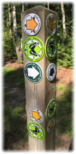
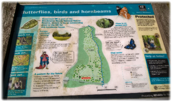
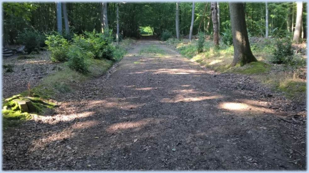
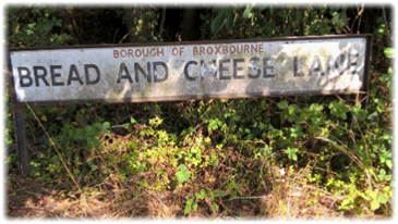
At a T-junction turn left into the delightfully named Bread and Cheese Lane which bends right and then left. When it turns right again at a house called Hawthorns continue on a grassy path straight ahead.  On your left are the vast greenhouses of Lines Nursery. A tarmac path joins from the right. Continue ahead. Where the road bends left turn right into a private road to Tanfield Yard. At its gates find a path ahead between hedges and, with a pylon looming large, drop down into the woods. You are now entering Broxbourne Woods National Nature Reserve, a largely unchanging environment of shadows and disarming shafts of light that will dominate the next few hours. If it is an overcast day it will be a gloomy trudge under the oppressive tree canopy.

The 240 hectares of Broxbourne National Nature Reserve – Hertfordshire’s only NNR – covers the woods of Hoddesdon Park, Wormley, Broxbourne and Bencroft.   It is also a Site of Special Scientific Interest.  When the Ice Age ended about 10,000 years ago the climate grew warmer and wildwoods replaced the ice sheets.  Since then people have used the woods as a source of raw materials.  It’s many hundreds of years since they were completely natural.   It is thought that by the time the Romans arrived much of the woodland had been cleared and turned into fields for pasture and crops.   The old Roman road of Ermine Street cuts through directly to the east of the wood, first mentioned in 6th-century documents.  When the Romans left the woodlands returned.  In the centuries that followed people cut timber for building materials and fuel, hunted boar, deer and other wild animals and grazed their own pigs and cattle.

William the Conqueror would almost certainly have passed through the area after his victory at Hastings and Oliver Cromwell is also said to have ridden through. The solitary coal post in the middle of the wood – repainted and now vertical – is a reminder of the fact that duty once had to be paid on coal and wine from the London ports to help finance the rebuilding of the capital after the Great Fire of 1666.

The Hertfordshire Way roundels will prove to be a virtually faultless companion as the footpaths and bridleways meander through the undulating and increasingly, by nature, unchanging landscape. If unclear as to where the route heads do not trust to luck and blaze a possibly wayward trail on an enticing path that looks as if it might be going in the correct direction.  If unsure, retrace your steps or stop and look around to try to pinpoint the next logical roundel. Consult the Ordnance Survey map or the TFHW official guidebook if carrying one, or both. There are countless roundels for separate trails which can seduce the anxious walker to switch direction – particularly if there isn’t a reassuring Hertfordshire Way waymark accompanying many others.   Normally if there isn’t a roundel for guidance best practice is to keep straight on, or as near enough straight on as is possible. Most of the tracks are broad, obvious and – by virtue of the fact that scores of “take no prisoners” cyclists will whizz by at unjustifiable speeds – obstacle free. But keep your wits about you. 

Anyway…….  back to the pylon at the beginning of the woodland ramble.  On entering the wood turn left alongside Turnford Brook to a pointless, isolated stile by a sign welcoming you to “Wormley Wood and Nut Wood”. Turn right and follow the path up a slight incline to join a clearly delineated and wide bridleway that snakes through the dimly lit woodland for nearly half a mile, past the coal post and across Wormleybury Brook on a wooden footbridge (below left).

Continue up the slope and locate a National Nature Reserve board between Wormley Wood and Bencroft Wood. Go right through the fence and almost immediately right on to a footpath (above right) which you follow unerringly for 700 yards, dipping in and out of small narrow gullies using steps and bridges.

At the end of a boardwalk turn sharp left and pass through a fence to emerge on to a bridleway (pictured below left) where you turn right and walk to a metal gate alongside a sign which welcomes visitors to Emmanuel Pollards. At this point, if you aren’t carrying food and drink, you need to make a decision. The Huntsman pub at Goose Green, mentioned in earlier editions of the TFHW guide, is now closed and is a private home – another sad casualty of a seismic shift in pub use and ownership that has blighted so many settlements. So the Woodman and Olive pub in West End Road is the only watering hole before journey’s end.  If you need sustenance turn right and head downhill into a secluded valley before turning left to the pub/restaurant. It is about a 10 minute walk to get there, and an uphill trudge on the way back. The “Olive” addition to the traditional name is an ill-fitting nod to its hugely Greek influenced menu and ethos. I don’t advocate ordering a multi-course Meze for lunch unless you’re prepared to grind to a bloated halt mid-afternoon or abandon reaching Broxbourne altogether – which can, after all, wait for another day! Clearly the pub owners feel that time is pressing, however. I arrived on September 1st to find a garish banner urging people to book a place for the Christmas party.

If piped Bouzouki music and Athenian rock’n’roll isn’t for you then turn left from Emmanuel Pollards and walk to the T-junction at White Stubbs Lane. Cross over and go through a kissing gate into a field – which when I passed through with its rows of circular bales of hay conjured up a romantic image of picture postcard countryside (below) – followed by another two kissing gates. When the path forks, take the right hand track towards and through Pembridge Farm, courtesy of one kissing and two wooden gates, to appear in Pembridge Lane. Cross over and three kissing gates in quick succession lead into a pasture where the path heads diagonally right to the corner of the field where another kissing gate gives access to woodland once again (Below middle and right).

Go over Spital Brook on a footbridge and follow the path half right between barbed wire fences as it climbs up the slope.  Go through a gap in the fence and continue until you reach a T-junction where you turn right on to a fresh track. Follow it downhill for 50 yards where a waymark sends you left.

After a fifth of a mile turn right and cross a brook by a bridge before turning left and entering, through a kissing gate, an impressive conifer plantation. It’s a welcome change of scenery where a cathedral of towering trees entices the rambler forwards on a cushioned path. Stop for a minute and admire the scale of your surroundings (see below).

Follow the path through the plantation to where a roundel points you right before the track bends left to a kissing gate where you leave the enclosure. Pick up the path crossing Broxbourne Common to a bridleway where you turn left, then left again, to connect with a broad bridleway which – passing a thatched house – drops downhill for 100 yards to where a kissing gate on the right leads into Danemead Nature Reserve. If you’re heading the right way you’ll see this sign.

With the stream on your left walk for just over a quarter of a mile crossing a boggy area on walkways.  At the end of the walkway you’ll encounter two small wooden footbridges at a near 90 degree angle to each other.  If using the guidebook don’t be deceived into thinking these are the “two footbridges at right angles to each other” you’ll reach when you leave the nature reserve.  There is a tempting route through ferns and waist high foliage on the right, and slightly further on, a kissing gate into an enclosure.  Ignore both.  Simply keep walking. I was side-tracked and followed the path to Cock Lane, some distance from where you should meet the road – so had to shamefacedly backtrack.  There wasn’t a reassuring roundel at this critical junction, so having been spoilt by clear waymarks en route so far, and failing to realise I’d hadn’t walked a great distance since entering the nature reserve, erred on the side of foolishness.  So keep going.   You will reach those two wooden footbridges at a 90 degree angle to each other.  Traverse them and then cross the unassuming bridleway.  However, the bridleway is in fact a section of the historic Ermine Street which bisects Broxbourne NNR.

The one-time important Roman strategic route from London to Lincoln and York – built between 45-75AD – had the Old English name of Earninga Straete, named after a tribe called the Earningas who inhabited land on the Cambridgeshire/Hertfordshire border.  It is also known as the Old North Road from London to where it joins the A1 Great North Road near Godmanchester in Cambridgeshire.  You’ll meet Ermine Street again on Leg 11. Whereas history records it as a trail blazing, cross country thoroughfare it is now overshadowed by the thick woodland you’re passing through. And though steeped in the past it is a modest track whose Roman pedigree and glory has long gone.

Go through the kissing gate (below) into Hoddesdon Park Wood, turn right and drop down to Spital Brook.  Turn left and walk alongside the modest watercourse for a quarter of a mile looking out for an information board on your left.

Here is a medieval moated enclosure designated a Scheduled Ancient Monument – though to be honest it was difficult, because of heavy undergrowth, to identify any clear features when I encountered it (see below left). The enclosure is 60m x 55m in size with a partially water-filled moat up to 10m wide and 3m deep. Moats were often a status symbol rather than a practical military defence.  It is believed that Hoddesdon is an historic park and this moated site was possibly the location of the medieval park keeper’s lodge (below right). The surrounding woodland contains earthworks and the remains of a small castle.

Keep walking until a wide track joins from the left. Turn on to it and walk up the sloping avenue of trees (below) until you reach a strategic crossroads. Turn right and pick up the pace to reach a kissing gate where, finally leaving Broxbourne NNR, turn right into the grounds of Hoddesdon Lodge.

Follow the track to pass a pond on your right (below) and go between the lodge and outbuildings to a kissing gate.  The route now heads diagonally left to an obvious gap in the hedgerow.  Go through the kissing gate there and head diagonally right to the corner of the field at the bottom of the A10 embankment.  Turn right on an uneven footpath – and wincing at the traffic noise after the contemplative peace of the woods – head uphill to reach Cock Lane.  Turn left, cross over the A10 and walk past a car park to locate a kissing gate into Lucy Warren Open Space. The outskirts of Broxbourne are only a minute away. Sadly.

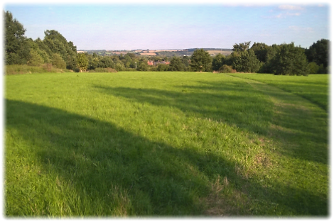
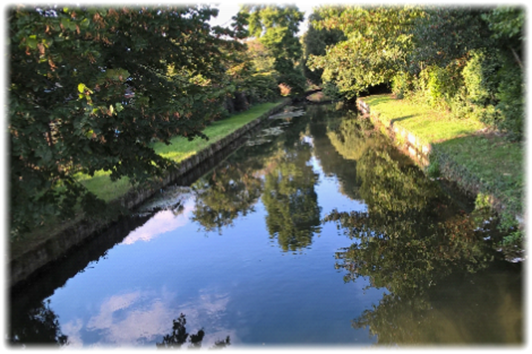
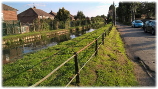
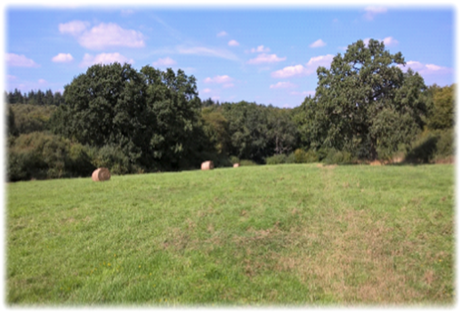
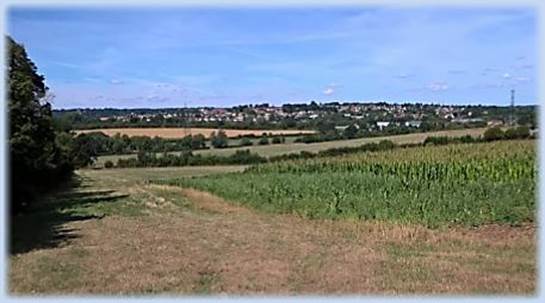
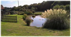
Follow the footpath as houses encroach on the left to a kissing gate. Pass through four more to a junction of paths. Bear right along the bridleway penned in by a fence and houses until you reach Allard Way. At the end of the road turn right into Baas Lane, cross over and look for the footpath just before the road bridge.  Go through into Top Field and Cozens Grove Nature Reserve and follow the path diagonally right downhill towards the trees. There is a nice panorama to enjoy across the River Lea valley to the hills beyond (below left). Go into the trees and locate a footbridge. Turn left and follow the track downhill between sports fields and ramshackle tennis courts into Cozens Lane West,  At this point you’ll meet for the first time the charming New River (below right), which is neither new nor a river. The watercourse will be your close companion for much of the delightful Leg 10b, a day’s walking worth waiting for. For a full history of the New River go to Leg 10b on the menu.

At the end of Cozens Lane West – suddenly the solitude of the earlier part of the day will become a fond memory – turn left into the noisy main road and walk to the pedestrian lights. Cross over, turn right and then left through the kissing gate and follow the embankment of the New River (below left) for 10 minutes until Mill Lane where you’ll turn right and pass the Grade One listed Broxbourne Parish Church (St Augustine’s), believed to have been built by 1460. At the bottom of Mill Lane turn left past the restored Broxbourne Mill and into the car park.

A mill stood here for 900 years before being destroyed by fire on 1 October 1949. It is the only mill in the area to be mentioned in the Domesday Book. The remnants of the mill were renovated by the Lee Valley Regional Park Authority in 1977 including 16th century brickwork floor and window frames of the 19th century two-storey miller’s house. The original water wheel has been restored to include lighter replacement paddles made from re-cycled plastic. The mill and its surroundings, which are open to the public, are known as the Old Mill and Meadows site.

Continue through the car park and pick up the footpath between the mill stream and the railway (above right). Go left over the bridge and through the station car park to finish at the foot of the New River embankment where Leg 10b starts.

It was a compass defying start and an increasingly noisy ending. But my earlier and arguably unjustifiable gripes about an overdose of woodland, the leg – reliving it months after walking it – wasn’t at all bad. If you’re committed to completing the Hertfordshire Way “loop”, and you will regret not doing so, then this leg will be the less attractive of the two. But the county’s wooded National Nature Reserve – and I would argue, having walked through it, is worthy of the description ‘forest’ – imbued on this leg a sublime calm. As American author Washington Irving said:

“There is a serene and settled majesty to woodland scenery that enters into the soul and delights and elevates it, and fills it with noble inclinations.”

Next Leg 10b..  Water, water everywhere.  And enchanting countryside to drink in.   Apologies Coleridge!