Distance: 12.5 miles

Start/finish: Broxbourne Station, Station Approach; East Hertford Station, Mill Road OR Parliament Square, Hertford.

Map(s): Ordnance Survey Explorer maps 174 and 194

Public transport:  Never has a leg been better served by public transport than this delightful journey along the Lea Valley in the company of not only two watercourses but the five mile long Hertford East branch of the West Anglia Main Line starting at Broxbourne. The intermediate stations include Rye House on the outskirts of Hoddesdon, St Margarets/Stanstead Abbotts and Ware. It means the route can be divided into smaller sections if need be. A return off-peak fare from East Hertford to Broxbourne costs £5.10p. (2020 prices). Parking at the commuter dominated pay car park at Broxbourne station is almost certainly doomed to failure on weekdays.. All nearby roads have single or double yellow lines. The only solution is one minute away over the bridge into Nazeing New Road where there is a large pay car park on the right.  Weekends will be a lot easier.

The 310 Arriva Herts and Essex bus service neatly and fortuitously links Ware, Great Amwell – also on the walk – St Margarets, Hoddesdon and Broxbourne station. Check timetable for services. The Uno 341/641 services link Hatfield, the centre of Hertford and Station Road, Broxbourne. Again check timetables.

Pubs/restaurants: 

Hertford is home to McMullens brewery and there are, unsurprisingly, too many pubs to mention along with countless shops, restaurants cafes etc.

Route description: This charming excursion could reasonably be described as Tales from the Riverbanks as the day is spent repeatedly criss-crossing between the New River – neither ’new’ nor a ‘river’ – and the largely canalised River Lea(e), one of London’s most impressive waterways. Up until now – especially in west Hertfordshire – the walker will have encountered enfeebled and exploited ‘rivers’ largely unworthy of the distinction, including the dribble of the Mimram, the trickle of the Gade, the put-upon Ver and the slightly more confident Colne. Whichever member of the Friends of the Hertfordshire Way championed a deviation from the original route to take in the Lea Navigation was obviously a connoisseur of riparian delights and has added much to the aesthetic joys of the entire 195 mile walk. Much of the 12.5 miles is towpath walking with tantalising glimpses into nature reserves, gravel pits, lakes and reservoirs through the trees either side of the official route. Only once does the path leave the confines of the waterways to explore the empty and pretty Ash Valley before returning via the Amwell Walkway to the New River and the Lea. A simple, straightforward and unencumbered journey. It would be short-sighted and daft to avoid the circular extension and stick to the original route between Cuffley and Hertford.  It is one of the Hertfordshire Way’s classic legs.  Wonderful.

For this leg “10b or not 10b? That is the question”. And the answer must be an emphatic Yes

At the drop-off point and taxi rank at the front of Broxbourne Station climb a flight of steps up the embankment to the New River path and turn right. What follows is a comforting and comfortable walk on a well-trodden hard core based path and then a grass path (below left and right). So mollycoddled were my walking companion and I that a kindly soul had freshly mown parts of it so the first mile and a quarter to the Essex Road pumping station – and beyond – could have been walked in slippers. As you head north opulent and impressive homes overlook the waterway with manicured lawns stretching to the water’s edge under a canopy of weeping willows.  Monied commuter belt par excellence. The noticeably smooth flowing New River is straddled by a number of footbridges as the path crosses St Catharine’s Road, Admirals Walk – beyond which, on the right and through the trees, you can glimpse Admirals Walk Lake – and Conduit Lane East to reach the pumping station.

The New River is an artificial waterway opened in 1613 to supply London with fresh drinking water taken from the River Lea(e) and the Chadfield and Amwell springs – the latter ceased to flow by the end of the 19th century – along with other springs and wells along its 20 mile course from Ware and Hertford to Stoke Newington. It originally ended near Clerkenwell in Islington until 1946 when the Eastern Reservoir was created, now managed as the Woodberry Wetlands. The design and construction of the New River is often attributed solely to Sir Hugh Myddelton, although Edmund Colthurst first proposed the idea in 1602, obtaining a charter from King James I in 1604 to carry it out. After surveying the route and digging the first two-mile stretch Colthurst encountered financial difficulties and it fell to Myddelton to complete the work between 1609 and its official opening on September 29th, 1613. The expense and engineering challenges of the project were huge. The New River relies on gravity to allow the water to flow carefully following the contours of the terrain from near Hertford into London, meaning it drops just five inches per mile. Myddelton faced considerable opposition from landowners but the king, who agreed to pay half the project's expenses in return for a 50% shareholding, helped silence the scheme's critics. The New River, which was in danger of being abandoned at one stage until demand for resources increased as more homes were built in the capital and the working population grew, still supplies eight per cent of London’s water. There is a 28 mile signed walk, developed by Thames Water, which follows the functional part of the river and some stretches of the disused course.

At Essex Road cross carefully – traffic can be unrelenting – to the kissing gate in the metal fence diagonally opposite and head right on a grassy bank. The experience is partly ruined by a bank hugging graceless industrial estate opposite on the outskirts of Hoddesdon, its grim blocks of brick and metal an unwelcome companion on the half mile to Rye House Station. At Rye Road turn right over the bridge and on the left by the car park a tarmac path drops down to the River Lea Navigation and an assortment of moored and weather-beaten narrow boats and unambitious pleasure craft.

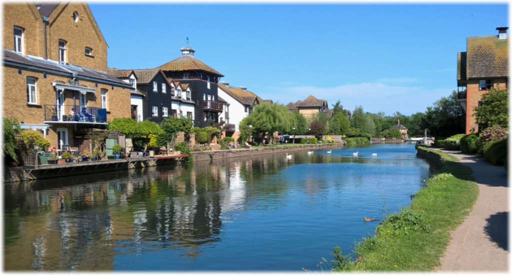
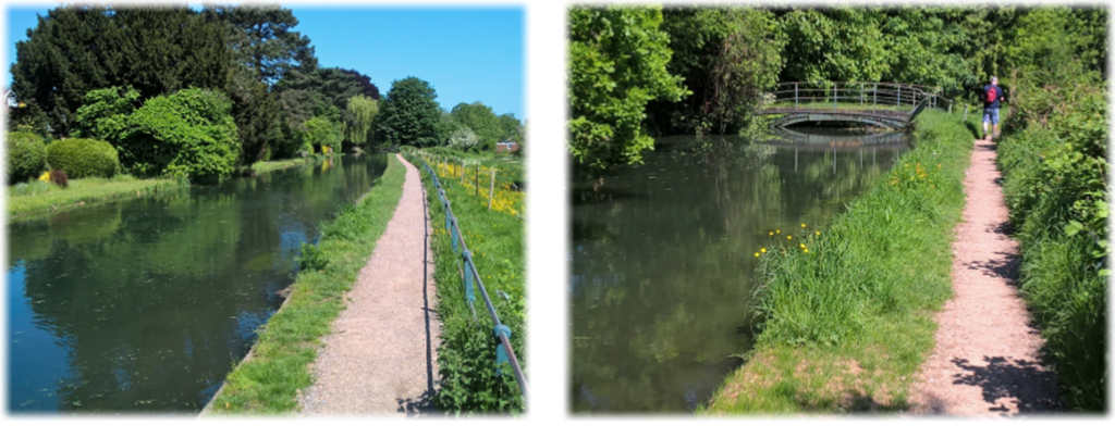
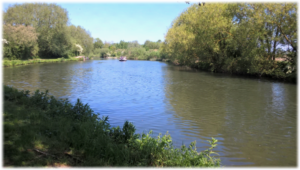
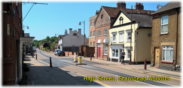
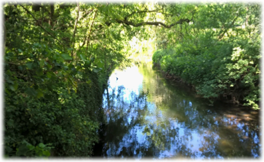
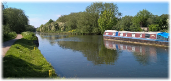
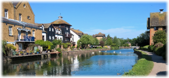
Compared with the modest but delightful New River the Lea is a strikingly broad expanse of water. For those excited by a flowing river in all its glory this is an impressively grown-up example. Robust, resolute and sure of itself. After all it has an extensive valley, its own regional park authority, is a transport corridor, a source of water for London, a key role in sand and gravel extraction, a recreational area, an industrial hub and– in its lower reaches – a meandering feature of the 2012 Olympics. Admittedly it has been ‘canalised’ to make it navigable into east Hertfordshire and beyond. But such artificial intervention can never detract from the Lea’s incontrovertible status as the best waterway the Hertfordshire Way can offer. Nothing comes close.

The 42 mile River Lea (e) – both spellings are used from Hertford to the Thames – is usually thought to have its source at Leagrave in the Chilterns, the chalk hills adding to the extreme hardness – high mineral content – of London tap water. It flows generally south-east, east and then south through east London to meet the Thames at Bow Creek, one of the major tributaries of the river. Its valley landscape is marked by a long chain of marshy ground along its lower length which has been exploited for gravel and mineral extraction, reservoirs and industry.

The Lea Valley was for years the industrial centre of London and home to many inventions including the first monorail (horse drawn), the driving power behind the motorcycle industry, the great railway works, buses, guns, gunpowder, chemicals, shipbuilding and, after the invention of the diode in Ponders End in 1904, UK’s first ‘silicon valley.’ The largely rural 50 mile Lea Valley Long Distance Path was opened in 1993 extending from Leagrave to Limehouse Basin.

To appreciate the widespread influence and environmental impact of the River Lea one would need to study Ordnance Survey maps or computer-based satellite images. Following the valley bottom towpath is a constrained plod – no worse for all that – but the walker is probably unaware of the picturesque lakes, reservoirs, minor rivers, RSPB wetlands, marsh land and even the HQ of Hertford County Yacht Club that lay beyond the confines of the official route. It is quite an eye-opener. To debase and insult Samuel Taylor Coleridge:  “Water, water everywhere. And a lot of it to drink.” Just as well for Londoners.

From Rye Road it’s a mile long towpath walk, underneath the A414, past Stanstead Marina to The Jolly Fisherman at St Margarets/Stanstead Abbotts, a charming spot for refreshments alongside the bridge and overlooking narrow boats. Turn right at the bridge – you’ll rejoin the river 90 minutes later – and walk 300 yards up the High Street to a mini roundabout opposite The Red Lion (below left) and bear left into Cappell Lane

The manor of Stanstead Abbotts was granted to Anne Boleyn and remained with the crown after her execution.  In 1559 Queen Elizabeth granted it to Edward Baeshe and it remained in the family for several generations. Stanstead Abbotts has many old buildings in the High Street although a lot have now made way for newer residential properties as the village is on the commuter friendly Hertford East branch line. The main industry used to be brewing but many of the original maltings have now been demolished to make way for a small business park.

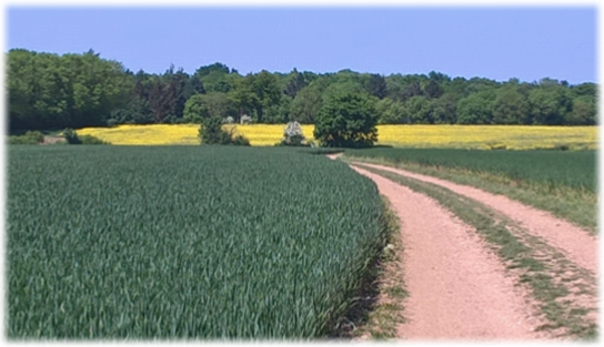
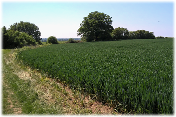
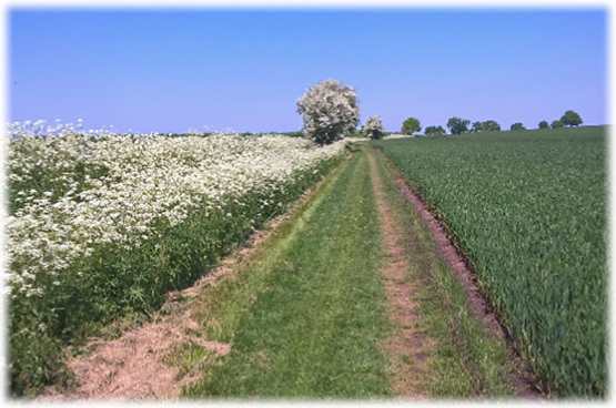
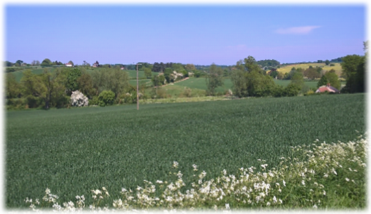
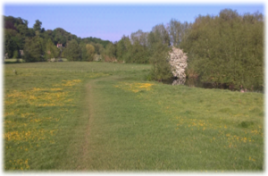
A third of a mile on – after passing the 137-year-old Grade II listed St Andrew’s Church (left) – pinpoint a long brick wall on the right which ends at a set-back garage. A narrow, sinuous and signposted grass track heads uphill between trees and hedgerows to emerge amid hundreds of rolling acres of arable land as a wide farm track leads you into the sequestered and peaceful Ash Valley. You certainly don’t need directions after emerging from the path. Follow the track for just over a mile (see below), ignoring intersecting bridleways and other distracting paths, until it drops down left past some woodland to emerge at red brick cottages at a junction with a dismantled railway.

A clear track leads into the Ash Valley (bottom left and right) on a stunning Hertfordshire spring day.

The Buntingford branch line connected six stations between Buntingford and St Margarets after it opened in 1863. Residential travel and goods services became significant at the end of the 19th century but the line remained predominantly agricultural and after 1948 use of the line did not keep pace with rising costs. When the adjacent Hertford East branch was electrified the Buntingford branch trains were reduced in frequency and quality. The line was cited for closure in the Beeching Report and passenger services ceased in 1964, goods traffic a year later.

Stick with the lumpy, bumpy hoof churned path (below left) for nearly half a mile. When the river meanders north-west (below right) on its faltering and twisting course in the direction of Ware find a stile. Watch for the roundel which points LEFT alongside a fence – ie DON’T climb the stile – and find and climb a second stile which returns you to the disused rail line

The line on maps is now called the Amwell Walkway and heads unerringly south back to the waterways passing under Hollycross Road with flooded gravel pits either side including the Amwell Nature reserve on the left.

In the early 1900s otters were common in Hertfordshire but had disappeared by the late 1970s due to persecution, pollution and hunting. In 1991 six were released at Amwell Nature Reserve and have bred, not only in this lake, but at other sites in the county. The reserve, a Site of Special Scientific Interest and Special Protection Area, is also home to bitterns, great crested grebes and important numbers of wintering wildfowl. The reserve includes a mosaic of lakes, rivers, grasslands and woodlands.

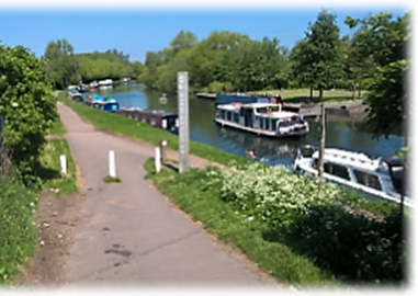
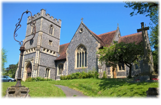
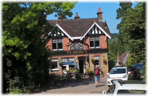
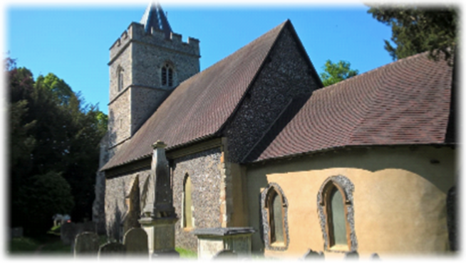
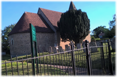
After the nature reserve normal service is resumed as you cross the River Lea by a footbridge at the beginning of an intriguing “three sides of a square” detour which means ignoring the steps down to the river on your right and continuing on the Amwell Walkway on to a concrete path to cross the railway (the Broxbourne to Hertford branch line). Obviously caution is recommended. A track leads to Amwell Lane to reunite you with The New River straight ahead up an embankment. Climb the steps, turn right and cross the footbridge before the islet and climb the track alongside the 11th century, Grade II St John the Baptist Church (arguably the “toughest” ascent you’ll face all day!)  Turn right around the church and drop down through the churchyard (below) to St John’s Lane and The George IV pub (below left). (NB: The pub has restricted weekday opening hours. Check website.)

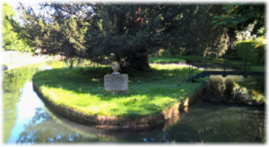
Facing the pub take St John’s Lane on the right slightly downhill to opposite the church gates where a Hertfordshire Way sign sends you on a steep and narrow track to a T-junction straddling the New River. On your right – on that islet – is a simple stone monument to Sir Hugh Myddelton (left), the prime mover behind the construction of the New River. The urn near Amwell Springs was erected by Robert Mylne, Chief Engineer to the New River Company from 1769-1810, bearing the inscription:  “Sacred to the memory of Sir Hugh Myddelton, Baronet, whose successful Care, assisted by the Patronage of his King, conveyed this stream to London. An immortal work, since Man cannot more nearly imitate the Deity, than in bestowing Health.”

Go left through the kissing gate on to the towpath and as grassland opens up on your right walk the third of a mile to a kissing gate in Lower Road next to its junction with Amwell Hill (the A1770).  Turn right and almost immediately at the bend head along a gravel track, cross over the railway line for a second time to reach the Lea again at Hardmead Lock (below). The lock has a reputation for being difficult to negotiate. The sizeable lock-keeper’s cottage stands on an island formed by a section of the River Lea Flood Relief Channel which flows through an automatic sluice gate adjacent to the lock. Turn left at the lock and walk the two thirds of a mile to the centre of Ware.

The relaxing towpath walk takes you through some typical river landscape (above left) with narrow boats for company before an eclectic and stylish mix of new and renovated properties sit imperiously on the opposite river bank, their residents safe in the knowledge that they have some of the best seats in town. At the bridge – assuming you aren’t seeking a rest stop before the last hour to Hertford, and there are a lot of options if you are – then continue on the same side of the river on the towpath. Opposite is Water Row’s which has a unique claim to riverside fame.  

Nowhere else in Britain can you find so many gazebos along a single stretch of river. Their origins can be traced back to their construction in the 18th and early 19th centuries though a few date from the late 1600s. They were built by innkeepers and other owners of property on the high street as odd and peaceful bolt-holes from their hectic lives in town. They were originally called Dutch Summer Houses after William of Orange. Other accounts claim that because of the heavy vehicles used to serve Ware’s burgeoning malting trade roads often became impassable. As a result England’s first turnpike was built at Wadesmill in 1663. Faced with paying a toll a lot of traffic sought alternative routes threatening the livelihoods of the inn owners – who then laid out riverside gardens with summer houses or gazebos to lure customers. During the 1980s East Herts District Council, the Ware Society and other sponsors paid to restore them.

Continue past the weir and lock – here the Lea splits just before the weir (above left) to create an island which ends near the 680-year-old former Ware Priory, now a wedding and conference centre, where the two stretches of water rejoin – until you reach a steel and wood bridge over the Lea with a charmless block of offices and industrial buildings ahead of you. Fortunately you immediately turn left on to a track which skirts the tennis courts and football pitch at the private Allenburys sports club as the A10 looms large. At the embankment of the bypass find a gap in the fence and turn left to pass under the road alongside the river. On the opposite bank and beyond is a nature reserve – and beyond that the north eastern residential area of Hertford -the town not far away (above right).   After the underpass the path turns off right to a line of trees and hedges and a clear track. Follow it left for two thirds of a mile, past a series of properties – opposite these the River Beane joins the Lea which heads off south west towards Hertford – before emerging at Ware Park Road, a minor road by some houses.    

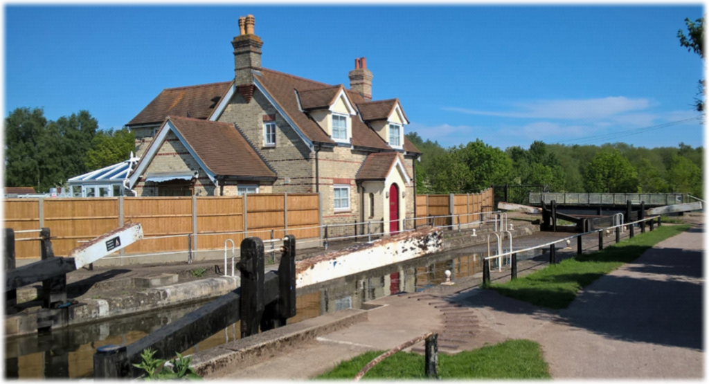
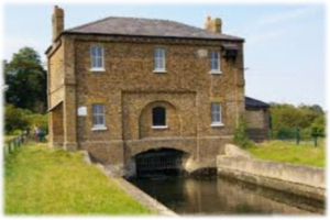
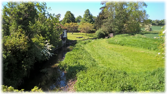
As you walk along look across the Lea to the New River Gauge House where the waterway, our languid companion for much of the day, joins one of its key suppliers.  The building houses the current gauge which regulates the flow of water from the Lea into the New River – currently 102 million litres a day. In 1855 the New River Company secured an Act of Parliament to abstract 4.25 million litres from the river each day – arguably a small drop compared to now. The distinctive Grade II listed brick building was finished in 1856.

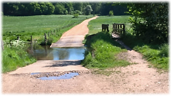
At Ware Park Road turn back on yourself 180 degrees and locate a wooden bridge over the River Rib which leads into a field where a clear diagonal path heads towards a concrete bridge over a stream. Go straight on and at the next footbridge again go straight on and then turn sharply right – or opt for a diagonal route to cut corners – up the hill ( above right) towards the 12th century Norman church of St Leonard’s in the old settlement of Bengeo (left).

The Grade I listed church is located on the hillside overlooking the shared Beane and Lea valley. It dates from around 1120 and has the distinction of being Hertford’s oldest building. It served as the parish church until the larger Holy Trinity was opened in 1855 when it was stripped of its fittings and stood empty until the Gosselin family – who lived at nearby Bengeo Hall – commissioned its restoration and fittings between 1884-1894. Remains of medieval wall paintings were uncovered during restoration work in 1938.

Go through the gate into the churchyard, bear right around the building and leave by a kissing gate where a sloping gravel path ahead eventually splits. Take the left hand fork and cross the River Beane to appear on Hartham Common, a large area of football pitches and recreational land overlooked by Hartham Leisure Centre. There is a sinuous tarmac path which bends around the park en route for the leisure centre. Purists, and those averse to grass, will follow it. Most – including my companion and I – ever mindful of the train timetable headed diagonally and swiftly across the park to a bridge over the Lea, turned right and from there to the rather grand looking Hertford East station. For those anxious to comply with the official finish take the right-hand footbridge across the weir, follow the towpath past the Old Barge pub and then via Bull Plain, Salisbury Square, Market Place and Fore Street to reach Parliament Square.

“Rivers know this: there is no hurry. We shall get there some day.”   A. A. Milne

There was no hurry. The wrongly named New River and the optionally named Lea (e) were – despite the flawed nomenclature –faultless companions as they took their slow, wistful and majestic courses through some delightful countryside. Time passed cheerily on a journey that was savoured – not rushed. The flat and purposeful towpaths are kind on the feet, the unspoilt Ash Valley a welcome diversion and the Lea a constant reminder that it, above all, has helped shape the landscape and been the lifeblood in the evolution of the characterful towns en route as well as playing a critical role in the area’s history. This leg was devised as a worthy addition to the original route and should never be treated as an optional extra. After mourning the depleted weak-willed chalk streams in the west of the county Broxbourne to Hertford proved to be the perfect antidote

Next.  Leg 11.  Hertford to Widford.  Where alliteration comes to the fore as we travel through Waterford, Woodhall Park, Wadesmill, Wareside and Widfordbury.