Distance:  13.6 miles

Start/finish: Parliament Square, Hertford (pay and display parking nearby/free street parking will involve a 10 minute walk – unless you’re lucky);  High Street, Widford (plenty of street parking around the village).

Map: Ordnance Survey Explorer map 194

Public transport: The 351 bus service runs from Hertford to Bishop’s Stortford through Widford High Street, stopping outside the former Green Man pub. Check the timetables before leaving home.

Pubs/restaurants: 

Route: This is the second longest leg of the Hertfordshire Way at nearly 14 miles. It’s undulating, not especially physically taxing – a fair amount of the day is spent following river valleys – but on reaching Widford you’ll feel Hertford is a distant memory. Even though, courtesy of the meandering, compass confusing ‘drift’ around the county, you’ll only be about four and a half miles from the town by car. But the compensations are enchanting. From the prelude in historic Hertford to the picturesque Waterford Marsh, the classic lines of Woodhall Park and neighbouring Sacombe Park, a lonely cross country march to thirst quenching Wadesmill and lonely Wareside, the empty Ash Valley and modest Widford. There truly is something for everyone – including a ruined historic church and a dismantled railway track.  One of the route planning obstacles is that you will have to travel nearly eight miles before a refreshment stop, in this case Wadesmill. But if it’s a pleasant day and time is on your side the journey will never seem to be a burden before reaching the village.   Route marking is near perfect. Like a lot of the day’s rambling.

This leg can compete with the very best in scenic quality, variety and rural charm.  Set off early – so you don’t have to rush it. It’s worthy of your time.

Apart from St Albans – which is, of course, a City as it has a cathedral – Hertford is the next most historically important and culturally fascinating stop-offs on the 195 mile journey.  Sorry Royston and Bishop’s Stortford but humility is a worthy virtue.  It’s been the county town since Saxon times and, albeit temporarily, was the seat of the English Parliament during a plague outbreak in London in 1563. In the town are the remains of the original late 12th century Hertford Castle, principally a motte. The castle’s gatehouse, the central part of which dates to a rebuild by Edward IV in 1463, is now the home of the town council.  The motte, from the original Motte and Bailey castle, can be found behind Castle Hall.   In Railway Street can be found the oldest purpose-built Quaker Meeting House in the world, in use since 1670. But an even stronger claim to religious distinction – though contested – is that the first National Synod met in Hertford in AD 673.  The rivers Rib, Beane and Mimram (the latter first encountered on leg 3) join the Lea (below left) in the town to head south as the Lea Navigation to the Thames.  The McMullen family has been brewing in the town since 1827, (below right) leaving beer lovers spoilt for an historic choice of pubs.  Hertford still has a traditional “market town” feel to it and time spent exploring it won’t be wasted.

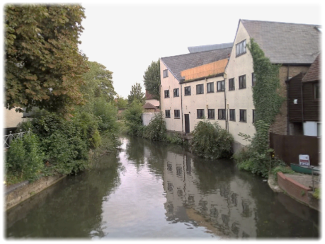
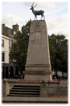
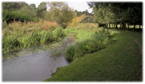
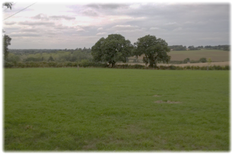
Start the day’s journey in Parliament Square by the war memorial (right), one of Hertford’s most striking landmarks. The bronze stag/hart – the symbol of Hertfordshire – sits atop a great stone plinth. At the bottom are inscribed the names of 564 men who died in both world wars and, unusually, the names of nine civilians, seven men and two children, who died in an airship raid on the town in October 1915. With the war memorial on your right continue ahead down The Wash, cross the River Lea, pass The Woolpack pub and turn right at the traffic lights into Old Cross and then Cowbridge. On your right is an intrinsic part of the town’s heritage, the McMullen brewery.  Where the road splits – Port Hill is right – walk straight on into the long, narrow cul-de-sac of Port Vale. Continue through the road barrier past The Millstream inn – a quirky, truly ‘backstreet’ local – to a crossroads. Go straight on into Molewood Road until the road becomes a lane running parallel to the former millstream of Goldings Canal. Pass Molewood Mill, go under a railway bridge and keep walking until you reach North Road (A119). Turn right and pass High Molewood and Great Molewood.  After the last property a footpath disappears right into trees and drops down to Waterford Marsh and the River Beane (below) which you’ll follow for the next two delightful miles.

The 16 mile long Beane is a chalk river and tributary of the River Lea, currently undergoing restoration to its water quality and biodiversity. It rises to the south-west of Sandon in the hills north-east of Stevenage and joins the Lea at Hartman Common in Hertford. The river is home to grey herons and little egrets. As Hertfordshire’s population increased substantially in the second half of the 20th century the Beane, particularly in its upper reaches, suffered from over extraction by the licensed water company.

This is peaceful ambling country with no immediate need to force the pace. Walk along the river bank – when I passed through chilled out cattle grazed the pastures – until the Beane veers left when you continue onwards to Waterford passing through a kissing gate to Vicarage Lane. Turn right and take the first left into Barley Croft. At the end, go through a kissing gate then left to another kissing gate on your right. Cross the meadow and pass under the railway bridge and through a wood to emerge in Bushmill Lane. Turn left and then right into an unnamed road passing properties on the left. When the road forks continue ahead alongside a large agricultural building.  When the woods start on your left locate the entrance to a narrow, sinuous path which re-joins and flanks the River Beane for three quarters of a mile until you reach the churchyard of the charming Grade Two listed St Mary the Virgin at Stapleford (below). 

It is thought to be a 12th century structure with additions in the 13th, 16th, 18th and 19th centuries.

Ladder stile and a kissing gate giving access to the Woodhall Park estate

Go through the church gates, turn right and then left into the wonderfully named cul-de-sac of Clusterbolts. Continue ahead to the parking circle where a Hertfordshire Way sign will direct you on to another riverside path which heads through Clusterbolts Wood, passing surely the county’s most pointless stile (top right), continuing straight on until you reach an impressive ladder stile and a kissing gate giving access to the Woodhall Park estate (below left). The choice is yours. Ladder stiles are relatively uncommon in southern lowland areas, though are often encountered on Lakeland fells, the Pennines and the Yorkshire Dales where the terrain is criss-crossed by dry stone walls.  In Hertfordshire they are a curiosity, though a welcome one.  What’s more, there’s another one shortly to follow.

Woodhall Park estate

NB. On Ordnance Survey Explorer maps – unless updated – the Hertfordshire Way heads east from St Mary the Virgin church largely cross country via the village of Tonwell to Bengeo Temple Farm.  But TFHW have wisely extended the walk to include the scenic Woodhall Park before heading back through Sacombe Park to the farm. A worthwhile, impressive deviation.

Woodhall is a privately owned estate centred on the enlarged neo-classical 1775 mansion leased to Heath Mount School since the 1920s. An earlier substantial Tudor building was destroyed by fire in 1772. Architect Thomas Leverton was commissioned to design a new house nearby – while the site of the ruined mansion was used for the existing elegant stables. The parkland was also created in 1775 but has been changed and enlarged over the years. To the east of the stables are glades of hornbeams and ancient oaks. The lodges, gatehouses, park walls and railings on the estate and the ha-ha surrounding the mansion were built in 1838 at the same time as a herd of fallow deer was introduced. The five acres of walled formal and kitchen gardens were created during the Napoleonic Wars by captured soldiers. Sir Joseph Paxton started his working life at Woodhall.  The River Beane was damned to create a lake, called the Broadwater, in 1778. A short detour to the left of Woodhall Farm gives views of the lake.

Almost immediately start to slowly incline right past clusters of trees to pinpoint a waymark post highly visible on the skyline. Walk past the post and pass through arguably the tallest, most ornate iron kissing gate you’ll find on the entire 195 miles. As with a lot of the estate it’s completely over the top – but all the better for it. Admire. Continue to a gravel drive and turn left to reach a brick bridge. Turn right at the T-junction to a skewed crossroads. On your left up the hill are the huge stables with their dome and clock (above right) which, I confess, before looking at the map, assumed was the main house at the end of the arrow straight drive (above).

At the crossroads turn right down the main drive between majestic rows of trees. After 200 yards look for a kissing gate on the left behind the trees. Go through and aim slightly right towards a clump of trees. A dry river bed, known as the Dane End tributary, is below you on your right. At another cluster of trees identify a waymark post which directs you onwards to a second post and then the second ladder-stile in an impressive brick boundary wall (below left) which must have taken labourers and brickies months, if not years, of toil. Over the wall turn right on a narrow, uneven and partially overgrown path which heads into some woods to emerge at a road by a lodge house. Continue into the field opposite with trees on your right to reach another road where you turn left.

Ignoring the left hand fork follow the road as it bends right to emerge at the busy A602 Ware Road. Virtually opposite is the entrance to 17th century Sacombe Park.  Head down the drive across a cattle grid – there are some far reaching views (below right) – and pinpoint a concrete drive to your right which angles towards a banked covered reservoir, a kissing gate and an open field entrance which renders the gate pointless! With bushes and trees on your left keep to the field perimeter and head resolutely on to reach Bengeo Temple Farm.

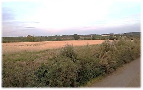
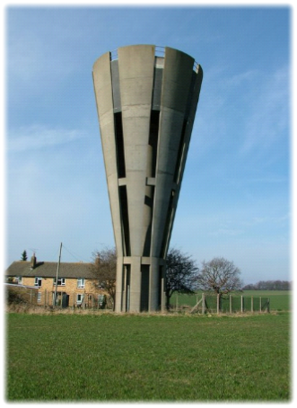
Across the fields on your right is the striking Grade Two listed, V-shaped Tonwell Water Tower built in 1964. The structure, which held 50,000 gallons of water, was reputedly sold by Affinity Water for £135,000 in the summer of 2018.

When you reach the farm you’ll be confronted by a brick building, attached to which is a HW waymark, sending you left to the back of the agricultural block and a kissing gate. Drop down to a small wooden bridge, through a kissing gate, over a second bridge crossing Chelsings Tributary and then follow the track left to the bottom of the hill. Go right, then swiftly left, and climb the steps to a field with a hedge on the left.

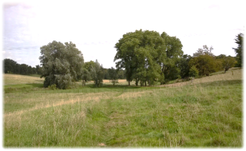
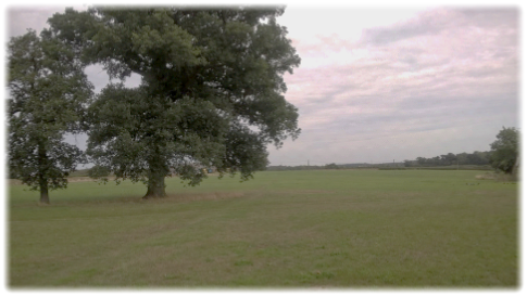
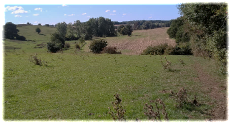
The path heads left and then bends right until an intriguing gap in the hedge line appears, enticing you to investigate.  On the other side a clear path heads diagonally to the right of a large tree (see below left) heading towards the right flank of Chelsing Farm.

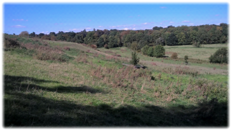
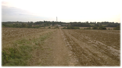
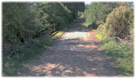
Cross a track and continue on a directed path which cuts across the next field until veering right to follow a hedge to an effective ‘crossroad’ of paths and field boundaries. Go up a small rise where telegraph poles act as way markers across the next field.  Wadesmill and Thundridge are now in view. (See below right).

Continue to a T-junction of paths and turn left. Walk along the bank to some trees, go right and drop down to emerge between two properties into Anchor Lane. Turn left and walk into Wadesmill. At the junction The Anchor pub (below left) is immediately on your right – the Three Feathers (below right) is left on the opposite side of the road. You will have travelled more than half of this leg by the time you reach Wadesmill so the reward of food and drink has been well earned. Rest your feet for a while.  But not for too long. There’s still some way to go.

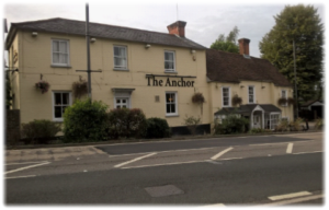
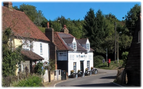
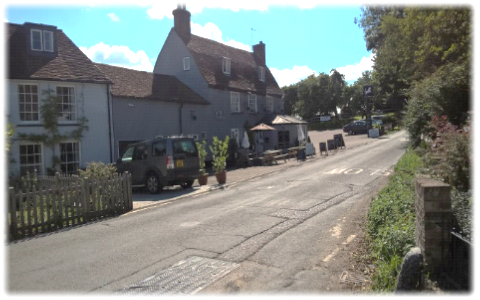
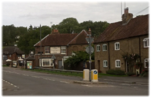
With your back to the Anchor turn right and pass over the River Rib before crossing over to Thundridge Village Stores; which looked permanently shut when I passed. I hope that situation has changed. Bear right, to once again, be reacquainted with another idiosyncratic variation of Ermine Street (below left). On the left is the White Hind, presumably once an inn, now a private home.  When the road bears right continue up a drive towards cream coloured houses when a path to Thundridge Old Church will appear.  Go through two kissing gates to join Old Church Lane which heads right to an underpass below the A10. After 50 yards Old Church Lane turns left. A Hertfordshire Way sign should and ensure you don’t miss the turning. With hedges on your left continue on the wide track until a ruined church tower emerges from the trees on the left.

Ermine Street
St Mary and All Saints Church

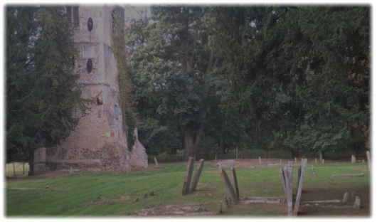
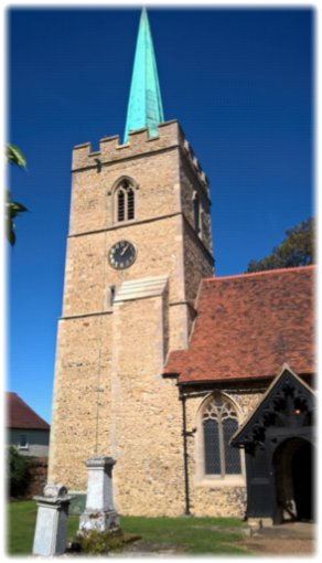
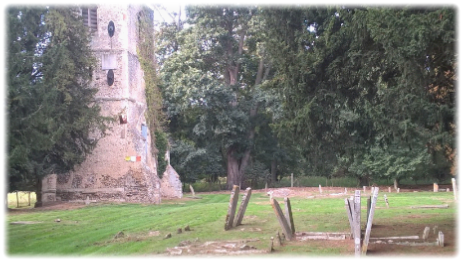
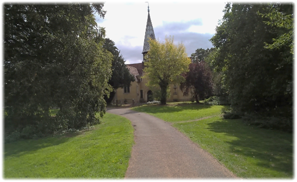
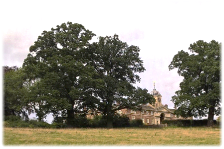
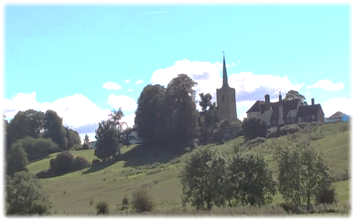
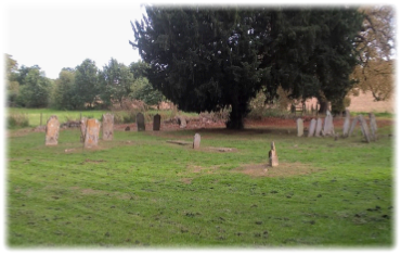
Only the 15th century west tower of the original Norman church of St Mary and All Saints (above right) and its graveyard remain, although the vestiges of a large moated enclosure associated with Thundridgebury House exist. The site is a Scheduled Ancient Monument and the tower is Grade Two listed.  In 1853 the rest of the building was demolished and the stone used to restore Sacombe church three miles away – the same time as a new parish church was built in Thundridge. Look for the 12th century doorway reset in the blocking of the tower arch.

It is worth stopping off to explore the site. The graveyard and grounds had just been mowed when I was there.  As a Scheduled Ancient Monument it must be maintained. One of the few dates visible on the heavily worn headstones was 1802. Continue on the track passing through a gate and crossing a concrete drive before bearing left to join the River Rib.  Continue with the river on your left passing a ford and bridge on your left (below).

River Rib ford
Field of Triffids

Continue walking along the river bank for nearly half a mile, ignoring any footpaths and distractions to either side.  Namely. Opposite the ford heading right uphill is a path to Cold Christmas Lane which you will meet eventually – having gone the right way!!  Ignore. Shortly after that is another line of trees heading uphill right. There is no indication there is a footpath. Ignore. Then after that there’s another track heading right towards Cold Christmas Lane. It is an official footpath but again ignore.

You need to find the next footpath further along which heads right to a bridleway between two high hedges. But – and here’s why I ‘wandered’ confusingly at this stage – there wasn’t an HW waymark at this spot. Any waymark. Instead there was a field of Triffids (above right).  Eventually I managed to pinpoint the double line of hedges and trees half way up the hill.  Head up the bridleway to arrive in Cold Christmas Lane opposite some houses. Turn right and walk to the bend in the road and then left into the drive of Timber Hall.

Pass the house and bear half left to skirt some converted barns. In 100 yards you’ll reach a small wood on your right and a marker post. When I passed, there was indeed a post – indicating a wishful thinking route through an impenetrable barrier of waste high stinging nettles and tangled undergrowth.  If someone has reopened the path with a machete and flame thrower all well and good. If not continue onwards 20 yards to a wide gap between fields, turn right and then immediately left and follow the perimeter path as it twists left then right before entering Buckney Wood. Eventually cross a footbridge and continue on a footpath to the right to a gravel drive. Turn left past Legges Cottage and reach a road near New Hall Farm by a sign declaring “Oncoming vehicles in middle of the road.”  On the stretch between Buckney Wood and Wareside there are some pleasant views across open country. (See below).

Cross over the road and continue ahead with a wire fence on your left. Go on for 100 yards to another kissing gate on the right which leads to a clear track between a wire fence and a hedge. Either keep ahead – or aim diagonally left as per Ordnance Survey map – and cross the field to a telegraph pole where you turn left with a fence and hedge on the right to a gap between trees. If no clear path ahead turn left around the perimeter of the field and then right to find the gap in the hedge line. Go down the wooden steps to the road, turn right and then left and walk into the village of Wareside. If in need of sustenance there are two pubs, the 15th century former coaching inn The Chequers (below left) and The White Horse (below right). Check opening hours. The White Horse is shut on Mondays (apart for Bank Holidays) and neither are open all day during most of the week.

With your back to the Chequers Inn turn left, cross over and locate the second footpath sign on the right. Initially a wide track, the path drops to meet a hedge on the right within which runs Nimney Bourne. Continue to where the stream joins the River Ash near a wooden footbridge which you cross and then keep right around the edge of the field to meet a disused railway track, a stretch of the now dismantled Buntingford branch line (bottom left: see leg 10b for further information). This is the stretch between the stations of Mardock and our destination at Widford which closed to passenger trains on November 16th, 1964 – a victim of the Beeching cuts. You can, of course, follow the track bed until it ends at the B1004. But you will deny yourself some wonderful vistas of the Ash valley by doing so. Assuming you choose the latter route, climb the stile in front of you and turn left on a field perimeter path to head uphill. The views behind you open up as your climb higher (below right). Go through a kissing gate and over a footbridge. Continue uphill for a quarter of a mile looking for a marked path on your left which drops down through woods to a road (A1004) on a bend.  Continue ahead – there are no pavements – with the former CPL North London coal depot on your left on the line of the old railway. It now styles itself Widford Garden and Leisure. At its entrance on a bend identify a HW sign pointing to a rickety gate.  Go through and, staying left, walk alongside Crackney Woods on a cow pat splattered path crossing the Ash again. At this point the river widens. When I passed through on a very warm day cattle waded into the water for a cooling dip and drink (bottom left).

At this point the striking copper spire of St John the Baptist in the hamlet of Widfordbury looms large over the valley (below right). Try to overlook the brutal agricultural buildings to the right which sully the scene. Keep left and march on through the pastures to a stile ahead. On the other side join the diagonal path right which joins the river again at a hedge line.

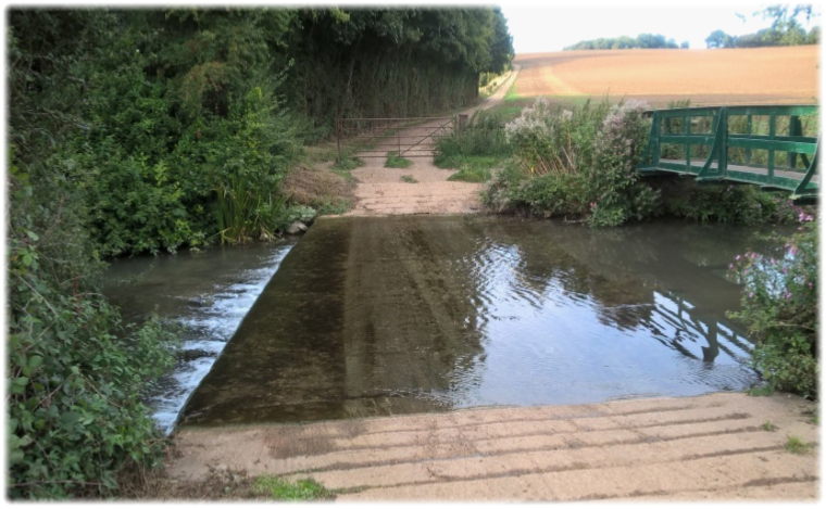
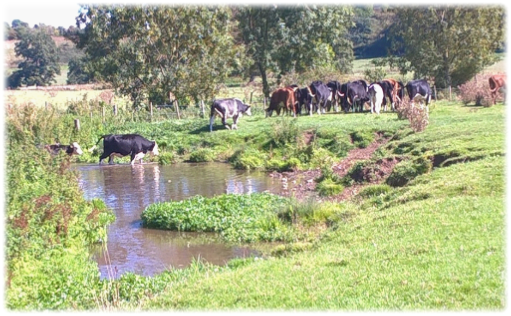
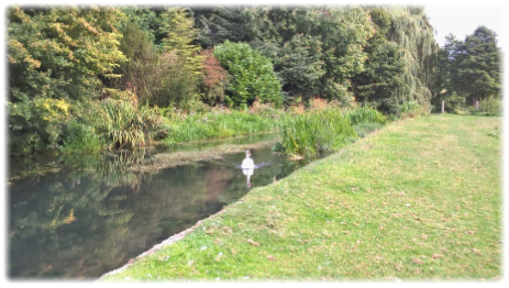
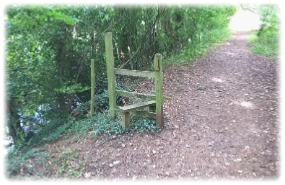
Find the footbridge and cross into the next field keeping left along the river bank until a stile is reached. The track then reaches a critical ‘crossroads’(see left) at a gate where legs 11 and 12 meet. The path before you is the start of another day’s adventure. Look forward to it – but don’t walk along it. So turn sharp right with the hedge on your left and, passing through a gate, start bearing left around the flank of the hill continuously rising until the oddity of a wooden staircase appears below the church. Head for that.  At the foot of the steps take the opportunity to look back across the Ash valley, a river that has gloriously intertwined its course with our journey across this part of Hertfordshire; (below).

Go through the churchyard and, if you have the time, explore St John the Baptist (below left and middle).

The oldest part of the church is possibly earlier than the 13th century. The current building was extended in the late 13th and 14th centuries.  Its oldest communion cup, dating from 1562, is on loan to the Abbey of St Albans where it is displayed at certain times. On both sides of the east window are faintly coloured 14th century paintings restored in 1936. In the south west corner of the graveyard is the final resting place of Mary Field (as named), grandmother of the essayist Charles Lamb who was constantly in the village when she was housekeeper at Blakesware. The church clock was installed in the tower in 1912 to commemorate the coronation of George V and is unusual in that it has Arabic – rather than Roman – numerals.

Turn left down the road – past the village sign – to the centre of Widford. Sadly the last stopping off point to have a final drink or wait for a bus, the Green Man pub (below), closed in December 2017.  Change of use to convert the building into three houses was initially rejected but approved on appeal in October 2019.   Another vital community hub destroyed.  I hope history scathingly judges those developers who clearly have little empathy with community needs but are motivated by more fiscal concerns.  Once historic pubs are gone, they are gone forever.  I have quoted Hillaire Belloc before, but it won’t hurt repeating his astute warning.

“When you have lost your Inns drown your empty selves, for you will lost the last of England.”

Oddly, while exploring the inside of St John the Baptist, a church elder told me there were once five inns in Widford.  Bearing in mind it is – without wishing to be rude – a small cluster of modest, unassuming buildings, its history must be one of raucous drink sodden revelry, probably involving thirsty agricultural workers. Either that or every villager was a passionate alcoholic!

So a long day and a long walk. But a journey not short of highlights. From the two mile long communion with the River Beane through Waterford Marsh, Stapleford and Woodhall Park; the elan and sweep of the Woodhall estate; a cross country trek from Sacombe Park to Wadesmill; an isolated ruined church; the Ash Valley; a dismantled railway track and the final stretch in company with the Ash as it meanders below a skyline dominated by St John the Baptist Church near the end at Widford. For scenic variety and dips into the area’s history this leg can never be called dull or repetitive. If we apply the “what’s your favourite leg?” test I would have thought Hertford to Widford would easily grace the top five. Arguably the top three. And it all starts again at the “crossroads” mentioned above. But that’s for another day. Reflect on today’s journey. It’s been a joy. Hasn’t it?

Next.  Leg 12.  Widford to Bishop’s Stortford and the world of sculptor Henry Moore.