Distance:  10.3 miles

Start/finish: High Street, Widford (plenty of street parking around the village); Tesco’s, Lancaster Way, Bishop’s Stortford.  Time limited parking at the supermarket though plenty of parking space in Dukes Ride and other roads opposite.

Map: Ordnance Survey Explorer map 194

Public transport: The 351 bus service runs both ways from Hertford to Tesco’s in Lancaster Way, Bishop’s Stortford.  It stops in Little Hadham, Much Hadham and outside the Green Man pub in Widford High Street. Check timetables before leaving home. If tackling the ‘original’ route to Bishop’s Stortford station, which is on the West Anglia Mainline, the 351 stops at the bus interchange close to the station.

Pubs/restaurants:

The Friends of the Hertfordshire Way, mindful of the impending intrusion of a new housing estate and allied infrastructure between the A1184 by-pass and Thorley Street, have devised and waymarked an alternative journey to Bishop’s Stortford from the village of Green Tye. The original route – as described in the first two editions of the guidebook – no longer exists. The revised third version details the new route which heads to the north-west outskirts of Bishop’s Stortford, missing out on the town centre. However, that’s no excuse not to explore it.

Route:  The bonus “loop” around Much Hadham with its showpiece rows of listed buildings, which should never be treated as an optional extra, a continuing companionship with the River Ash and the undoubted highlight – the 60 acre estate of the Henry Moore Foundation at Perry Green, home to the world’s largest collection of his idiosyncratic bronze sculptures – makes this an ever changing journey, much of it rural but never dull. The view back across the Ash valley as you climb the hill between Sidehill and Mill woods en route to Perry Green is sublime. The Prince of Wales inn half way at Green Tye is a welcome refreshment stop in an attractive village. And it is at this settlement that the new redirected route leaves the old. If you sit in the pub garden a reassuring Hertfordshire Way sign at the edge of the road opposite points the new way ahead. Remember. The latest edition of the official guide is the only one that details the updated route to Bishop’s Stortford. I have to confess I found the last half mile to the A1184, when two parallel paths set a field apart at the end of one leg, and the other the start of the next, confusing. Watch for a hard to spot sign on the right in the trees after passing between East Wood on the left and Stocking Wood on the right.  Use the electricity pylons to pinpoint where you are. They should be behind you. An unnecessary irritant at the end of a walk of two halves – and four sections. Not the very best – but a contender for one of the most beguiling.

So off we go. In Widford High Street locate the phone box next to the thatched cottage and take the footpath down to Benningfield Road. Turn left, cross over and follow the path on the right alongside number 10, passing allotments to a kissing gate. From there the route continues straight ahead dropping down to the river with pleasant views of the Ash valley (below left). At the bottom of the hill, go through a kissing gate to reach the ‘crossroads’ of four paths mentioned in Leg 11 (below right)

Take the track to the right and follow it to Pegs Lane. Cross over and walk up the concrete access road to a pumping station. The path bends left to skirt the water works and continues to climb on a perimeter path alongside a large field, with trees and, largely hidden, the River Ash to the left.  It eventually joins the A1004 Widford Road by a bus stop with a tourist sign pointing the way to the Henry Moore Foundation at Perry Green, which you’ll visit later. Cross over into Bourne Lane where shortly, by a large house on the left, a metal gate heralds the start of a two thirds of a mile walk on a wide track through Mill Wood (below left).  On the left the normally modest and unadventurous Ash widens into a large pool (below right).

On leaving Mill Wood you’ll reach another crossroads of paths (below left). You’ll be acquainted with the path on the right heading uphill en route to Perry Green on completing the “loop” in an hour and a half – maybe longer. Continue ahead on a bridleway through the aptly named Sidehill Wood (below right) to meet a road – Stansted Hill – where you turn left and walk to where the road bends right. Go through the kissing gate and cross the meadow to a ford at the junction of Malting Lane, Oudle Lane and Stansted Hill.  Don’t cross the ford over the bridge but turn right back up Stansted Hill 50 yards to a kissing gate on the left by a telegraph pole. Cross the field diagonally parallel to the fence; if the path is indistinct follow the fence on the right and then turn left towards a kissing gate.

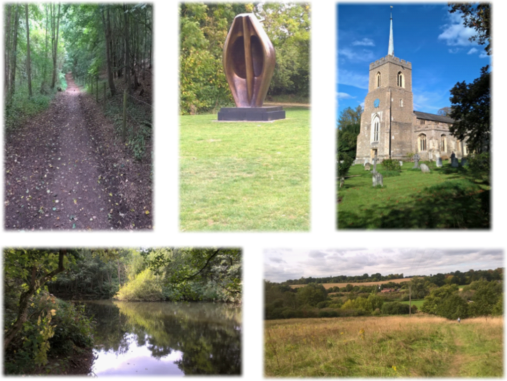
Continue ahead along a natural ‘ride’ sandwiched between banks of trees and below the self-evidently named Little Hill (left), across another meadow, through a kissing gate, across a private drive and then through a gate to a footbridge at the boundary of the meadow to emerge alongside a private house. Turn right and continue along Church Lane to reach the striking St Andrew’s set back on the right.

The west entrance to the Grade I listed parish church, built largely between 1225 and 1450, is adorned with two headstops sculpted by Henry Moore in 1953 (below).  Oddly it is shared with the local Roman Catholic congregation. Adjacent to the church is Much Hadham Palace, the country home of the Bishops of London for 800 years. It is conceivable that the Tudor dynasty had its origins at the palace. Henry V’s widow, Catherine of Valois, may have given birth there to Edmund Tudor, the father of King Henry VII.

If not visiting the church bear left down a pretty tree lined Church Lane, with the graveyard on your right, to the junction with the High Street and turn left. You’ve now reached the raison d’etre for creating the additional “loop”, namely the historic, colourful and architecturally important cottages, houses and hugely impressive detached properties facing High Street and Tower Hill. In the parish of Much Hadham – which includes the villages of Perry Green and Green Tye – there are four Grade I listed buildings and 143 Grade II listed. Some of the buildings, of varying style, have been painted in pastel colours to accentuate their heritage. Much Hadham is a linear village stretching one and a half miles alongside the River Ash. So set aside a good 45 minutes to an hour to truly appreciate the full panoply of design, structure and the historically organic evolution of Much Hadham.

The parish of what is now Much Hadham – once called Great Hadham – has been occupied since the Roman era while written records date back to the time of King Edgar. The village was in possession of the Bishops of London before the Norman Conquest and appears in the Domesday Book as Hadham. It became a strategic staging point on the road between London to Cambridge and Newmarket. The Olde Red Lion, built to serve passing traffic and trade in the 15th century, still stands, though is now in private hands and has ceased to be an inn. During World War I a British Red Cross Order of St John auxiliary hospital opened in the village – while another site became a PoW camp for Italian and later German forces during World War II, as well as housing American and Gurkha troops ahead of the D-Day landings. The camp closed in 1950.

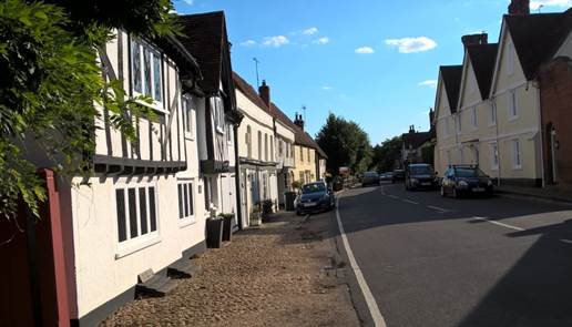
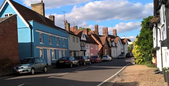
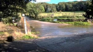
Continue admiring the High Street as you walk for nearly three quarters of a mile passing Hopleys Garden Centre on the right – where there is a café – to where you become level with the sports ground. Look for a house called Old Schoolhouse next to a safety barrier, lamp post and a telegraph pole where a No Cycling/Hertfordshire Way sign leads you left into an initially tarmacked path which drops back down into the Ash valley and the ford you met earlier. See below.  There’s a sense of déjà vu, albeit a mirror image, in the walk back to that strategic crossroads from whence you came earlier. Simply retrace your steps – namely, cross the river by the bridge and go through the kissing gate (right), across the meadow, through another kissing gate, up Stansted Hill and then right along a bridleway through Sidehill Wood to the crossroads. At this point, if coming back from Much Hadham turn left, if coming from Widford turn right and if coming downhill from the pumping station (described below) continue ahead.

However. There is an alternative if you don’t want to walk the same route back. When you get to the Old Schoolhouse keep going up the B1004 for a third of a mile passing a garage until a detached white cottage appears ahead on the left.  Just before it is a footpath sign indicating a track which drops down into the valley passing a pumping station to reach the crossroads. Purists may baulk at this option; but it is simply that, an option. The choice is yours.

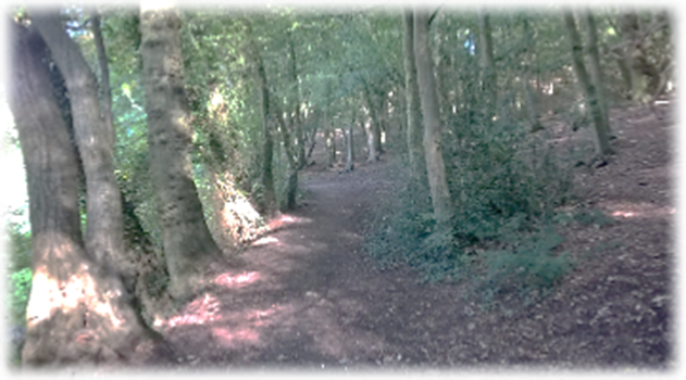
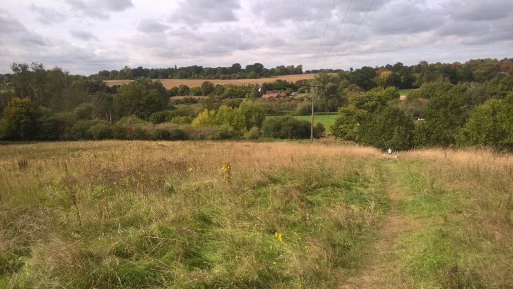
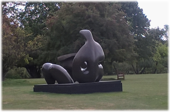
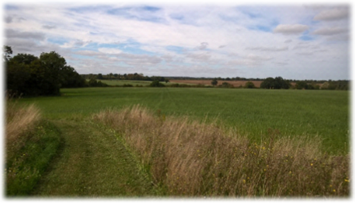
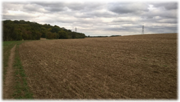
At the crossroads head up the hill past a bench with Sidehill Wood on your left. As you climb the views back over the Ash valley are excellent (below).

Where the wood ends bear left to skirt it. Almost immediately turn right onto a straight-as-a-die path across cultivated land, past a telegraph pole to a T-junction of tracks by a large oak. Turn right and in 100 yards left onto a track which passes behind The Chase Farm. Go through a kissing gate, across a meadow and then through another kissing gate to enter the Henry Moore estate.  It is a captivating and inspirational place; thought provoking, intriguing and impressive in scale and artistic genius. It merits more than just a lingering appreciation as you pass inconsequentially through the grounds. Hours should be spent wandering the estate discovering the iconic sculptures. It is worthy of a day out alone. Tantalising glimpses as you pass through will always fail to do justice to this wondrous collection. Visit henry-moore.org/visit/henry-moore-studios-gardens

Copleys café opened at the studios and gardens in 2018.  It welcomes café only visitors who haven’t paid for a Studios and Gardens ticket.

However, during busy periods, Sundays and Bank Holidays, it is reserved for ticket holders only.  NORMALLY, lunch is served from 11.45am-3.45pm.

Follow the HW waymarks through the estate passing the studios and gallery on the right to reach a green with a throwback red telephone box on your right. Behind is Henry Moore’s local, The Hoops Inn.  Cross the green to Ash Tree Cottage next to the pub, go through a gap and turn left on a perimeter path alongside a hedge. Continue to Bucklers Hall Farm, skirt a pond, swing left and stay left as the path meets up with another row of trees with a wood ahead. Just before the wood an obvious lane on the left passes a thatched house and becomes tarmacked. At the T-junction is the whitewashed, charmingly rustic Prince of Wales inn in the stylish village of Green Tye (below right) – a worthy stopping off point before the last stage.

At the T junction turn right and walk up the road passing a village notice board and a post box to locate a waymarked gap in the hedge line to enter a large field. Turn right and follow the edge of the field as it curves left. At a drainage ditch bear right and head downhill to meet another path. Turn right with Guy and Wright Nurseries on your left (below left). (The company which produces tomatoes for supermarkets in three acres of glasshouses also has its own anaerobic digester complex to produce biofuel, the only commercial unit in the world where the biogas exhaust is cleaned to provide carbon dioxide for growing the tomatoes). Continue walking downhill (below right) watching out for a narrow path on the left which runs between gardens to emerge in Dane Bridge Lane. Turn right downhill to Danebridge Road where you turn right and walk a third of mile to the B1004 at Dane Bridge (bottom left).

Turn right and almost immediately left to pick up a track on the opposite side of the road heading to Bury Green.

From here to Bishop’s Stortford it is a straightforward and leisurely ramble through largely open countryside to journey’s end. But look out for the HW roundels to ensure you are on the right path. You’re unlikely to meet anyone until you get near the town.

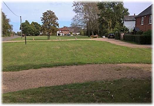
From the Bury Green sign take the track behind outbuildings and follow it for half a mile as it skirts the fairways of Great Hadham Golf and Country Club; if you’re a rotten golfer like me you will be pleased to learn that the course has few bunkers!

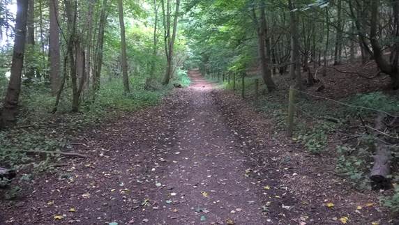
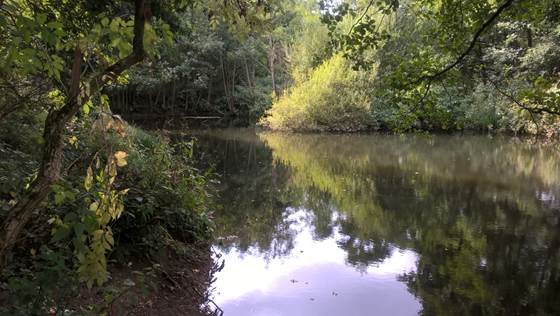
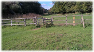
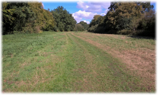
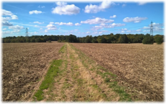
As the tree line peters out go through a gate to enter a large meadow with a stream on your left. Continue, crossing a rough track, the right one heading up to the clubhouse. At the end of the meadow go through a gate and stick to the bridleway with the stream still on your left. Harveys Wood is now on your right. Shortly after the woods end continue on over a footbridge with the stream still on your left. Where the path crosses Lower Road – actually a muddy public byway – continue on the bridleway (below left) before a footbridge on your left leads you, immediately right, into Stocking Wood. You’re now approaching that tell-tale line of electricity pylons which can be seen on the skyline. When you get to the pylons turn left parallel to them and follow the bridleway (below right). Look for an easily missed path in the trees to your right, cross the footbridge, and embark on the last third of a mile cutting through broad cultivated fields (bottom left) to a fork.

You now face a choice, unless you need a train or a town centre bus to get home. The new “official” route ends at Tesco’s supermarket the other side of the by-pass. But a true purist won’t be able to forsake the opportunity of making that extra effort to reach Bishop’s Stortford proper. At the fork take the left path if you are heading for Tesco’s which will take you under the A1184 into a cul-de-sac called Lords Avenue. Turn left into Duke’s Ride – where you may have parked earlier in the day if you are a two car walking team – and from there to Tesco’s.

If a praiseworthy twinge of conscience convinces you that overlooking the town centre would be unforgiveable then embark on the relaxing and untaxing stroll on smooth tracks and tarmac paths that’ll take about 20/25 minutes to reach the unmistakeable spire of St Michael’s Church. So, take the right hand fork to a stile alongside the by-pass. Cross over using the traffic island and climb the stile opposite going through a neat stand of trees to a large field/sports pitch. Climb another stile and then turn left along the tree line to another stile. The path now heads diagonally across a large patch of grass to a gate and stile in a fence opposite Hillmead Primary School. Go over and bear right over another stile to meet a tarmac road. When the tree line on the right ends pinpoint the track on the right that runs alongside a hedge on the left. Continue through a kissing gate, bear left and then right alongside an all-weather sports pitch. Continue on a tree-lined tarmac path (above right) which cuts through the playing fields. A track will eventually appear virtually straight ahead of you. Go down it, through a kissing gate and continue with Bishop’s Stortford College Sports Hall and Bishop’s Stortford Swimming Club behind the fence on your left. You’ll emerge into Bells Hill. Turn right and then swing left at the roundabout into Windhill with St Michael’s ahead on the right.

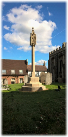
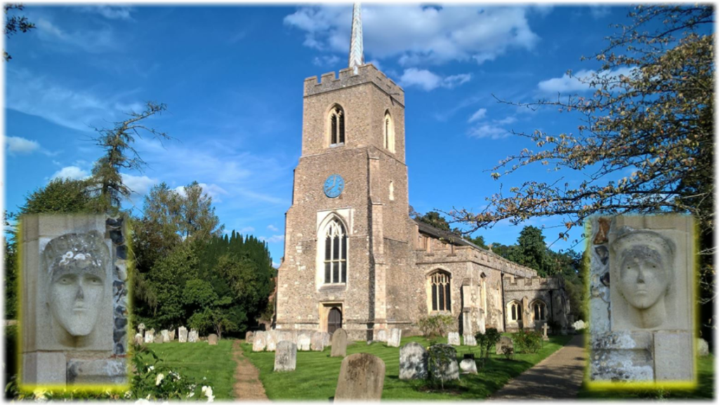
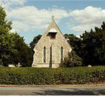
The Grade I listed St Michael’s – saintmichaelweb.org.uk – crowns the hill above the fording place of the River Stort and dominates the skyline for miles around. It is unusually large – 52 metres long with a spire 56 metres high – and has been associated with the Bishops of London since the Norman Conquest. Only the baptismal font from the Norman era survives. There has probably been a church on the site since the 7th century but St Michael’s as seen today was largely built in the Perpendicular style in the 15th century. It was altered and restored in both the 17th and 19th centuries. The belfry and spire were built in 1812. In the churchyard is a World War I memorial market cross made of limestone (right).

Intriguingly the River Stort is named after the town, not the other way around.  A Saxon settlement evolved on the site named Steort-ford; the ford at the tongue of land. In 1060 William, Bishop of London, bought Stortford manor and estate for £8, leading to the town’s modern name.  At the time of the Domesday Book the village had a population of around 120.  The Normans built a motte-and-bailey structure called Waytemore Castle; only earthworks, the large motte, and the foundations of a round tower remain.

In 1769 the River Stort was made navigable and the town became a stop on the mail coach road between Cambridge and London. By 1801 Bishop’s Stortford had grown to be a market town and a corn exchange was established. The main industry was malting. In 1842 the railway arrived.  In the census of 2011 the population had reached 38,000.

If you’re heading home by bus or train then walk to the traffic lights at the bottom of Windhill and turn right through Market Square, along South Street and left into Station Road crossing the river to reach both travel hubs.

In hindsight this leg can be divided into four sections – one of which, theoretically, you could miss. But it would be shameful to forsake the Much Hadham ‘loop’. The striking highlight, for walkers all too brief, on the stretch between Widford and Green Tye is Henry Moore’s peerless, iconic legacy at Perry Green. The third section from the Prince of Wales pub to Bishop’s Stortford is a decorous tribute to unalloyed cross country walking; untroubled, almost certainly shared with few, if any, other walkers; weaving through woods, meadows and around fields. And it is a reminder that the official route from Green Tye has changed significantly. So watch carefully for the new directions and don’t drift off route. And then, of course, the simple – but stand-alone if necessary – walk into town from the by-pass.

It is an eye-catching journey with varied stop-offs to savour historic architecture, historic art, historic inns and a large historic church. It lifts the spirits.

Next. Leg 13.  Embracing a quintessential English landscape on a picturesque rural ramble to Hare Street