Distance: 10.5 miles if starting from the Tesco supermarket on the by-pass; 12.4 miles if starting from Bishop’s Stortford station; 12 miles if starting from St Michael’s Church in the centre of town. If starting from the station or the church retrace the route to Tesco described at the end of Leg 12.
Start/finish: Tesco, Lancaster Way, Bishop’s Stortford, CM23 3BL / Bishop’s Stortford station, Station Road, CM23 3BL / St Michael’s Church, 1Windhill. CM23 3ND. Finish at the Beehive pub, Hare Street, SG9 0DX.
Map: Ordnance Survey Explorer map 194.
Public transport: The 28 service from Buntingford to Bishop’s Stortford only seems to run on Monday and then only one bus a day. The 386, Bishop’s Stortford to Stevenage service, calls at Hare Street twice in the evening. Check the web for up to date timetable. If you are relying on public transport do your homework studiously. This rural part of Hertfordshire around Hare Street is not well served and using the web to try to unravel what bus goes where and when is a tortuous experience.
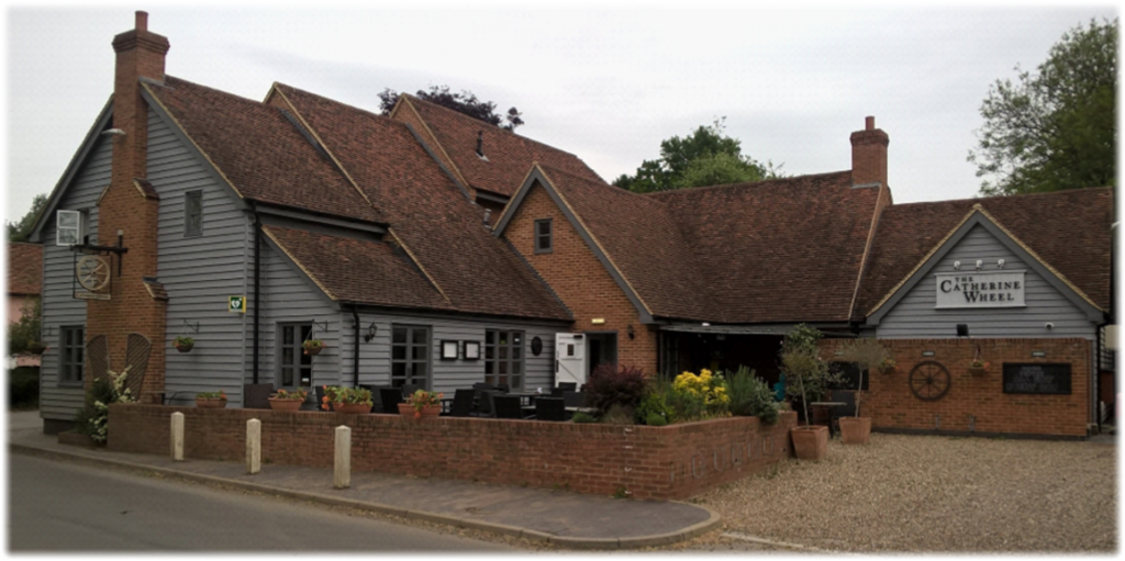
Pubs/refreshments: The Catherine Wheel, Pelham Road, Gravesend, Albury, Ware SG11 2LW. Open 12am-11pm every day. It is the only chance of refreshments en route.
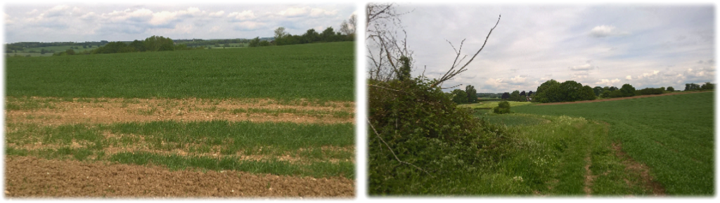
Route: Did you know that of the 634 square miles Hertfordshire covers, 60 per cent of the land is farmed? And two thirds of those acres are linked to arable crop production? If you needed evidence that these figures are correct then this is the leg for you. You’ll share most of the day’s walk with thousands of acres of cereal crops – whether following paths around fields, straight through fields or cutting diagonally across fields – or, if tackling the journey later in the year, thousands of acres of a ploughed and cropped landscape. This is a heavily rural section. Lonely, often peaceful, with sweeping views, discreet little corners, humble hidden footpaths and few people. It’s hardly “wilderness country” but the sense of isolation will occasionally be profound. Apart from the Hadham Hall estate and Patmore Heath you’ll pass a few scattered buildings – but certainly no village shops to replenish food and drink; though you will be starting very close to a Tesco for provisions. I walked the second half of the leg, from the Catherine Wheel pub to Hare Street, twice. The first time a friend and I were caught in an unexpected, but relentless, fine drizzle downpour which blotted out the horizon and transformed the countryside into a miserable shroud destroying any hope of taking decent pictures. I returned on a guaranteed sunny day and completed the task. Proof, if it were needed, that walking on fine weather days is an option never to be sniffed at. And with the Hertfordshire Way you can forensically pick and choose. Bishop’s Stortford to Hare Street is a distinctive leg and one that – looking back at the year’s walking adventures on a cold winter’s night – you may remember more out of affection than adoration. Don’t forget. The original route has been changed to pre-empt obstacles for when the two-lane by-pass carrying the A120 around the northern edge of Little Hadham is completed. Ultimately, it doesn’t matter. Just set off for a blissful day’s walking.
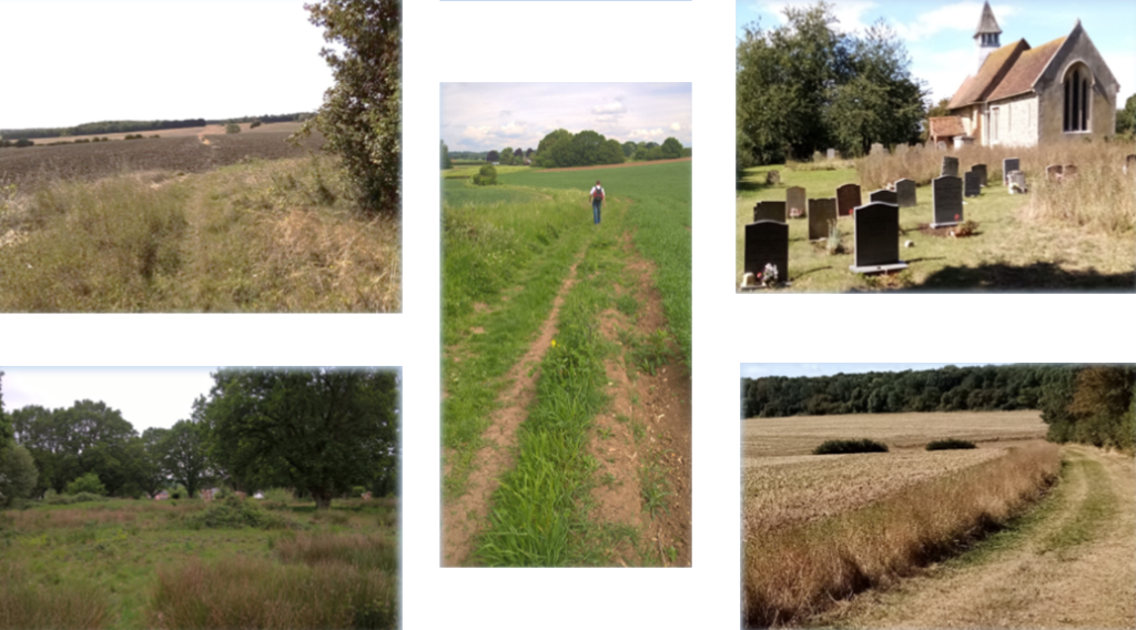
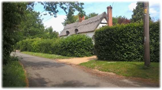
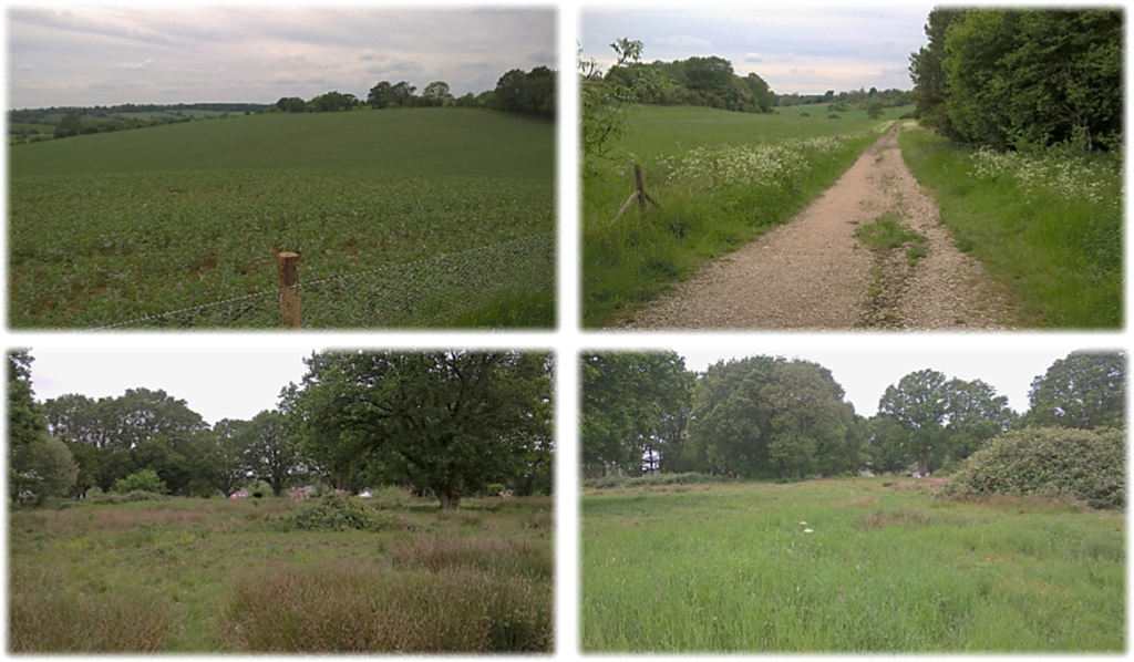
At the roundabout leading into Tesco take the road opposite – Duke’s Ride, which has ample on street parking – and walk to where a Hertfordshire Way sign opposite Squires Close leads you into a public footpath and through a small wooded area to appear at the A1148, Taking care, cross over to where a clear HW sign points to a track down the right hand side of a field with thick hedges on your right (see below left). Pylons and a wood lie ahead. Follow the narrowing path into a wide grassy area with a clear path (below right), turn left and head to where a gap emerges between East Wood on the right and an obvious hedgerow ahead, right of a small concrete bridge. Keep along the hedge until you reach a road junction at Cradle End with a sign directing you to Green Street. Continue ahead for 250 yards to a footpath on your left opposite a telegraph pole, behind which stands a charming thatched cottage (bottom left).
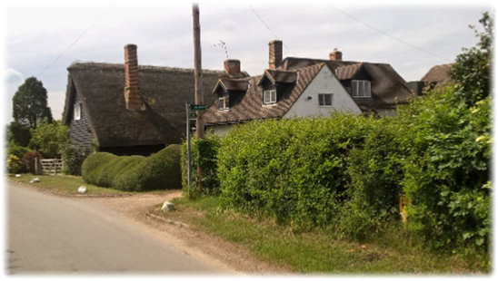
Go through the gap and turn immediately right following a 90 degree turn around a paddock to where the path turns hard right with a hedge on your left. Follow the path as it sinuously tracks through a number of fields to reach Millfield Lane opposite the eponymous cottage (top right). At a wooden telegraph pole take the path alongside the property entering a large field (below left). Follow the hedge to the corner of the field where you turn right to follow an obvious grass track (below right) with a hedge on your left until the track bends left heading towards the corner of the beguilingly named Muggin’s Wood! When you reach the wood the track turns sharp right and drops downhill to join a tarmacked road taking you through Stone House Farm to the A120 Stortford Road.
Told you there was a lot of agricultural land on this leg!
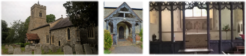
Cross carefully into Church End opposite and walk 200 yards to a post box on your right. Opposite, between a white house and a cream bungalow, is the entrance to the churchyard of the Grade One listed St Cecilia’s with its conspicuous ‘Hertfordshire spike’- remember St John the Baptist Church in Aldenham visited in Leg 8? – its tilting medieval porch and three deck pulpit. It’s certainly worth a stop-off.
The tower at St Cecilia’s is circa 1400 while the timber south porch looks to be on its last legs until you look at a drawing done by Victorian architect John Buckler and see it had a dangerous tilt in the 1850s – and has yet to topple over. The early 17th century brick north transept is striking; its big four centred arch is wide enough for the interior to read as T-shaped, especially as the box pews throughout the church face the three decker pulpit of 1633 against the south wall. This Protestant preaching box is still common in Ulster and Scotland but fell out of fashion in England in Victorian times. The transept looks more early Jacobean rather than Tudor and once held a gallery which, when removed, revealed painted texts.
Continue up the road with a fenced paddock on your right to a footpath sign which leads you behind stables on an enclosed shrub-arched track to skirt a rather rancid looking pond emerging in front of an impressive gatehouse (below left), some of which extends back to the 1440s. You are now at the heart of the historic Hadham Hall estate which has undergone wholesale demolition and rebuild over the centuries, though the manor itself is mentioned in the Domesday Book. On the left is a magnificent brick Tudor barn, built as a granary (below centre) and to the right is Hadham Hall (below right) now converted into private homes.
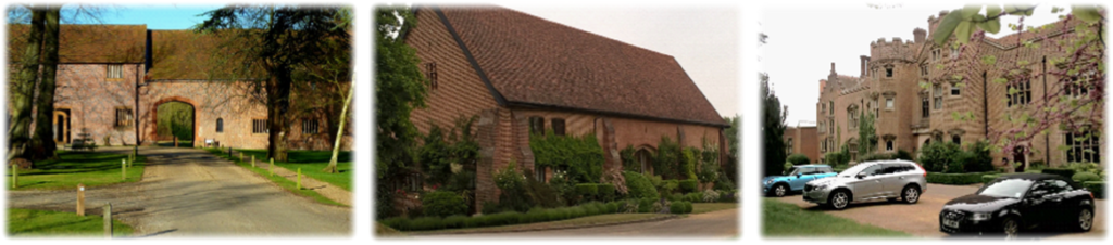
The site of Hadham Hall was first settled by the Catuvellauni, one of the Belgic tribes that led Celtic resistance to Julius Caesar’s invasion in 53 BC. (Remember Devil’s Dyke – Leg 4?) The history of the manor of Hadham dates back to the 11th century when William, Bishop of London, owned it. At his death, in 1076, William the Conqueror made a grant of land in Hadham to William of Baud in Normandy, who had followed him to England at the time of the conquest. His name is recorded in the Domesday Book as Lord of Hadham. He built the first Hadham Hall surrounded by a stockade and moat. By 1440 brick was taking the place of wood for house construction so Thomas Baud built a far more substantial manor house on the site of the original. The second Hadham Hall stood for 130 years but all that remains now is the eastern section of its gatehouse, a barn and part of an old cottage. In the late 15th century a number of social and economic changes forced the Baud family to sell Hadham Hall and its 980 acres. It was bought by William Capel, the son of a Suffolk squire, who made his fortune trading in London and twice became the capital’s Lord Mayor. Over the next 20 years extensive alterations were made to the hall even though Capel remained at his estate in Essex. Between 1572 and 1578 Capel’s ancestors demolished the second hall and built the Elizabethan mansion, parts of which stand today. One of the guests who lodged there was Elizabeth I.
In the 1630s Arthur Capel – soon to become a Hertfordshire MP – added a banqueting room and Italianate garden. In the years after 1669 Hadham Hall fell into disrepair, possibly due to the cost of the Civil War or the impact of the plague which raged in Bishop’s Stortford and the surrounding area. The mansion was partly converted into a farmhouse, the estate divided up into three farms – though still under the ownership of the Capels – and the banqueting hall demolished. Up until the start of the 20th century Hadham Hall was farmed by a series of tenants. Finally, in 1900, George Devereux de Vere Capel, the 8th Earl of Essex, sold the hall and land to prosperous London merchant William Minet who began to restore the existing buildings to their former state. In 1948 the Minet family sold the hall and the manor to Hertfordshire County Council which spent £65,000 converting it into a co-educational school which opened in September 1952 with 142 pupils. The school survived for 38 years until the county council decided there were too few pupils to justify the expense of keeping it open. The listed house, outbuildings and 40 acres of land were then put on the market for £3 million. For more information log on to stortfordhistory.co.uk/thorley/hadham-hall
Head towards the arch in the gatehouse passing a slab of the conglomerate pudding stone; though not as big as the piece in front of Kingsbury Mill in St Albans (Leg 4). Pinpoint the waymarks as you bend right then left bisecting two equally rank looking ponds. Then left and right into a large field. From the field corner head up the obvious gravel driveway in front of you with a hedge on the left on a simple mile long walk to the hamlet of Upwick Green. Ignore the track on your immediate left and aim for what looks like a small island of trees. In fact the trees hide a circular moated artificial earth mound surrounded by a shallow ditch. The most probably explanation is that the feature is a moated mill round or an ornamental landscape feature connected with Hadham Hall.
Continue ahead. When my companion and I walked this stretch in late May 2019 preliminary work had already started in the distance building the £40 million, 2.3 mile Little Hadham bypass. It officially started on July 23 and is due to open to traffic at the end of 2020. It was sad to think that the bucolic charm of the lush, rolling acres on either side of the track, heavily cultivated of course and spreading to the horizon, would soon be bulldozed as the ugly scar of road construction carves its way across the landscape. On the other hand. If you’ve ever sat at the traffic lights in Little Hadham for what seems an eternity a by-pass will be a salvation.
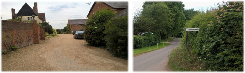
Keep going until the bridleway swings half left, again ignore the track joining it from the right, with the hedgerow on your right. You’ll soon pass Upwick Hall (below left). Walk down the drive to a lane, turn left and head into Upwick Green. Continue past a thatched house and look for a wooden telegraph pole, a whitewashed house and a sign pointing to Brooks Farm (below right). There is a HW sign in the hedge.
Continue northward along the track – forgetting a drive on your left which leads to a square of buildings – aiming for the edge of Upwick Woods (below left). The path is bisected by tracks either side. Ignore. The track then briefly enters a copse before following a hedge downhill to Mill Lane and the quaint looking Bogs Cottage. Turn right for 50 feet and then immediately swing left onto a clear track (below right) which heads directly to Patmore Heath. You emerge between houses with a HW roundel on a small post in front of you. Cross the common for 50 yards (bottom left and right) and then head half left to an information board and, with houses in front of you, take the road on the right to The Catherine Wheel pub and restaurant on the Albury Road. Remember. This is the only stop for food and drink en route.
Patmore Heath, a Site of Special Scientific Interest, is probably the best remaining example of grass heath in Hertfordshire – a scarce habitat in south east England – which sustains its own ecological system. The area was probably cleared of trees during the Bronze Age and for centuries would have been grazed by livestock, a practice which ended in the 1930s. The information board shows five ponds on the heath, through in the summer you’d be hard pushed to find them. Nevertheless they are home to the three species of native newt (like the pond on Bricket Wood Common – Leg 8). The reserve is typified by wavy hair grass, red and sheep’s fescue grasses and sweet vernal grass, with characteristic summer flowers such as heath bedstraw and sheep’s sorrel. It is protected by the Herts and Middlesex Wildlife Trust.
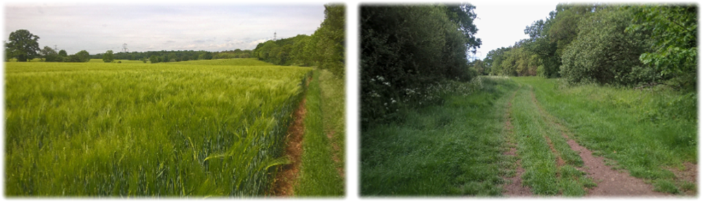
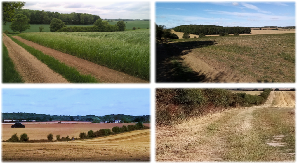
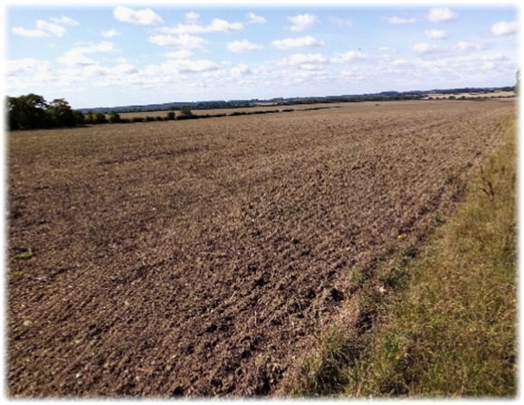
Turn right along the road and, after the last house on the left where the road bends right, take the wide track signposted on the same side at the start of a mile long walk to Patient End. The landscape is quintessential Hertfordshire, with rolling terrain and hundreds of cultivated acres – told you! – stretching across the valley of the River Ash to the skyline, the vista broken up by large islands of woodland. On a summer’s day (below left) it is a captivating view, the changing seasons and wide scale harvesting leaving it no less impressive in early autumn (below right and bottom left)). Continue on the track as it dips and rises with woods on your left to reach an isolated house with a large garden at a crossroads. On both occasions when I walked this section there was no HW sign in any shape or form indicating which of the three routes is the one for you.
So DON’T be tempted to go left or straight on. The path is to the right. With a hedge and wild fruit bushes on your left (bottom right) it drops down to a ditch and then ascends to emerge in The Causeway. Turn left and virtually immediately right on to a wide gravel drive to Patient End Farm. Pass the farm and pick up the path that swings left.
The path then angles away westward drifting left and right between a hedge/s with High Wood ahead of you. At the bottom corner of the wood cross a bridge and go left alongside a ditch. Turn right, keeping the shrubs and the ditch on your left (below left), and continue for near half a mile to Rotten Row and an eye-opener of a pond (below right). As ponds go it’s one to envy; making mine look like a piddling puddle. The setting, after miles of unrelenting agricultural land, is a charming interlude.

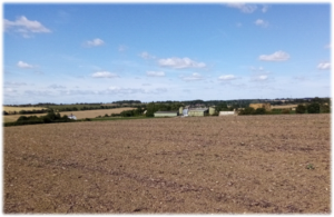
Skirt the pond and garden to reach a drive. Turn right and a HW sign (below left) identifies a trailblazing path diagonally across the field in front of you aiming for the corner of a wood. Enter the wood and bear right to appear in a field where the clear path heads towards the corner of a hedge. Keep it on your left until your reach a “crossroad” of conjoining hedges. Head left on the mile long trek to Mutfords Farm with far-reaching views across miles of unbroken farmland (below right).
Eventually the hedge runs out and turns 90 degrees right. Go the same way for about 50 yards to a cross field path (left) which heads directly downhill. If you’ve got good eyesight you might be able to pick out the waymark post at the bottom. On reaching the hedge turn right and walk through the farmyard. Ignore the gate and road on your left and pinpoint a path which runs parallel to the front garden passing some large outbuildings. Continue ahead to a hedge, turn right for 70 yards and cross Little Hormead Brook. Continue ahead for a third of a mile with the hedge on your right. As the path climbs the ancient church of St Mary the Virgin at Little Hormead slowly appears. On reaching Duck Street turn left to the church.
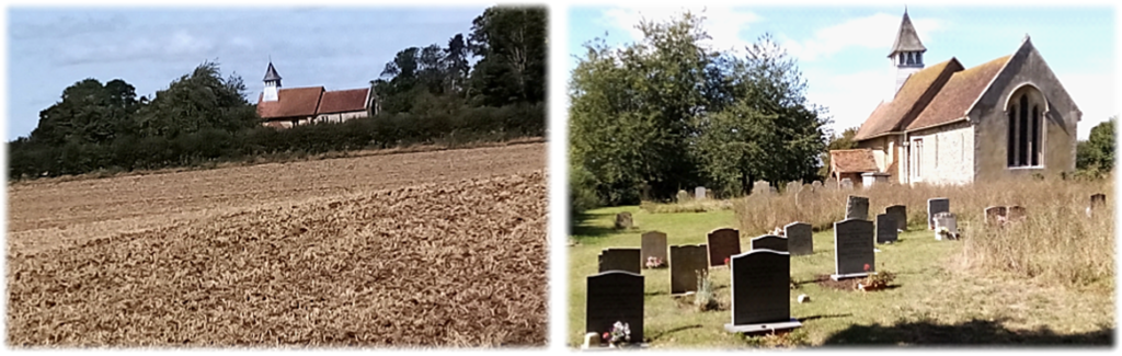
Although now redundant, the Grade 1 listed 11th century St Mary the Virgin is protected as a rare, precious and outstanding architectural and ecclesiastical gem, noted for its craftsmanship in wood and ironwork. The Anglican place of worship, mentioned in the Domesday Book, contains a wealth of antiquities including an exquisitely carved 14th century font and an unusual set of Charles II Royal Arms dating from 1660. There are two Norman doorways. The original one, made with wood and ironwork, is more than 1,000 years old and stands preserved inside the church. The chancel was rebuilt in the 13th century and a bell turret containing two bells – one of which is among the oldest in Hertfordshire – was added in the 15th century. In the 13th century St Nicholas Church was built in Great Hormead and Little Hormead lost its independent rector in 1886. The church is under the care of the Churches Conservation Trust. Viewing is by appointment only.
Just after the churchyard on the left a track heads downhill towards a gap in the hedge line. Go through it – don’t take the path ahead – and immediately turn right and walk to Worsted Lane. Turn left and cross an old bridge with its quaint, anachronistic sign clearly from another era which reads:
“County of Hertford. Take notice that the bridge is insufficient to carry weights beyond the ordinary traffic of the district and that owners and all persons in charge of locomotives and other ponderous carriages are warned against attempting the passage of the bridge.”
Locomotives? Ponderous carriages? I thought we had traffic problems! Shortly after the bridge on the right is a gap in the hedge from where a path climbs through scrappy scrub and grass to join the B1368 in Hare Street. If you seek refreshment turn right and walk to The Beehive inn.
It was Samuel Johnson, the writer, playwright and essayist, who curmudgeonly coined the epigram: “When you have seen one green field you have seen all green fields.” I am sure he didn’t walk the Hertfordshire Way – certainly this leg – but fellow cynics who baulk at words like rustic, bucolic, rural and pastoral will subscribe to his smog-filtered urban griping. The rest of us, seduced by the undulating, colourful and humble patchwork of fecund acres, will joyously experience the often empty landscapes and wide horizons of this extensively farmed northern part of the county.
It’s certainly a strikingly different leg than say Codicote to St Albans, Tring to King’s Langley or Broxbourne to Hertford which are arguably more varied and interesting. But it would be folly to sell Bishop’s Stortford to Hare Street short. If you enjoy unencumbered lonely field walking, with highlights including two ancient churches. Hadham Hall and the rare ecology of Patmore Heath, this penultimate section is one to savour. Though what detours – or a bridge! – may impinge on the route when the Little Hadham by-pass is completed will be one for the road planners. They’ll hopefully have the vision to avoid leaving too brutal a scar on this currently untroubled area of countryside. Enjoy the walk and disprove Samuel Johnson wrong.
Next. Leg 14. Hare Street to Royston and the end; or the beginning. In the words of Simon and Garfunkel it’s Homeward Bound.