Distance:  12.6 miles  

Start/Finish:  Start opposite the bus stop and to the right of a cottage called Timbers on the B1368 which runs through the linear village of Hare Street; finish at the Royse Stone at the junction of King Street, Melbourn Street and Baldock Street, Royston.  

Map: Ordnance Survey Explorer map 194 and 209.

Public transport:  There seems to be a convoluted bus journey from Royston to Hare Street – and vice versa – which involves the 18 service from Royston to Buntingford and then the 331 from Buntingford to Hare Street.  This leg seems only tolerably achievable by taking two cars parked at either end. Or a taxi is involved.

Pubs/refreshments:

Unsurprisingly there are many pubs, cafes, restaurants and hotels in Royston at journey’s end.

Route:  The Hertfordshire Way’s swansong is, fittingly, a walking tour de force with much of interest crammed into the 12 and a half miles. The finale, when you reach the brow of a rising path en route to Grange Farm revealing a striking panorama across Cambridgeshire and the Fens, is a topographical pay-back for the hours walking muddy field perimeter paths, tarmac roads, lengthy stretches of sun deprived woodland and endless pastures of cow pats and horse manure endured during 195 miles. But before that you’ll encounter some wonderful historic churches, a walk across the skeletal remains of a World War II airfield, a museum and two memorials commemorating the American airmen who were based there, architecturally graceful Barkway – arguably the nicest village visited on the entire walk – tracts of uncompromising north Hertfordshire farming landscape, some cheery isolated pubs and then that long, unerring descent from the escarpment into Royston to complete the circular journey. 

There have been some, though not many, disappointments and dreary sections among the 16 legs that the committed rambler should have tackled. It might have taken weeks, months or even years – it should never have been a race or even a test of endurance – but being reacquainted with the Royse Stone should engender feelings of pride, satisfaction, perhaps even smugness, that you’ve travelled and experienced a bewitching meandering route that took you from Royston on the Cambridgeshire border to almost cross the threshold into a north London borough.  You may even have become an expert on village ponds, learnt to be reverentially inquisitive while visiting ancient churches, been assured that isolated out of the way pubs can still thrive and seen evidence that Hertfordshire’s rare and precious chalk streams are at risk because of over extraction.  But it’s those hundreds of square miles of undulating farmland that will probably remain the striking memory of crossing a fertile, vibrant and flourishing county.  It was almost certainly a walk of personal achievements and shared memories.  And I am sure you’ll agree you’re indebted to the diligent, comprehensive and studiously updated HW signposts and roundels that have been your trusted companions courtesy of the route’s guardians, the Friends of the Hertfordshire Way.   Now you have a choice.  Bask in the glory of having completed the long distance footpath and clocked up a worthy walking milestone – to be fondly remembered in times to come with stories to relive and experiences recounted – or take a breather, clean your boots, restock your rucksack, turn around and set out on the 195 mile journey in the opposite direction!   An aimless challenge?  Or an ‘undiscovered’ and possibly heart-warming variation on a theme?    I guess it depends on how sore your feet are.

But before then let’s go back to Hare Street and embark on the last day’s walk.

Find the narrow, straggly footpath alongside the property Timbers and follow it through a field to a recreation ground.  Pinpoint a bridge in the hedgerow slightly right to cross the lacklustre River Quin – though I did this leg during the summer – to emerge into a large farmed field.  You’ll see a path slightly right and then straight on heading for some woods at the top of the moderate ascent.   Go through a kissing gate to enter a meadow.  Ahead is an obvious gap in fences hemming in the driveway to Great Hormead Bury.  Go through both to emerge in another meadow with tidy, symmetrically planted and well tended trees forming an enticing avenue (below left).  Don’t be too distracted not to spot a kissing gate in the treeline on the right and a path alongside the house into the churchyard of St Nicholas (below right).

St Nicholas Church

St Nicholas was constructed in flint rubble with stone dressings over a period of years, beginning from about the beginning of the 13th century.  It is now predominantly 19th century; the Victorians, with their major restoration in 1873, rescued a badly decaying building.  The nave is the oldest part of the building and was lengthened by a west bay in the first half of the 14th century. http://www.achurchnearyou.com/great-hormead-st-nicholas/

Walk through the charming churchyard before locating a gate in the far left corner which gives access to Horseshoe Lane.  Ahead is a sign posted wide track leading to a meeting of paths where you turn left following another track to the corner of the field.  With the houses of Willow Court on your left leave the track and locate a kissing gate which leads to a meadow, a second kissing gate and then a narrow path between gardens leading to some steps which drop down to the B1038.  Turn left if you’re thirsty, though you haven’t gone very far yet, to the Three Tuns which is two minutes’ walk. 

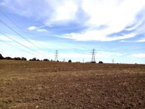
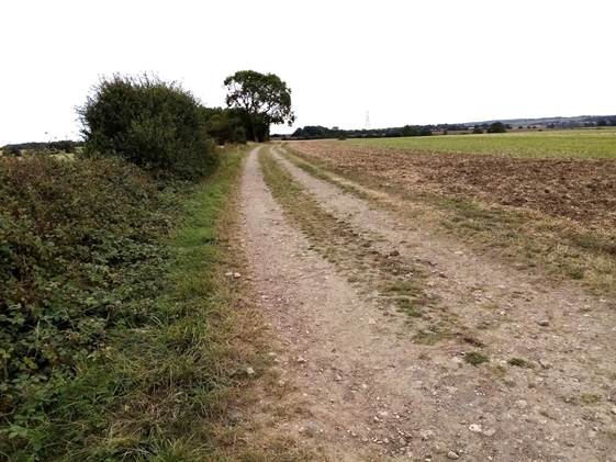
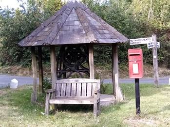
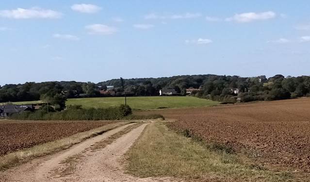
If not, turn right and first left into Hall Lane and follow the road to the entrance to Great Hormead Hall. Locate a footpath on your left which runs alongside a hedge, then two more kissing gates in quick succession to pop out at the track running around the back of the farm.  Turn left, head straight on and follow a field perimeter path in the company of parallel rows of landscape scarring electricity pylons (left).  There are 88,000 of them around the UK, and with dismantling costs estimated to be £7 million each – and then the huge expense of replacement underground cables – I suspect they’ll disfigure the skyline for the long-term future.   When you reach a narrow road turn right and walk for just over a quarter of a mile, past another pylon on your right, to a small copse on the left at the end of which a footpath heads diagonally across the adjoining field towards a hedgerow and a few isolated trees.  Cross a bridge, turn right and then virtually immediately turn left on to a grassy track which heads unerringly – bisecting a small patch of woodland -to emerge, after a two third of a mile long cross country trek (below left) at Daw’s End.

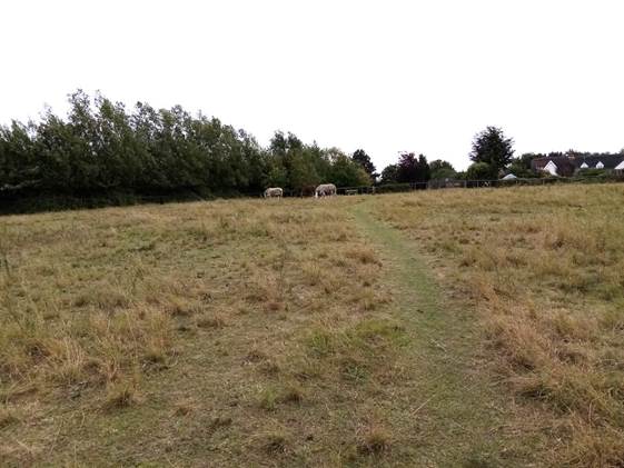
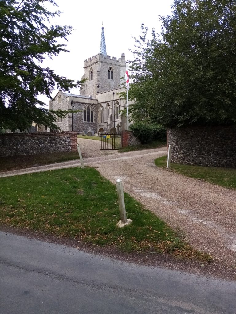
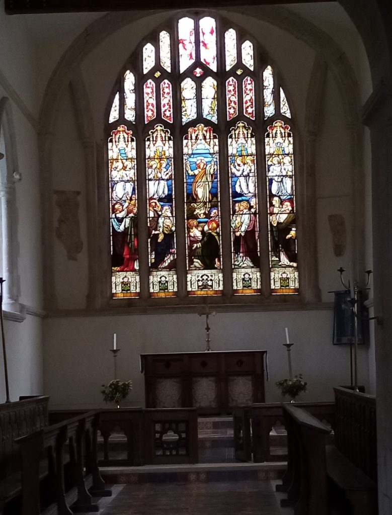
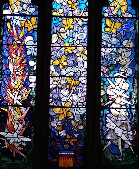
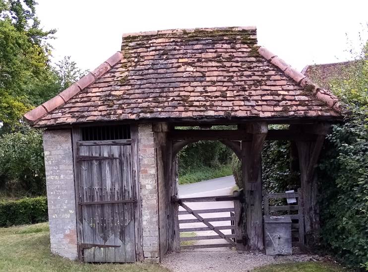
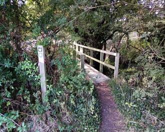
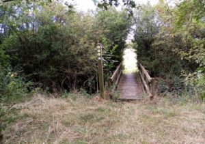
Cross the road to a kissing gate opposite and go through two more kissing gates and across a bridge, turning left to drop down through a meadow (above right).  When you reach a sturdy looking wooden bridge (left) note the HW roundel directs you left before the crossing along a path between hedges to veer slightly right when you near the road to cross a relatively new bridge. It has a HW sign to confirm that you’re still on course.   Turn right and climb the hill past the primary school to the centre of Anstey and St George’s Church which, with its striking gate, lock-up and impressive stained glass windows, is well worth a visit.  Not to do so would be folly and a missed opportunity to admire what others have knowledgably acknowledged as a true architectural and ecclesiastical gem.

The Shell Guide called it the “most loveable building in the county.”

St George's Church
St George's Church

The Grade One listed St George’s Church is a medieval building in a dominating position dating from around 1170.  The mound on which it stands is probably artificial and marks the meeting point of ley lines.  The present church is the third on the site.  St George’s is cruciform in plan like a miniature cathedral retaining its Norman core, crossing and lower tower completed in 1175.  The chancel transepts and nave are early English finished about 1290, probably recycling stones from the castle next door which was demolished on the orders of Henry III earlier in the century.  The upper tower with its distinctive ‘Hertfordshire spike’ – and we’ve seen quite a few on our journey – was added later.  The font is one of only two in the country of its style, with mermen holdings their tails.  The church is noted for its abundance of early graffiti including some from the 13th century depicting military helmets and shields and that of an Elizabethan man.  The 15th century lych-gate incorporates a village ‘lock-up’ (below right).   Inside the church one of the most striking features is its most recent.  A Millennium memorial window (below left) is dedicated to American airmen – based just over a quarter of a mile away – who gave their lives during World War II.  Its design is a mass of butterflies flying into a sky filled with bomber aircraft.  The names of all those pilots who died are inscribed on the butterflies’ wings.  St George’s appears in the book “Britain’s 1,000 Best Churches” and is visited by people from all over the UK and abroad; especially American tourists who are specifically interested in the history of the nearby USAF base.

www.ansteyvillage.co.uk/church/

St George's Church stained glass window
The 15th century lych-gate incorporates a village ‘lock-up’

Continue past the church up Hare Street and the Blind Fiddler pub (below left) and a quirky and unconventional roadside ‘feature’ (below middle) – complete with bench, post box and antique pump under a tiled shelter – to a fork at a grass triangle where you bear right into Mill Lane (below right).  As the lane dips amid fields on the right and with two thatched cottages on the left, continue to a row of five cottages looking out for the HW sign at the field edge opposite.   Turn left into a track to a yard.  Go through the fence on the left, following it to its end and then cross a meadow (bottom left) and join another track first to the left edge of East Wood which bears right alongside Scales Wood to encounter a sign, that isn’t probably replicated anywhere else on the long distance path, proclaiming RUNWAY (bottom right).

Blind Fiddler pub
A quirky and unconventional roadside ‘feature’
Mill Lane
No Dogs - Runway sign

Those tell-tale words are an intriguing prelude to what comes next.  The arrival at what remains of the World War II RAF Nuthampstead.  The scale and lay-out of the strategic base can only truly be appreciated from the air (below right) as it straddles the Hertfordshire and Essex border. The eastern part of the airfield is in the latter.  Even though most of the concrete hard standings, perimeter tracks and most of the runways were removed for aggregate – used as hard core to construct the fledgling M1 motorway – it is possible to, with a bit of imagination and curiosity, recreate the noise, activity and logistical planning that defined this sprawling hubbub of life, and tragically death, in the early 1940s.  Normally articles about the relics of disappeared airfields and historic landmarks draw on the clichéd symbolism of “ghosts”,  the spirit of a “lost and forgotten place in time” and “abandoned memories.”  But there are no ghosts here.  Just an austere reminder of the ruinous ugliness of war and conflict.

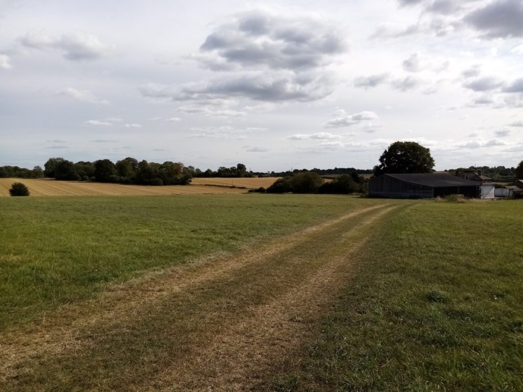
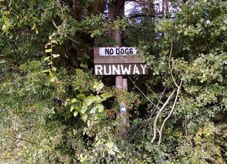
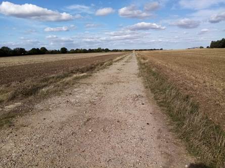
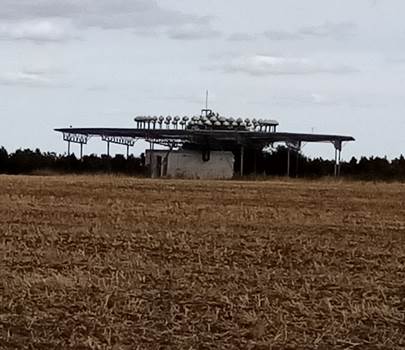
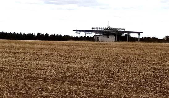
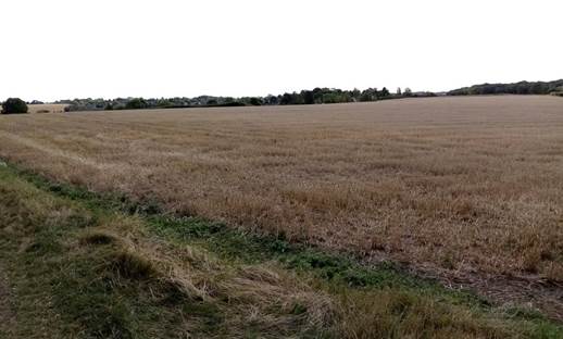
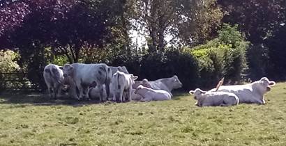
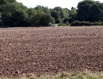
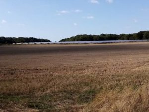
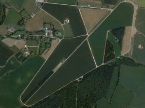
Bear left at the end of the woods and head for the furthest stretch of concrete (in the aerial shot it is the closest to the highlighted Woodman Inn) and begin to walk nearly a quarter of an uneven mile to a HW waymark which sends you left down a concrete path and then a track to appear at the back of the pub.  One visible relic of the land’s former use is what appears to be a circular aerial/radar centre (see below).  Most of the airfield is now agricultural land (below right).  Where it once provided wartime hopes of victory and peace now it provides food.

Circular aerial/radar centre

During World War II RAF Nuthampstead was home initially to the 55th Fighter Group and then the 398th Bombardment Group (Heavy) of the US Army Air Forces which was its primary occupant flying Boeing B-17 Flying Fortresses heavy bombers on missions over occupied Europe.  The airfield was built by US Army battalions starting in 1942 on the site of Scales Park – a sizeable part of which still exists – which was planted with oak trees after the Battle of Trafalgar.

Although the airfield was built to accommodate heavy bombers, from September 1943 to April 1944 it was the base for the 55th Fighter Group which included the 38th, 338th and 343d Fighter Squadrons flying Lockheed P-38H Lightnings on long range escort missions.  The planes proved to be mechanically flawed which compromised flight capability and resulted in a high attrition rate.   However, pilots flying from Nuthampstead in March 1944 became the first Allied fighters to reach Berlin on an escort mission.

From April 1944 to June 1945 the airfield was taken over by the 398th Bombardment Group (Heavy) – which included the 600, 601, 602d and 603d Bombardment Squadrons – flying Flying Fortresses on strategic missions attacking coastal defences, bridges, railways, power stations and airfields; and enemy troops during the invasion of Normandy, the Battle of the Bulge and the Allied assault to cross the Rhine in March 1945.   Its last mission was bombing an airfield in Pilsen, Czechoslovakia on April 25th, 1945.  After VE Day the group transported liberated prisoners from Germany to France.

The 398th flew 195 missions out of Nuthampstead losing 58 planes.  After the USAAF left, the base was transferred to the RAF Maintenance Command in July 1945.  It finally closed on March 1st, 1959.

In 1968-71 the Commission of the Third London Airport considered Nuthampstead as one of its four short-listed sites – and then, fortunately for the residents of north Hertfordshire, rejected it.  Areas of the former airfield have been converted into a shooting ground.  Since 1992 it has had permission to stage major championships in four international shooting disciplines.

398th Bombardment Group (Heavy)

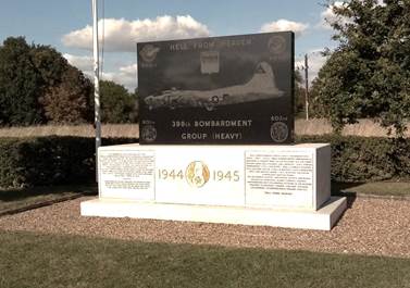
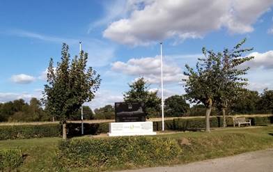
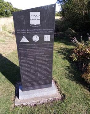
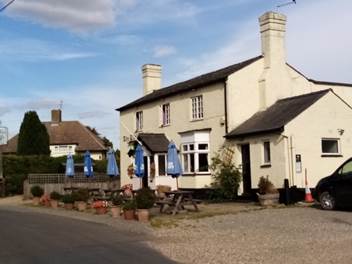
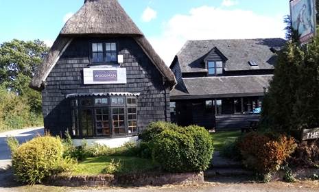
The Woodman pub was built in the 17th century and unsurprisingly during World War II was the well frequented watering hole for the officers and ground crew stationed a few hundred yards away.  The pub is full of historically unique photographs chronicling the life and times of the young flyers.  Outside are two memorials to those from the 55th Fighter and 442nd Air Service Group and the 66th Fighter Wing, VIII Fighter Command, killed in action.  There are too many names.  A Nuthampstead Airfield museum which opened in 2016 is located to the rear of the pub car park.   To find out about opening times visit www.nuthampsteadairfieldmuseum.com 

Turn right out of the pub and, ignoring Bell Lane on the left, continue ahead and then fork left past two black boarded properties to where the verge on the left ends and a kissing gate gives access to a meadow.  Cross the meadow heading slightly left to a gate before another kissing gate leads into another meadow – full of contented grazing cows and a rather cheesed-off looking bull when I walked through it (see below).  There are some pleasant cross country views around this point (below right).  Pass through a kissing gate and cross a large agricultural field (bottom left) heading towards a small wood which you enter.

Contented grazing cows
Cheesed off bull

When you pop out the other side turn left, and then virtually immediately right, onto a track with a ditch on your left.  At a man-made earth bridge cross and head arrow straight towards Bury Farm crossing another footpath at 90 degrees heading for a gap in the upcoming hedge.  Cross a bridge (below centre) and a path emerges alongside picturesque properties (below right) at Bury Farm.

Turn right and just beyond the brick wall on the left bearing the Bury Farm sign is a kissing gate into a field, Pinpoint a double kissing gate ahead, go through them, turn left and aim for the far end of Earl’s Wood.  Go through another kissing gate and pick up the obvious track between the woods with a hedge on the left (below left).   Step up the pace.  It’s pleasant underfoot and Barkway is only 10-15 minutes away where there are refreshments and an opportunity to admire possibly the most attractive village on the whole 195 mile journey.  My choice.  Maybe not yours. Where the wood ends continue ahead on a wide farm track – with Barkway beyond (below right) – which drops down to a group of plush converted barns where you swing right and then left .  Continue up the track until it bends right when you pick up a footpath which squeezes between houses to emerge into High Street.  Turn left for the Tally Ho pub which is 300 yards down the road.  (Remember.  Check opening times if you’re planning to have a break and a drink).   If not, the heart of Barkway is right.

Personally I found Barkway beguiling and architecturally impressive.  Sit on the seat by the pond and village sign and admire the craftsmanship of the buildings. There’s a ‘model village’ feel to the High Street.  One of those places that could easily be used as a backdrop to TV and film historical dramas – without any form of makeover.   Colourful Much Hadham (Leg 12), Northaw (Leg 9), Letchmore Heath (Leg 8), Chipperfield (Leg 7) and Aldbury (Leg 6) all have their idiosyncratic charms but, if honest, had an aesthetic inconsistency which is never evident in Barkway.    It’s a splendid place.

Barkway
Barkway sign
Barkway
Barkway
St Mary Magdalen

The 800-year-old Grade One Listed St Mary Magdalen (above) is built of flint and stone dressings which were renewed in 1861 when the church was rebuilt from its foundations. The chancel was built in the 13th century and the chancel arch was widened around 1400. The aisles and the west tower were built in the early 15th century.  The church has a peal of eight bells which are rung every week.

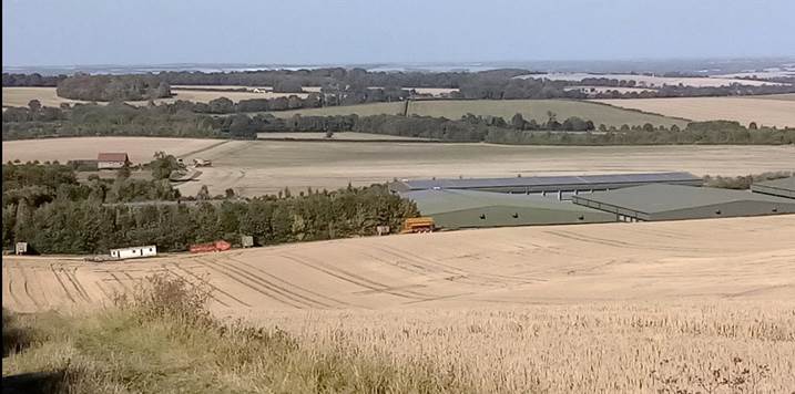
Walk down the High Street and look out for a terrace of cream-washed cottages on the left opposite Somerton House.  Turn left into Church Lane and enter the churchyard by the main gate.  Walk around St Mary Magdalene and leave by the back gate to rejoin Church Lane, Turn right, bear left and follow the track for about 400 yards until a glaringly incongruous solar panel farm appears uphill on your right (left).  Look for the HW sign and head towards Rokey Wood.  When you reach the trees turn left onto a clear, wide track which skirts the wood and then crosses another field to follow the southernmost part of Bush Wood.  Continue to a T-junction of paths and turn right. (The FOHW guide book reminds purist walkers that the supposed ‘official’ route cuts the corner diagonally through the field on the right before you reach the T-junction.  When I passed it was, by virtue of crops and undergrowth, a challenge too far.

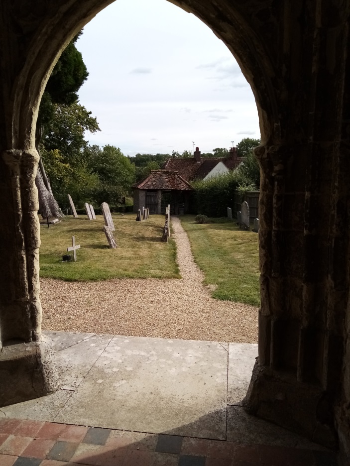
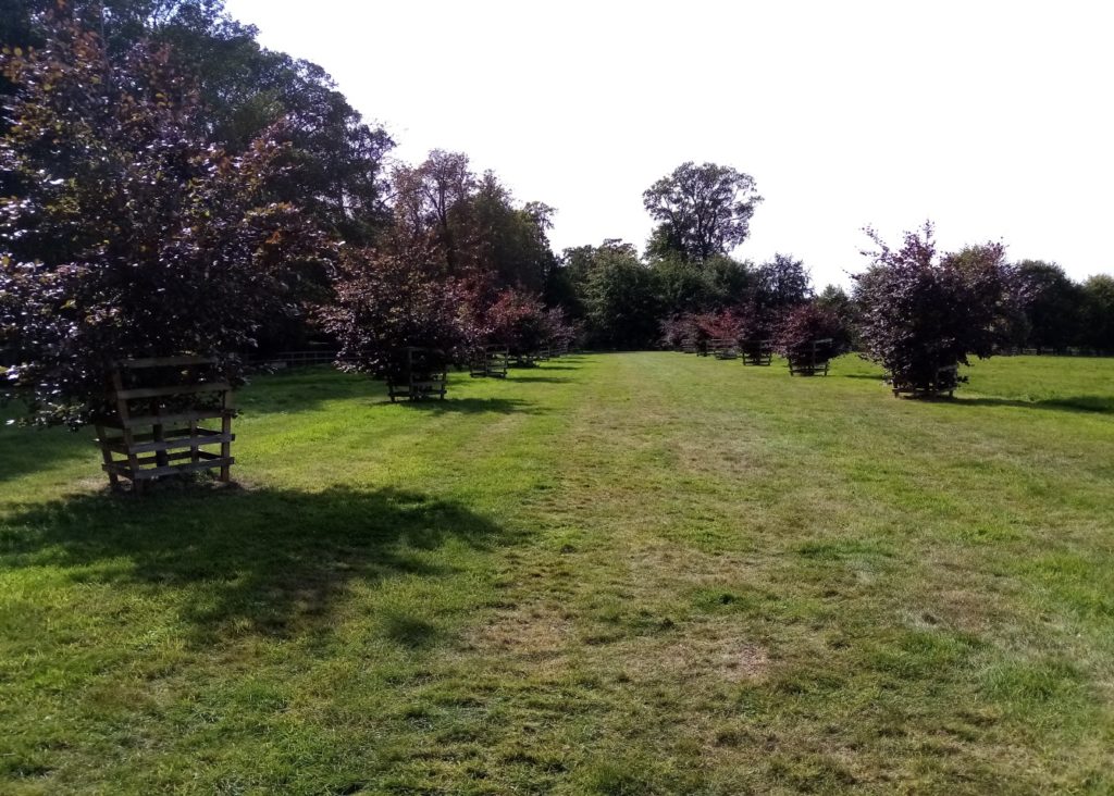
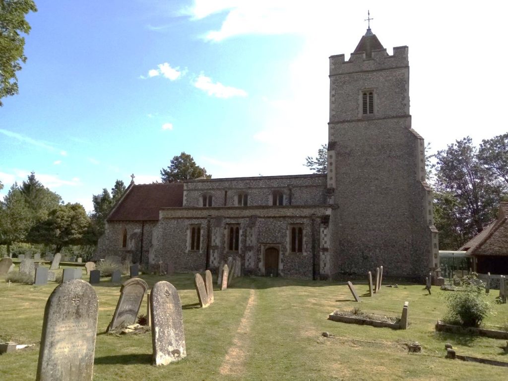
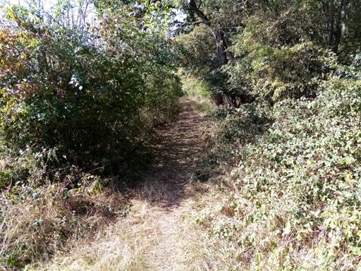
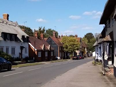
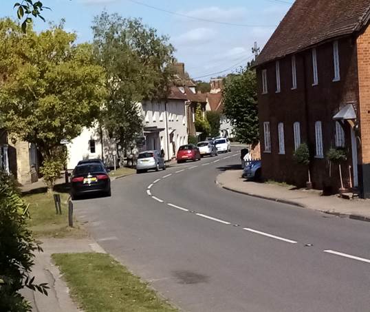
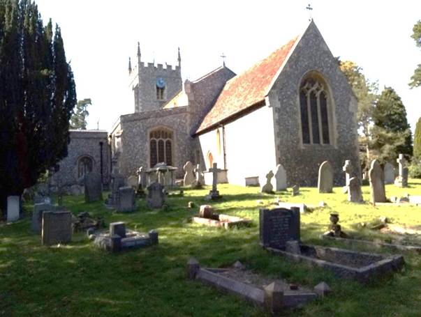
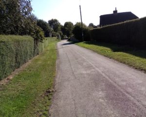
Continue on the track towards the trees where it bends left.  When it heads right at the end of the small wood go straight ahead across a modest sized field to a barrier of hedges and trees.  Go down some steps to an old sunken path and turn left and then quickly right through a gap in the hedge.  Head across another field to St Mary’s Church in Reed (left).  The Grand I Listed church – of coursed flint with stone dressings – has parts dating back to the late Saxon period.  If you’re interested in getting a closer look at the church walk behind the 15th century tower – the favoured route – and then turn diagonally across the churchyard to a bridge.  If you wish to take a minor short cut when you enter the grounds head diagonally right to the same bridge.  Pass through a kissing gate and cross the field heading towards a fence dividing the land and a kissing gate.  Bear left across the meadow to another kissing gate which spills you out on to a quirkily named road called Driftway.  Turn right and then left into the High Street and pass The Cabinet pub whose long-term future has been the subject of an acrimonious battle in recent years between a private developer, villagers, pub aficionados and the Campaign for Real Ale.  The Save The Cabinet at Reed campaign has persisted in its battle to reopen the Grade Two Listed, 400-year-old pub as planning applications, retrospective listed building consents and a public inquiry have supposedly failed to resolve the fractious deadlock.  When I walked past it certainly didn’t look open.  It looked like a private home.  And I am sure it still is.  If so another intrinsic part of the rural community has been lost.  The Cabinet is/was a rarity being the only pub in the country bearing the name.  I mourn its passing. Continue up the verdant High Street (below right) to its junction with Jackson’s Lane and Crow Lane

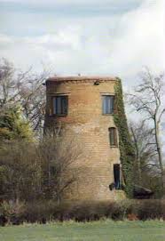
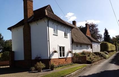
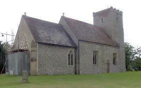
Reed is situated on a chalk ridge at almost the highest point in the county.  The Prime Meridian passes just east of the village.  It has a converted and truncated windmill (left.)

There’s reputedly been a settlement at Reed for 2,000 years and the community was mentioned in the Domesday Book of 1086 as Retth.  A number of houses have remains of ancient moats and there are some very old woods on its outskirts.  Reed has been awarded protected status as a conservation area.

Opposite, to the left of a cottage and the right of a fence, is a kissing gate which leads to a grass track between ordered lines of trees and bushes to appear at another intriguingly named minor road called The Joint.  Locate the HW sign, and a second one pointing to “Grange Farm I.5 miles” to your left 50 yards away.  Turn right into the expansive fields and embark on a stately and celebratory two and a quarter mile march, largely downhill, into Royston.  If you’re blessed with cloudless weather the huge skyscape and tantalising horizon at this point hint at the walk’s breath-taking coup de foudre.   So press on.  And then, suddenly, as you reach the brow of the chalk escarpment you’re greeted by superb views (see below) where Hertfordshire ends and Cambridgeshire and The Fens begin.    At this point you are about 520 feet above sea level. Hertfordshire’s highest spot is 803 feet on the Chilterns near the hamlet of Hastoe south of Tring.  You might be able to spot Ely Cathedral.

Where Hertfordshire ends and Cambridgeshire and The Fens begin

With the soft grass track beneath your feet enjoy the Hertfordshire Way’s elegant swansong – bar the obtrusive heavy-duty storage buildings on your right – as you head resolutely north with Royston slowly revealing itself beneath you as the landscape unfurls placidly to the horizon.  If anyone ever argues with you that Cambridgeshire isn’t flat take them to this stretch of the walk and show them the indisputable proof.

Combine Harvester
Please shut the gate

After passing the depot the path drifts left through some trees to emerge at the approach road again. Turn left. It was just north of the depot that I came across a combine harvester and its huge support vehicles (above left).  Their presence, against a backdrop of thousands of prairie-like acres of harvested cereal crops, was somehow sublimely symbolic of – not only of the day’s walk– but of the predominant theme of the entire 195 miles.  I didn’t keep a tally but I wonder how many fields those taking on the challenge of the HW walk around, across – diagonally and straight – and hug in close proximity on this deliberately rural and pastoral journey.   Perhaps someday someone will work it out.  I can’t think what it will prove though.  No forget it.  Just enjoy the walk.   North Hertfordshire provides food.  And perhaps not food for thought.

March on.  Don’t deviate from the straight and narrow.  Ignore tracks on the right and left.  You’ll pass through a gate with a delightfully unequivocal demand to adhere to the country code (above right) and down a grass track between hedges en route to Grange Farm.  When you get to the complex look for a path diagonally right alongside the boundary fence and follow it as its skirts right then left around the paddock and gardens.  Cross another path and, just when you thought it was all downhill, a field side track rises with the distinctive wooded “island” of Half Moon Plantation on the right, to reach Flint Hall Farm. Now it’s a breeze. 

Continue ahead and walk downhill through the trees to appear in the cul-de-sac of Grange Bottom.  At the end turn right into Beldam Avenue and then left into Barkway.  Continue to where the A10 merges at a triangle of road markings and bear right past the No Entry signs to where two-way traffic merges.  Cross over into Priory Memorial Gardens and head across the park to St John the Baptist Church which, when I arrived, was wreathed in scaffolding towers and plastic sheeting following a devastating fire in December 2018 which destroyed much of the medieval roof and bell tower and damaged the wooden interior. 

The 850-year-old Anglican church was built at the same time as the Cathedral of Notre-Dame in Paris and originally formed the quire and sanctuary of a large church belonging to the Augustinian Priory of Royston.  It was converted to a parish church after the Dissolution.  The nave and aisles were built in the 13th century, the west tower in the 16th and the chancel and the east end of the south aisle in the 19th.  http://www.roystonparishchurch.org.uk/

Take the exit gate into Melbourne Street opposite Banyers House and turn left.  Walk to the traffic lights.  On your left opposite, surrounded by seats, is the Rowse stone.

The Royse stone – from which the town obviously gets its name -has been a landmark for more than 900 years.   It was used as a base for a cross, thought to have been put up by Lady Roisia, around 1066.  Royston has 161 listed buildings but the two tonne glacial stone – which was formed in the north of England – is not protected.   It originally stood at the crossroads of the ancient track ways Ermine Street and Icknield Way and was moved to its present site in the 1920s.

The American writer Joseph Goldstein, a contemporary author of numerous books on Buddhism, wrote: “If we are facing in the right direction, all we have to do is keep walking.” Some argue it is an original Zen proverb.

Either way it perhaps has a more profound philosophical interpretation than simply using it to celebrate walking around Hertfordshire – and not always facing the right direction thanks to the compass defying meandering route!!!  But the words arguably do champion purpose, commitment and a sense of eventual fulfilment.  Hopefully if you tick off all 195 miles you will share my sense of achievement and reflect on what was a magnificent exploration of the UK’s greatest asset – its countryside.

If I may hark back to the opening page of the website and revisit the quote from Alfred Wainwright: “An objective is an ambition and life without ambition is ….well, aimless wandering.”

Well I did a lot of aimless wandering, often walking off route for a deserved lunchtime pint in an idyllic old pub, and on several occasions when I lost my way. Largely my fault.  Not the official guidebook or the maps.  Simply being distracted and not paying attention.

I met some charming people, on one occasion managed to fall into a ditch and unsurprisingly, at scenic points, sat down for a while and reflected on the unfolding beauty of modest and often unrealised Hertfordshire.  And I learned a lot about the history of a land that proved to be such an indulgent companion.

I hope you have as much fun, enjoyment and build up a treasure chest of glorious memories as I did.  Remember it’s not a race and should never be confronted as a time-busting challenge.  It is to be experienced and savoured.   Happy walking.

Graham Newson.  Summer 2021.

It’s unfair and arguably folly, and will almost certainly be disputed by fellow walkers, to compile a league table of which are the best legs to walk, and which ones can be relegated to a ‘fair to middling’ days ramble.  I’ve hinted where my preferences may lie throughout this website, the choices being obviously hugely subjective.  But as a keen walker, and an even keener pub-goer, I might humbly suggest that my recommendations about which routes should be keenly anticipated, and which watering holes should be actively sought out, might not be wholly without merit.  So here’s how I would rank the 16 legs – and the ten best pubs to stop off at.

  1. Tring Station to King’s Langley – Leg 7
  2. Codicote to St Albans – Leg 4
  3. Broxbourne to Hertford – Leg 10b
  4. Hare Street to Royston – Leg 14
  5. Hertford to Widford – Leg 11
  6. Little Wymondley to Codicote – Leg 3
  7. Royston to Wallington – Leg 1
  8. Widford to Bishop’s Stortford – Leg 12
  9. King’s Langley to Shenley – Leg 8
  10. St Albans to Markyate –  Leg 5
  11. Bishop’s Stortford to Hare Street – Leg 13
  12. Markyate to Tring Railway Station – Leg 6
  13. Cuffley to Hertford  – Leg 10
  14. Wallington to Little Wymondley – Leg 2
  15. Cuffley to Broxbourne – Leg 10a
  16. Shenley to Cuffley – Leg 9
  1. The John Bunyan, Coleman Green – Leg 4
  2. The Candlestick, West End  – Leg 10
  3. The Woodman Inn, Nuthampstead – Leg 14
  4. The Catherine Wheel, Gravesend – Leg 13
  5. The Jolly Fisherman, Stanstead Abbotts – Leg 10b
  6. The Greyhound, Aldbury – Leg 6
  7. The Round Bush, Round Bush – Leg 8
  8. The Strathmore Arms, St Paul’s Walden – Leg 3
  9. Two Brewers. Northaw – Leg 9
  10. The Prince of Wales, Green Tye – Leg 12