Distance:  9.3 miles

Start/finish:  Little Wymondley: There is plenty of on street parking in roads off the main street. On street parking, including near to where the HW emerges in the High Street to the right of a garden centre.

Map: Ordnance Survey Explorer maps 193 and 182

Public transport:  At Little Wymondley there is the 80 bus service linking Hitchin and Stevenage (Centrebus (South)) and the 101 Sapphire-Luton-Stevenage (Arriva Herts and Essex).  It doesn’t have a station although the village is only just over two miles from Hitchin and two and a half from Stevenage. At Codicote the nearest rail station is North Welwyn.  There are a number of bus services passing through Codicote linking the village to predominantly Stevenage, Welwyn Garden City and Hitchin,  But beware.  A lot of the routes only operate on weekdays.  To check availability log on to www.carlberry.co.uk/rfnsearch.asp  Remember.  Never rely on bus timetables.  If using buses check they’re running before you leave home.

 Pubs/restaurants:

Please make sure you check with the pub/restaurant for their opening times.

Route: This is a superb day’s walk. And the shortest! Arguably the Hertfordshire Way’s “jewel in the crown.” If not ‘the, certainly one. Not because it is short though. But because it promises a lot and delivers it in pleasurable instalments. Undulating farmland, woodland, meadows, a charming chalk stream, far reaching views, a hidden ruined church, a dash across a busy dual carriageway, a mix of old and isolated pubs that mean you are unlikely to go thirsty, a link to royalty, chance encounters with deer …and much more. There are no ‘major’ settlements on the route but you dip into and out of hamlets and villages with convenient regularity. Although it is a short leg it’s unlikely you’ll arrive home hours earlier as there’s so much to take it and every reason to linger. If tackled on a long, warm summer’s day – with so many opportunities for civilised stops for food and refreshment – it is a ramble that’ll remain a firm favourite for years to come. If embarked on during any other season it’ll still retain its charm and repay you in dividends. I found it so bewitching that I was seduced into concentrating on the views and the walking on my first encounter – and forgot to take many pictures. So I walked it again. And it was just as good. If not better. As were the pictures.

So let’s discover this jewel.From the centre of Little Wymondley turn into the Buck’s Head car park and keep to the hedge on the left. The track disappears into the shadows and climbs slowly leaving the pub garden behind. Continue until a stumpy water tower comes into view but aim to skirt the idiosyncratically half-timbered pavilion of Wymondley Tennis Club keeping to the right of the hedges surrounding the football pitches and your destiny with the busy A602. The path drops down to the hard shoulder and a staggered gap in the central reservation gives you a break before the dash to the steps on the opposite side. Beware. It is a fast road but visibility is good. (It is by no means as dangerous as the life-or-death dash across Theobald Street en route to Shenley. Leg 8). The steps lead to a path which emerges at the Stevenage Road in the hamlet of Titmore Green. Turn right and walk to the Hermit of Redcoats pub opposite the obligatory, but somewhat lacklustre, pond.

The official guide quite sensibly offers walkers anxious to avoid the A602 the option of taking a mile long detour on tarmac roads to Titmore Green. Simply continue past the Bucks Head on the Stevenage Road on the pavement to a mini roundabout. Turn left into Blakemore End Road – note no pavement – and walk to the hamlet of Redcoats Green, going over the A602. Turn left into the unpaved Stevenage Road and walk to the Hermit of Redcoats.

Opposite the pub go through the gate on the right of a private drive and, keeping the hedge on your left, walk along a well-worn path through fields – I can never work out a lot of the time where one starts and another stops so simply press on – until a house appears at a bend in Lower Titmore Green, a narrow road ahead, which you avoid by swinging hard right to cross a bridge and pick up a perimeter path (below left) which snakes around what was then well-ploughed terrain, initially with the hedge on your right passing through two kissing gates. Where a small clump of trees/hedges and undergrowth appear in front of you look for directions to a diagonal cross field path on the left which heads uphill to an isolated stand of trees seemingly plonked in the middle of a huge area of cultivated land (below right), Oddly there are steps within the small copse as the path continues to climb to Almshoe Bury farm on the skyline. (If you miss the diagonal cross-field short-cut – which I confess I did by blindly ambling along on a sublimely beautiful late April evening – simply head towards the small row of farm cottages at the corner of the field, turn left and walk uphill to the farm. Dull but you can’t get lost.)

The path will join the farm track just before you enter the Almshoe Bury complex. Walk through the farm identifying a large barn on your right and a main access road which drops down to the left alongside a row of trees. At this point there are impressive and far-reaching views across the valley (below left). On that warm late April evening after I began walking the leg for a second time, as a red kite rode the thermals and with the sound of children playing in the fields below, the Hertfordshire Way was in its prime.
An obvious path (above right), which can be easily found ‘behind’ the barn, drops down the side of Mill Hill to the London Road (B656) at Chapelfoot. Cross safely over and walk the few yards to the Rusty Gun pub (formerly the Royal Oak). What a superb location, – a pub, restaurant and even a produce shop – for a deserved break. And with the promise of more blissful walking to come.
Having taken a refreshment break – or not – head up the signposted path between the pub (below left) and a shed and bid farewell to the fattened up pigs in the pen (I wondered whether they were ultimately destined to appear on the clearly displayed “Carvery” menu) and keeping a hedge to your left follow the parallel path as it climbs inexorably on well-travelled ground towards the lush looking and isolated Minsden Chapel plantation on the skyline. Skirt around the left hand side of the fenced off plantation which contains the remains of the chapel (below right), its largely hidden ruined walls strangled by thick vegetation. Although a sign discourages walkers from entering the enclosure it is possible to walk in – but not especially worth the effort. What is enjoyable is watching scores of pheasants and grouse scuttle off in all directions with their young as you approach.

The roofless shell of Minsden Chapel is a Scheduled Ancient Monument and is Grade II Listed. It was built in the 14th century but by the 17th century had fallen into disrepair. Marriages continued being held there into the 18th century until the crumbling masonry became too dangerous. One story says that a piece of falling stonework knocked the prayer book out of a curate’s hand during the marriage ceremony of Enoch West and Mary Horn on the 11th of July 1738. In the 20th century the chapel was closely associated with the historian Reginald Hind from nearby Hitchin who visited the ruins, obtained a lifetime lease of the building from the vicars of Hitchin and whose ashes were scattered on the site. Claims of spectral apparitions and ghostly sounds have been a hallmark of the chapel’s latter day history – all of which have proved to be spurious. But why was it built so far from any significant settlement?

Keep the plantation to your right until you reach a gate with a clear downhill path ahead (top left). This meets a path running parallel to the B651 (top right) which reaches a metal gate. Cross the road and find a narrow path which climbs steeply between vegetation to a tarmac road and some posh houses – notice the sudden drop on your right – at Langley End. Where the road bends left a path in front of you enters some trees before emerging on a perimeter path which keeps right alongside a hedge with views to your left (below left). The path drops to a minor tarmac road. Cross the road where a kissing gate reveals a blindingly obvious path heading towards dense woodland (below right). You will eventually reach a pavement free road, the B651. Turn left and pass the imposing Sue Ryder Home on your right to find an HW sign on the same side of the road. The path heads towards a telegraph pole which, in line with a hedge, you keep to your left until you reach a drive alongside a house. Turn left and then virtually immediately right into the churchyard of the beautiful parish church of St Paul’s Warden.

St Paul’s Walden has not only shaped the county’s religious history – but also the monarchy’s. For it was at this parish church – parts of which have Saxon origin – that Queen Elizabeth, The Queen Mother, was baptised in September 1900, six weeks after her birth. She spent much of her childhood in the area. Until her death on March 30th, 2002, she returned at least once a year, invariably attending church services. The Grade 1 listed 14th and 15th century church has an intriguing past! According to legend worshippers tried to build the church in a field near the present St Paul’s Walden Bury house. But each night the devil moved the stones to the opposite hill where All Saints now stands. Arguably its most precious feature is the early 14th century medieval quality glass in the south aisle window representing Virgin and Child. Few better examples exist in Hertfordshire.

The east window in the chancel (above) was given to the church in 1946 by The Queen Mother and her surviving brothers and sisters in memory of her parents the Earl and Countess of Strathmore.

Leave the churchyard south through the gates. Notice the Victorian wall post box on your right with the initials V R. Head straight on to pick up an obvious and signposted track which leads for two thirds of a mile to Whitwell. (If you need refreshments turn left at the gates and follow the road down to the A651. The Strathmore Arms are on your right. A pub recognised for its real ale). Retrace your steps. Follow the track gradually downhill with an emerging lake in the landscaped grounds of St Paul’s Walden Bury, the childhood home of the late Queen Mother, on your right. On your left is an architecturally intriguing property (below) with striking ecclesiastical-style windows and adornments. But, as it is off the beaten track and a short distance from All Saints’ Church, it seems unlikely it was ever used for worship. If it was it’s a pity it cannot be appreciated by a wider audience – and not just the lone rambler. At a grass triangle, where one of the main drives to the estate joins the track, bear right and follow the road until it joins another drive which continues on to the impressive St Paul’s Walden Bury. At that point find the track opposite between two fences and follow it for a quarter of a mile until it drops down into the valley of the River Mimram. When you reach a road leading to White Hall Farm, and want refreshments in somewhere other than a pub, go through the farm to reach the charming Emily’s Tea shop. If not, cross the access road and then the Mimram and follow the path into Whitwell.

St Paul’s Walden Bury – www.stpaulswaldenbury.co.uk – is an 18th century stately home and 50 acre landscaped garden, the latter of which is Grade 1 listed. Long avenues lead to temples, statues, lakes and ponds. The Grade II listed house, a home of the Bowes Lyon family, dates from 1720 with substantial Victorian additions. It is best known for its connection to the late Queen Mother. It was one of her childhood homes and probably where she was born. It was certainly the place where she finally accepted Prince Albert’s proposal of marriage. The garden only can be visited by appointment. £15.00 for charity. Email: [email protected]

The chalk river Mimram, which rises at a spring north-east of Whitwell, is unlovingly side-lined as a “Cinderella” water course of no national importance whose punitive abstraction levels have left it in a parlous state. Being devoid of the protection given to rivers like the Itchen its fate is perilous and its fauna and flora in danger of disappearing. See River Ver (Leg 6) and River Gade (Leg 7). The Mimram runs for 12 miles or so to its confluence with the Lea near Hertford. But, as the picture below shows, it is an embarrassed trickle at Whitwell. It’ll keep reappearing on the journey to Codicote, seemingly replenished in the watercress beds nearing the village, but is inevitably a pale imitation of its robust pristineness as recorded in the Domesday Book. The Mimram – with its springs and high groundwater level – has in the past fed a mixture of habitats in which birds, plants and animals have thrived including marsh, fen, meadows, ponds, lakes, wet grasslands and woodlands. Before World War II it was the “jewel in the Hertfordshire countryside”, a rival to the Itchen for fishing. The headwaters of the Mimram once powered mills. No longer. That’s unsurprising when 14 million litres of water are allowed to be extracted from the Mimram and its sources each day, most of which supplies Welwyn Garden City. During peak times that figure can rise to 21 million litres. With increasing housing demand and water usage in the years to come the Mimram seems doomed to be a blameless sacrifice to consumer needs.,

Ironically, while crossing the bridge over the depleted Mimram, I met an elderly river custodian taking water samples as part of a regular series of checks to monitor its quality and flow. He lamented the Mimram of old when it was a healthier feature of the landscape and pointed to the valley we were standing in which it had helped shape; but which, in its current pitiful form, could do little more than come half way up a pair of wellingtons. Continue on a path through a yard to High Street. If seeking refreshment at The Bull turn right. (But check beforehand to confirm it is open. When I arrived at 12.45pm on a Tuesday on a beautiful autumn day there was no sign of life and the doors were locked. This is the last pub until Codicote so plan accordingly. There are still a few hours walking to come.)

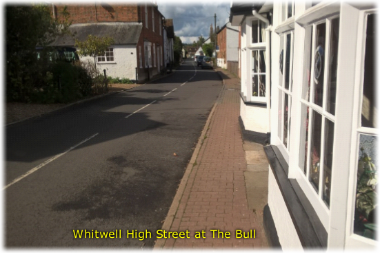
When you turn right and before the reach The Bull there is a narrow grass footpath on the opposite side of the road with a HW sign while the main arrow directs the walker to Kimpton 2.

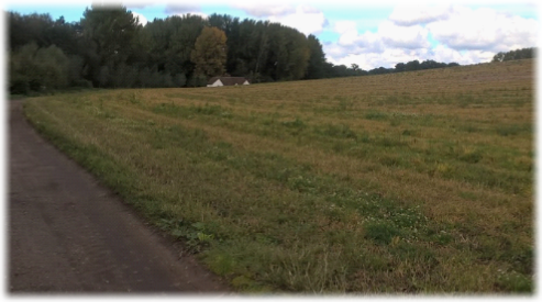
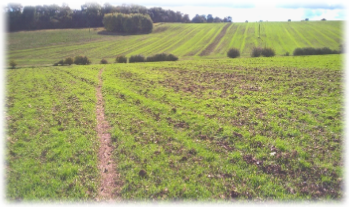
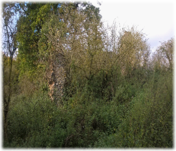
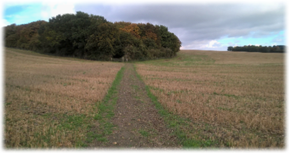
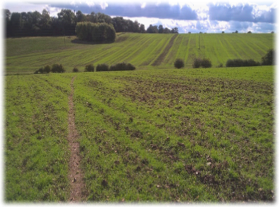
Climb the rising, narrow track until it suddenly emerges on a perimeter path facing hundreds of undulating acres of resolutely arable land. Turn left and then almost immediately right near a tree. Follow the path towards a telegraph post and scrubby bush where the route is indicated as heading left at a 45 degree angle to the corner of a field – keep the mobile phone mast in front of you – where it meets a farm road and a clear track named as Shacklegate Lane on Ordnance Survey maps. Go through the gap in the hedges and continue ahead on a path to a ridge – look back at the charming views – which then dips to meet another gap in a broad hedge (below left) (The second time I walked the route this path was indiscernible after the field had been harvested. Keep the phone mast ahead of you if you encounter a similar problem.)

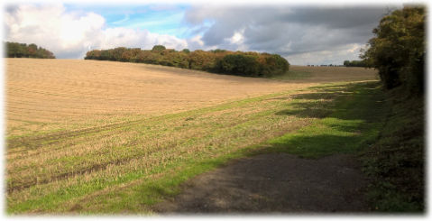
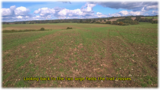
Go through the hedge and head slightly right, but to the left of a telegraph pole, as the track unerringly climbs to a line of sparse trees and bushes on the skyline. It was while traversing this huge field that a herd of roe deer broke cover from Thrift Plantation below me on the left.  Sniffing the warm summer air – and as I was upwind probably me – they stood stock still for a few seconds before slipping back under the cover of the trees. A welcome break from the seemingly unrelenting uphill trudge.

When the path reaches the tree line turn left and you’ll discover a robust and well maintained wooden bench – not overly-used I would think – on which to sit and admire far reaching views south across the valley in which Kimpton nestles. A place to take a breather. And to ponder why the deer thought you smelt.

The view towards Kimpton in summer and in autumn (right)

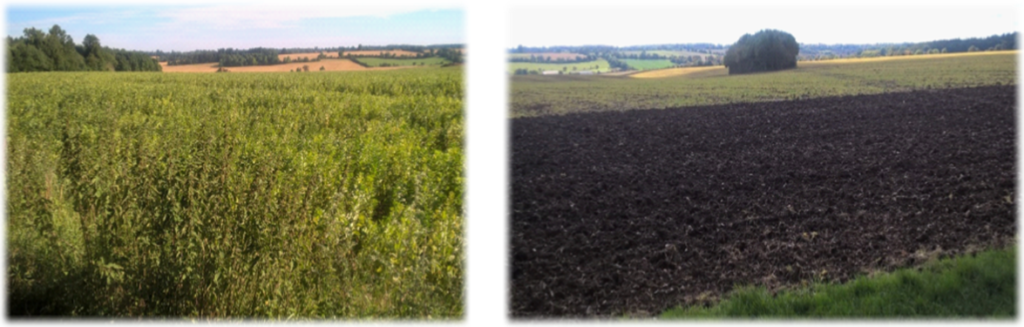
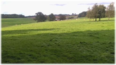
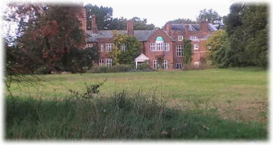
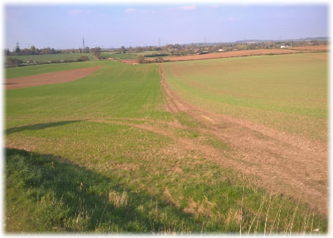
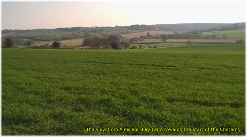
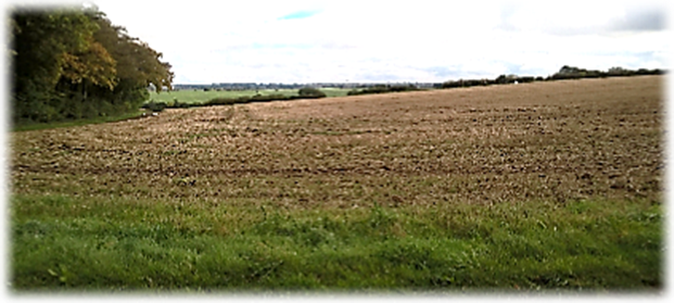
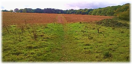
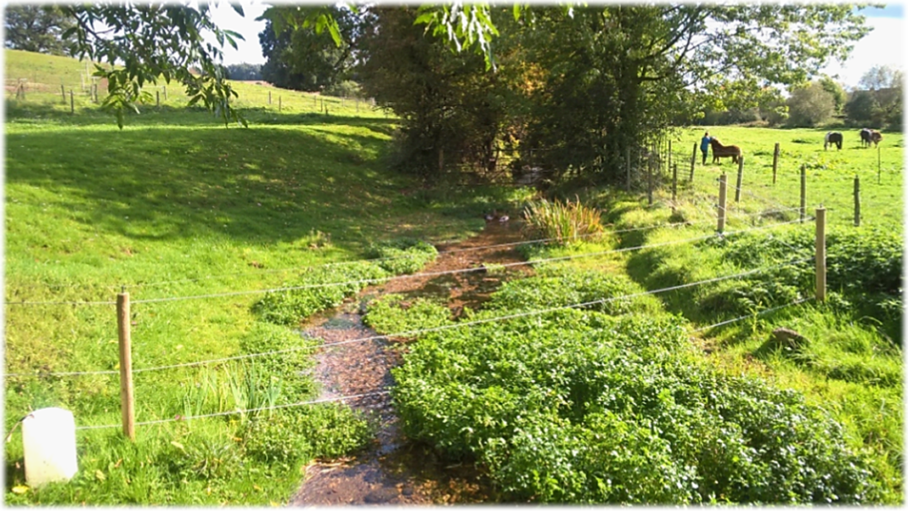
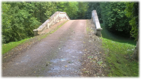
Keep on the perimeter path passing a barn and reaching a narrow road at Hoo Park Cottages. Turn left and then almost immediately right where a gate gives you access to semi- parkland with Hoopark Woods ahead. Skirt the edge of the woods on a clear path before emerging in a field with trees and bushes on your left.  Continue past another wood to a kissing gate and then downhill towards the, once again, feeble River Mimram. Turn left to reach a private drive and right to cross an impressive bridge which once straddled a now disappeared ornamental lake (left). At the road junction turn right into a wide track which you’ll follow for a mile, the meandering Mimram on your right, passing Rye-end Cottages in a lovely rural setting (below left)). Continue on towards Kimpton Mill. Shortly after a minor road joins from the left look out for an HW sign on your left at the start of a riverside bridleway. Walk a third of a mile until a wood opens up and another HW sign directs you uphill through the woods bearing left up a flight of wooden steps to a metal kissing gate at the edge of a large tract of pasture. Pinpoint two more metal kissing gates ahead which the path heads directly towards, the rolling grasslands with their extensive views (below right) being the last unbroken countryside you’ll encounter before arriving in Codicote. After the last kissing gate follow the path slightly right into woods and a steep drop to a minor road. Turn left and at the junction bear right. (Look ahead of you and worry that the earth is flat after all!). After 100 yards a path on the right heads through woods to emerge constricted between neat wooden fences as it crosses open fields towards a white bungalow. Suddenly, after hours of solitude and miles embracing the changing landscapes of fecund Hertfordshire, a kissing gate spits you out into busy High Street. Cross over, turn right and walk the remaining yards to the centre of Codicote where pubs and shops offer sustenance and the chance to reflect on a wonderful day’s walking.

Only the ungracious and curmudgeonly would deny that the nine and a bit mile journey didn’t deliver in spades. Not only has Hertfordshire shown off its varied, verdant and sublime landscape but the walk’s creators haven’t scrimped on providing intriguing highlights along the way, including such myriad delights such as a ruined church, a ruined river, royal history at St Paul’s Walden and humble acres of unrelenting farmland. You may meet many people on this section – particularly at weekends – as they’ve had the good sense to walk it too. If you’re travelling anti-clockwise you have the added joy yet to come of the Tring to King’s Langley section which is an equally peerless and seductive outing. I’ll leave it to you to decide which one is better. Or simply settle for the fact that the Hertfordshire Way will fulfil your expectations again and again.

Next.  Leg 4.  Codicote to St Albans.  This would convince even the most reluctant stay-at-home to take up walking.