Distance: 11 miles (including the 1.8 mile ‘St Albans loop’).  My version of the ‘loop’ will be longer. 

Start/finish: St Albans Roman Museum car park, Verulamium Park, pay car park: / High Street Markyate. On street parking in village centre.

Map: Ordnance Survey Explorer map 182.

Public transport: No rail link. Buses: 34 from Markyate High Street via Redbourne to St Albans City station.  Service runs hourly from Monday to Saturday. No service on Sundays and Banks Holidays.

Pubs/refreshments:

*The Rose and Crown is slightly off-route. There is also a small supermarket and sandwich shop in Redbourn.

Please make sure you check with the pub/restaurant for their opening times.

Route description: This is an untaxing, superbly way marked, not overly long and amiable leg. Arguably not as varied or intriguing as Leg 4 but a robust day’s walking not without its delights. Aside from the St Albans “loop” (see below) you will encounter one of Europe’s best preserved open air Roman theatres, the Gorhambury Estate, the important but abused River Ver, Redbournbury Mill, the easy walking on the former Nickey Line embankment at Redbourn and then a cross country trek that threatens to become dull until you drop into a pretty valley on the fringes of historic Flamstead. From the heart of the village it is a simple ramble across fields on easy to follow paths to Markyate.

The St Albans “loop”: (1.8 miles/ slightly longer if following my interpretation). The Friends of the Hertfordshire Way, its creators and diligent guardians, devised the “loop” as a tantalising precursor to the walk to Markyate. Purists will no doubt comply with the guide’s suggestion of the “loop” plus the nine mile ramble but, personally, I think it would be folly to embark on what would be a perfunctory preamble of one of the UK’s most historic cities. For those who haven’t visited St Albans before – and there may yet be a few in Hertfordshire; there certainly will be beyond – it promises a captivating exploration of Roman history, relics of the once thriving City of Verulamium, an early Norman cathedral that is the oldest place of continuous Christian worship in the country, a twice weekly market granted its Royal Charter in 1553 and streets, pubs and buildings that have remained unchanged for centuries.

For walkers aiming to ultimately reach Markyate they’re likely to be conscious that not only is time pressing but that the “loop” sells the City short. So what I would recommend is that those tackling the Hertfordshire Way set aside at least half a day to discover properly the heritage of St Albans. Possibly on a Wednesday or Saturday when the market, one of the largest in southern England, is operating.  Obviously Leg 5 would then require a commitment of two days. But as St Albans is a sublime jewel in the country’s historical crown it would be churlish not to extend it the respect it deserves.

To that end I have devised a slightly amended “loop” to that recommended by the Friends of the Hertfordshire Way. The loop can be found within the black bordered box below. If you decide not to use the “loop”, you can click here to skip the content.

From the Roman Museum car park in Verulamium Park find the hole in the hedge virtually opposite the museum and then walk diagonally across the park/football pitches to the isolated white building.

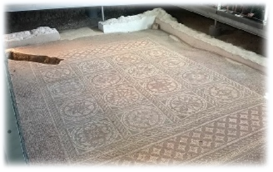
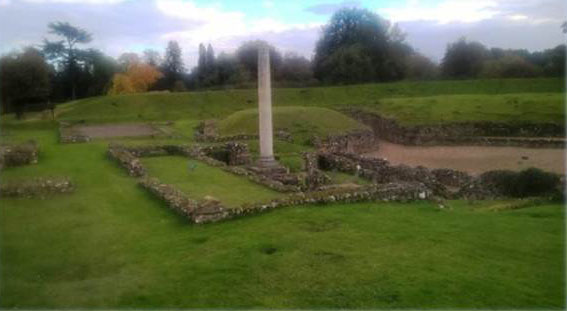
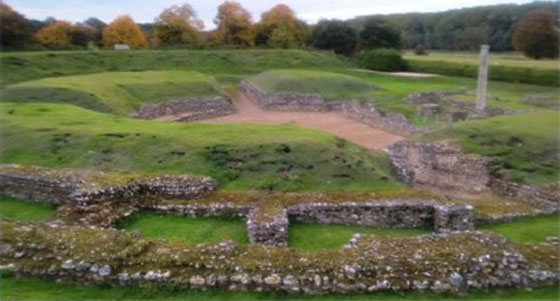
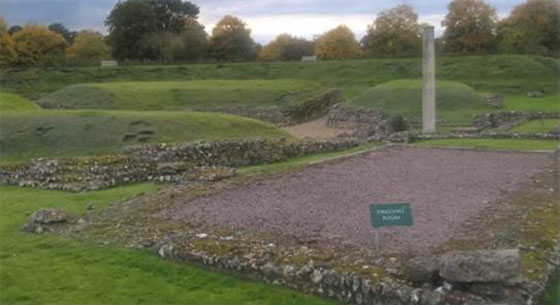
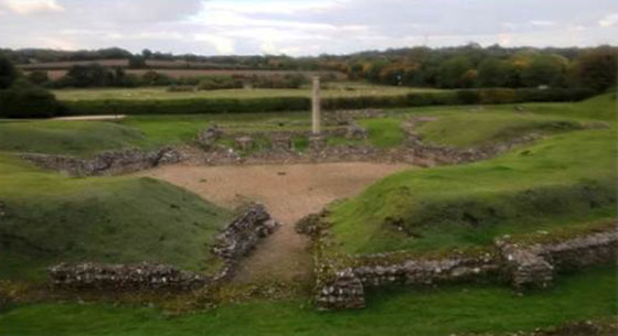
This houses a superb floor mosaic and hypocaust unearthed during archeological excavations in the 1930s (left). The Roman mosaic, built on top of the hypocaust which allowed hot air to circulate to heat the building, is thought to have been part of a suite of reception and meeting rooms of a large townhouse.

Admission is free. Opening hours are: April 1st to September 30th; Monday to Saturday 10am-4.30pm, Sunday 2-4.30pm. October 1st to March 31st; Monday to Saturday 10am-3.45pm; Sunday 2pm-3.45pm. There is disabled access. www.stalbansmuseums.org.uk/hypocaust

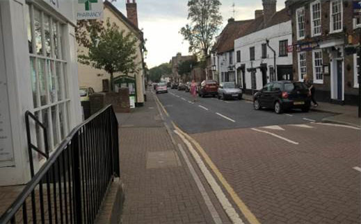
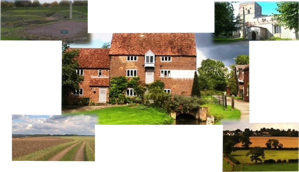
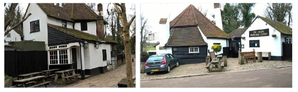
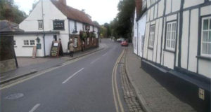
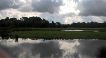
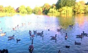
When you leave the building go straight ahead towards the tennis courts. At the junction of paths head right towards the fenced off section of extant Roman city wall. Beyond, at another junction of paths, turn right and walk 50 yards to the remains of the London Gate, the best preserved of four massive stone gateways controlling entry to the City of Verulamium. Retrace your steps to the head of the ornamental lake by the public toilets. Work on the lake (right) started in 1929 and, with its abundant and diverse bird life, is at the heart of the 100 acres of parkland. Cross the bridge over the, by now, more precocious River Ver and turn right to Ye Olde Fighting Cocks.

The Guinness Book of Records lists the octagonal building and its linked structures as Britain’s oldest pub – a distinction claimed by at least 20 other inns around the UK. Irrefutable historical evidence weakens Ye Olde Fighting Cocks’ supposed medieval status. The earliest date for which it can be proved to have been licensed is 1756, and even that date is uncertain. At that time records suggest it was trading as The Three Pigeons. Nevertheless, it’s thought an ale house did exist in the immediate area in the 9th century with the current pub “moved” to its present site after the dissolution of the Abbey (now Cathedral) in 1539.

To add to the historical mystery of the pub’s disputed past a sign on an outside wall asserts that Oliver Cromwell slept at the inn during the English Civil War of 1642-1651. As he was supposedly 6 feet 2 inches in height he, along with his men, almost certainly would have wacked their skulls on the low beams; presumably leading to the name Roundheads. But like a lot of Ye Olde Fighting Cocks’ history incontrovertible proof is lacking.

What is arguably very odd, however, is that in 2015 the campaigning People for the Ethical Treatment of Animals lobbied for the pub to change its name because it was “offensive” to chickens. Well you are walking the “loop” and “loopy” is an apt description of what they were seeking to achieve. The lobby group wanted the pub renamed Ye Olde Clever Cocks to celebrate “how intelligent, sensitive and social animals” fowl are. The deluded attempt at historical revisionism was fortunately given short shrift by the landlord and brewers Mitchells and Butlers. What would PETA make of the Fox and Hounds, the Dog and Partridge, the Dog and Pheasant and the wonderfully named The Drunken Duck in the Lake District where folklore tells of sloshed wildfowl staggering around the Cumbrian fells in knitted woolly jumpers? And with the number of Pig and Whistles and Cat and Fiddles dotted around the country perhaps it’s time someone pointed out that it’s cruel to try to teach an animal how to play a musical instrument. Especially if it involves catgut.

Ye Olde Fighting Cocks is well worth a visit. But remember to duck!  There is a large open fire and the walls are covered with articles chronicling the pub’s past. info@yeolde fighting cocks.co.uk.

After leaving the pub take the uphill path in front of you, BEHIND the railings, through the cathedral grounds towards the prominent Chapter House on the right. This leads into the South Transept. Both admission, and the guided tours, are free. Wander at leisure and you will come face to face with historical, architectural and religious superlatives.

As the oldest site of continuous Christian worship in Britain St Albans Cathedral’s spiritual status is inviolable.  It supposedly stands over the spot where Alban, the first Christian martyr, was buried after surrendering his life for his faith 1,700 years ago -200 years before St Augustine arrived in Canterbury. www.stalbanscathedral.org.

But it can also claim to have the longest nave in England, and the second longest in Europe, at 276 ft. The building’s entire length is 551 feet making St Albans the second longest cathedral in the United Kingdom.  Exploration will reveal the most extensive set of medieval wall paintings of any of the greater English churches over which looms the massive 11th century bell tower, the only remaining example of its type.

The Norman abbey, built using cannibalized bricks from the ruined city of Verulamium, was completed and dedicated in 1115. Celebrations took place in 2015 to mark its 900th anniversary. Interestingly, records show the eastern end of the abbey was damaged by an earthquake in 1250. It’s difficult to equate St Albans with seismic activity. Certainly the biggest rumble in most of our lives was when the Buncefield oil depot blew up in 2005. Perhaps we’re living on borrowed time.

St Albans differs in certain ways from other cathedrals in that it is also a parish church. The dean is rector and has the same duties and responsibilities as a parish priest in a small country community. A Vicar of Dibley with a bigger choir. Arguably the centrepiece of the cathedral is the shrine of St Alban, a place of national pilgrimage. Even if, like me, religion is a faith enviously shared by others but denied to oneself, there is a humbling spiritual resonance about the shrine. It is overseen by the only surviving Watching Loft in England, built around 600 years ago, where monks would sit in quiet contemplation to ensure the sanctity of the shrine.  The splendour of the choir, the High Altar, the Lady Chapel, the nave and the impressive Wallingford Screen only add to the overpowering sense of history and profound religious consciousness. The reverential atmosphere is at odds with the miles of footpath trudging to come. Unless, like the doyen of fell walkers Alfred Wainwright, the grandeur of nature also deserves worship by faithful converts.

Leave the cathedral by the west door and head towards a gate in the stone wall, go into Romeland, turn left and then right into Fishpool Street in front of St Albans School and then bear left. You are now entering one of the oldest, and most elegant, parts of St Albans. Fishpool Street – the name supposedly originated from the great fish pool on the royal estate of Kingsbury where inhabitants made a living – was originally the main north-west coach route out of St Albans. It became a conservation area in 1968 and has 72 listed buildings. Those properties with steeply pitched roofs are generally late medieval.

As you walk down the road you’ll pass the 17th century Lower Red Lion www.thelowerredlion.co.uk and then the magnificent 500-year-old Sir Michael’s Manor Hotel stmichaelsmanor.com with its five acres of garden and one acre lake dropping down to the River Ver and Verulamium Park. Non-residents can take afternoon tea and there is a bar menu. Note opposite the hotel the large drop from pavement to road. Guaranteed to wreck car doors but isolate irritating front seat passengers. It’s believed the height discrepancy may be due to “terracing” to provide flat ground for housing but may have been influenced by the fact that the lower part of Fishpool Street began life as a heavily used and eroded Roman road.

Fishpool Street
The frontage of much of Fishpool Street has remained unchanged for centuries. But like all communities it continues to evolve and a sign of the changing times are the closed Blue Anchor and Black Lion pubs standing opposite each other at the bottom of Fishpool Street. They, like others in the still pub rich city of St Albans, have fallen victim to fickle changes in social and leisure priorities and spending habits, a shift in emphasis in the drinks and catering industry, new laws, demographics, over supply and the development potential of pubs with large gardens and land. What would the Anglophile writer and essayist Hillaire Belloc have thought?

“.. when you have lost your Inns drown your empty selves, for you will have lost the last of England..” – Hillaire Belloc.

At the pubs bear left into St Michael’s Street passing the 16th century Kingsbury Water Mill and Museum, now a restaurant www.wafflehouse.co.uk/st-albansNote the chunk of Hertfordshire puddingstone, a conglomerate rock, on the front lawn. The ground floor workings of the mill are still visible from inside the restaurant. Cross the Grade II 300-year-old St Michael’s Bridge over the River Ver, the oldest extant bridge in Hertfordshire, with the Roman ford on the left. You are now in St Michael’s, a nucleated settlement that grew up on what was part of one of the busiest roads in England linking London with Chester and Holyhead.

That dubious distinction, with possibly 1,000 people and 70 mail and stage coaches passing through St Albans and down into St Michael’s each day, was courtesy of the Romans who by the 9th century had rerouted Watling Street from its course through Verulamium to skirt St Albans Abbey and drop down into Fishpool Street and beyond.  In the Middle Ages the road through St Michael’s Street was called Kingsbury Street but had changed to its present name by the end of the 15th century.

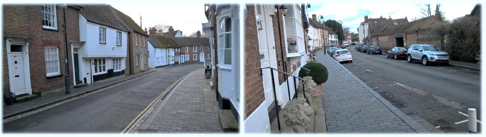
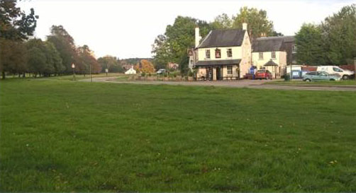
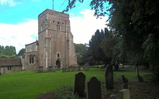
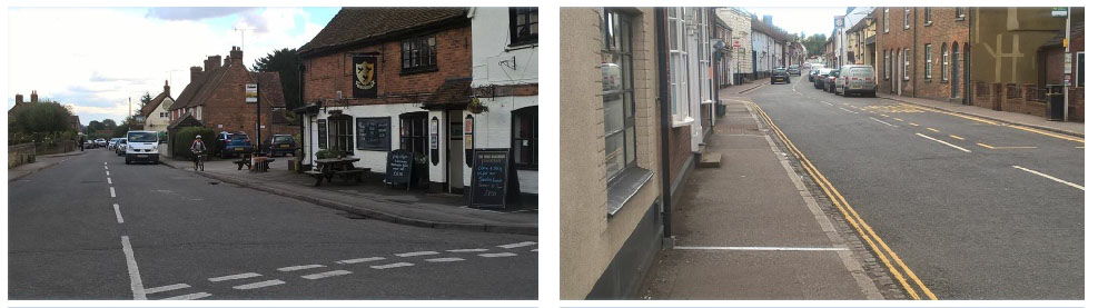
Two roadside inns, the 16th century Rose and Crown roseandcrownstalbans.co.uk and the 15th century The Six Bells the-six-bells.com remain landmarks in what locals still call “the village” (see left). Archaeological digs have revealed that The Six Bells stands on the site of a Roman bath house burnt down by members of Queen Boudicca’s tribe the Iceni around AD 60. There are references to Le Bell at St Michael’s in 16th century documents and it was renamed the Six Bells around 1770 to reflect the number of chimes in nearby St Michael’s Church (although it now has a ring of eight bells.)  Where the road divides in front of the primary school turn right and walk to the crossing in Bluehouse Hill. If you turn left in front of the school you’ll return to Verulamium Museum car park where you started. The “loop” is then complete.

True aficionados of ancient church buildings should set aside extra time to visit St Michael’s just behind the school. 

Much of the Grade I listed building is late 10th or early 11th century making it one of the most significant Anglo-Saxon buildings in Hertfordshire.  www.stmichaels-parishchurch.org.uk. The church houses the marble tomb of one of England’s greatest philosophers, statesmen, essayists and scientists Sir Francis Bacon, the first and last Viscount St Albans, who died in 1626. It is an historical treat.

Having crossed Bluehouse Hill you are now at the lodge and gate to the Gorhambury estate and Markyate is nine miles ahead. But there is still one historic gem that should be visited and is hardly a detour. On the left is the Roman open air theatre of Verulamium, the only example of its kind in Britain and one of the most important in Europe for having a stage rather than an amphitheatre. www.gorhamburyestate.co.uk.

The complex was built around 140AD and would have attracted crowds to religious processions, dancing, wrestling, armed combat and shows involving wild animals. In its heyday, possibly around 300AD, it could seat 2,000 people. The ruins were unearthed in 1847 and 1935.  Subsequent digs in the late 1950s/early 1960s, revealed a row of shop foundations, a Roman villa and a secret shrine thought to date from the 1st century. The theatre is open March 1st-October 31st (10am-5pm); November 1st – February 28th (10am-4pm), depending on the weather. It only costs £3 for adults to visit (students and seniors £2.50; children 5-16, £2.  Families £8.50). The site is well worth at least 30/45 minutes of your time. The column, by the way, is not an original but was erected to give a perspective of the stage.

Roman open air theatre and Gorhambury estate

Ahead lies a three quarter mile long walk along the tree-lined Gorhambury Drive amid a pastoral setting. The buried ruins of the Roman city are beneath your feet. The road is a permissive path normally open from 8am to 6pm. But there are days, particularly at weekends, when the drive is shut to the public. To check whether you need to make a detour log on to www.gorhamburyestate.co.uk which lists closure dates.

(The alternative route, after crossing the main road, is to turn right up the hill to Batchworth roundabout. Turn left onto the A5183 Redbourn Road and walk three quarters of a mile on the left-hand side pavement to Bow Bridge.  Locate the gate in the hedge, with a Ver Valley Trail waymark, opposite of which is a private road. The Ver is routed under the road at this stage.)

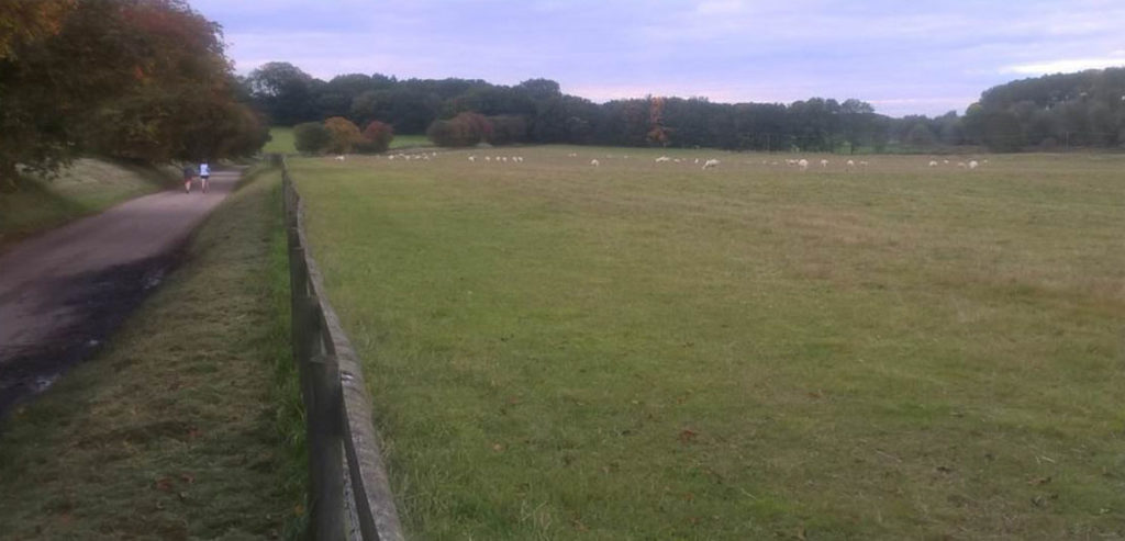
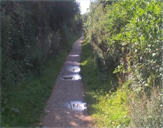
If Gorhambury Drive is open continue until a Ver Valley Trail waymarked path appears from the right. Rejoin the river in a confusion of undergrowth, muddy paths and small wooden “bridges.” At this point the sluggish, wayward Ver is striving to break free from the vegetation in search of a benignly friendly contour that could speed its way towards St Albans, Sopwell, Park Street and its confluence with the River Colne near Drop Lane in Bricket Wood. Its efforts often end in flaccid pools of water in nearby pastures and in the summer, when many ramblers are en route, its visible presence across the Gorhambury estate is difficult to spot. The Romans wouldn’t have recognized it. Their vessels sailed as far inland as St Albans.

It’s easy to forget that the Ver is a precious, fragile and vulnerable chalk stream, a globally rare watercourse. Of an estimated 220 (World Wildlife Fund figure) more than 150 are in England, most running through the southern counties. Only 12 worldwide are protected leaving many, including the Ver, at risk from over-zealous water extraction from aquifers, pollution from agricultural run-off, riverside development and non-native invasive species. As a result the flora, fauna and the water quality of these delicate ecosystems can be indefinitely impoverished. Although the Ver is only 17 miles in length the Environment Agency allows at least 30 million litres of water to be pumped up from underground sources to meet local demands each day. Vigilant volunteers, conservationists and laudably self-styled river guardians monitor and lobby on behalf of the Ver and its priceless habitat. www.riverver.co.uk  But the era when the healthily pure, fast-flowing and mineral-rich river that sustained a dozen water mills and a flourishing watercress industry is one for the history books.

When I crossed the Redbourn Road to be reacquainted with the slightly more robust Ver it was clear from the guide book that I would be in the company of the river until Redbourn.  Bear left keeping the watercourse on your left and follow the Hertfordshire Way or Ver River Valley Trail roundels. The routes coincide until near Redbourn.  Pass the charming Shafford Mill on a well-worn track until you reach waste treatment works in an old quarry. The route is not so clear-cut here so walk over the grass mound in an 11 o’clock direction and disappear into the undergrowth (very overgrown in summer) en route to Redbournbury Mill. Take a rest at the mill, even though you are not yet half the way to Markyate, at a beautifully carved wooden bench, one of a number commissioned as part of the Discover the River Ver Project. They interpret the local area on the carved backrests. Cross the footbridge and the mill stream and you arrive at the restored 18th century Grade II listed Redbournbury Mill, the only working mill on the Ver. 

Milling was recorded on the site at least 930 years ago with the Domesday Book listing it as one of the most valuable in the county. Redbournbury has been extensively rebuilt three times after fires, the last in 1987 which led to a 10 year restoration project. The mill and museum, and the bakery, are open from 9am-1pm on Saturdays and the mill on Sundays (1.30pm-5pm – 4pm in winter).  www.redbournburymill.co.uk

Top Left: Shafford Mill - Top Middle: Redbournbury Mill - Top Right: The Ver in summer
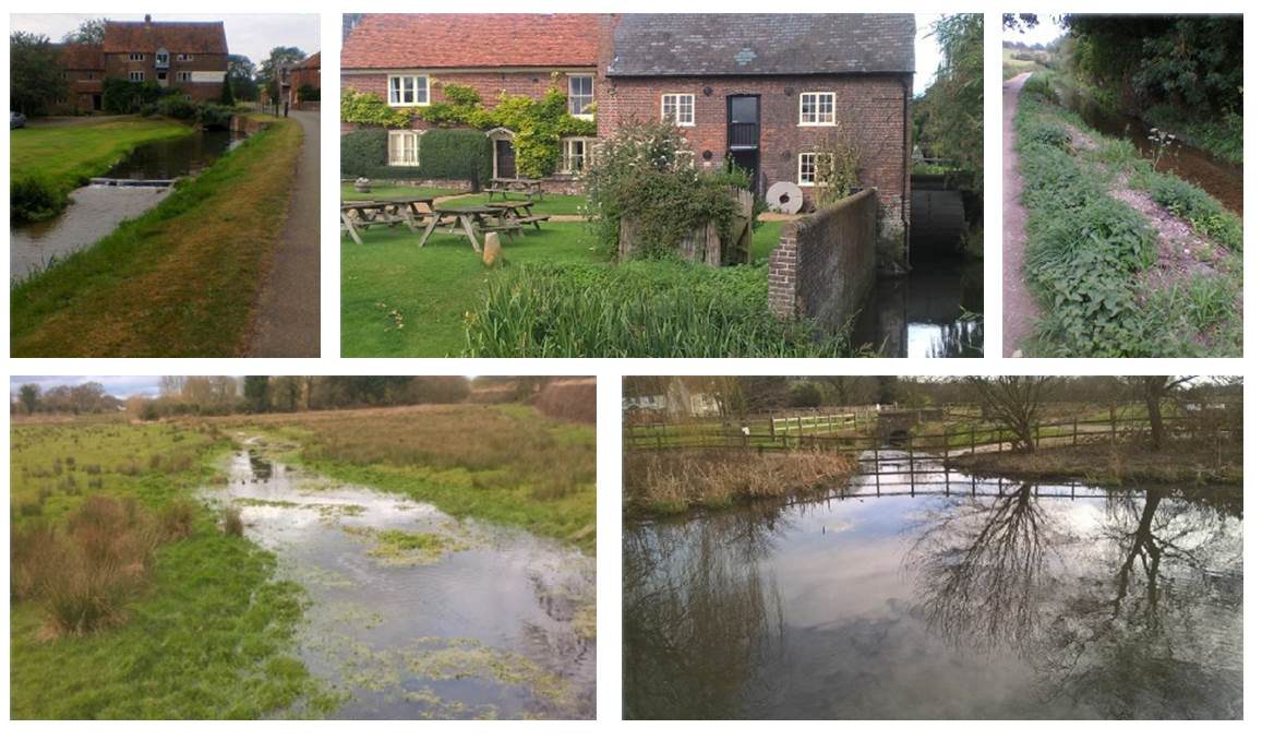
Bottom Left: The Ver in winter - Bottom Right: The Ver at Redbournbury Mill in Winter

Find a signposted path on the left of the buildings and follow it, with the river now on your right, to the A5183, cross the road into a farm, find a kissing gate and head right towards the A487 at Redbourn. If you want to visit The Chequers pub a couple of minutes away cross the road at Chequer Lane, follow the tarmac right to return to the kerb, cross over onto another tarmac path and follow it behind shrubs and trees into the pub car park. If you’d prefer to visit the centre of Redbourn turn right to the roundabout and take the first left under the railway bridge.

The charming and compact village has been settled since at least Saxon times. The bones of St Amphibalus, the priest who converted St Alban to Christianity, were reputedly discovered on Redbourn Common 50 years ago on the spot of a small priory. https://www.en.wikipedia.org/wiki/Redbourn www.british-history.ac.uk/vch/herts/vol2/pp364-371. Arguably the striking centrepiece is the huge common – much too expansive to be considered a village green and encircled by impressive houses – which remains the home of Redbourn Cricket Club, formed at least 200 years ago. Some Hertfordshire county histories, however, record cricket being played on the common as far back as 1666 – the year of the Great Fire of London. If true it would make the village one of the oldest recorded cricketing locations in England. The pavilion and square occupy pride of place off West Common, well situated for The Cricketers pub opposite. The common is worth a visit, being minutes from the route.

Redbourn High Street
The Cricketers, Redbourn Common
St Mary's Church
Historic Redbourn Cricket Club

Redbourn was once known as the “Street of Inns” with at least 25 pubs and inns at one stage to cater for the passing stagecoach trade. The arrival of the railways ended that Bacchanalian title. Now there is only one pub – The George – remaining in the high street.

I got the feeling walking around Redbourn that its past as a strategic transport stop-off has in part shaped the place – but the villagers are almost certainly grateful that that era has long gone. Retrace your steps to Chequer Lane on the A487, find the sign directing you through some bushes and up an embankment to the former Nickey Line, a branch railway from Harpenden to Hemel Hempstead which closed in 1979 after operating for a century and is now a footpath and cycle way. www.nickeyline.org. Increase your stride. This is half a mile of easy flat walking. If you wish to visit the common take one of the footpaths between houses on your right early on. Look out for the Norman tower of St Mary’s Church over the rooftops. You’ll find a roundel pointing to a narrow path between houses which takes you down to the Hemel Hempstead Road to enter the churchyard of St Mary’s stmarysredbourn.org.

The nave was built in 1110 with additions in the Perpendicular style built between 448-497 with further improvements over the centuries. The 900-year-old church was used as a stable during the War of the Roses. If you are seeking refreshments at this stage, or want a short break, the attractive Hollybush pub is through the gates at the bottom of the avenue of trees on the right side of the churchyard.

Looking back towards Redbourn
With your back to the tower, turn right to the church boundary and cross the easily identified path towards the M1 motorway until you reach Flamsteadbury Lane where you turn left. Then begins a mile long trudge first along a road and then a sturdy farm track through agricultural land. If you have a companion this is the time for a chat.  The scenery is pleasant enough but the exposed track and the clear unrelieved route ahead made this section seem, in hindsight, more wearisome then it actually is. Funnily enough I passed two dog walkers, some of the few people I saw on the route all day, (pub lunch excluded), including a lone rambler who looked remarkably like Margaret Rutherford. One fascinating oddity was the large number of chunks of flint littering the ploughed fields. Enough to keep a Stone Age community occupied for years (see picture above right). At the concrete barriers at a bend in the road turn right into a tree lined bridleway until a footpath sign on your left. In the distance is Flamstead. Ignoring all other paths that deviate from the straight and narrow drop down into a valley and then continue on until you emerge in a modern cul-de-sac called Linnins Pond. Turn left and then right into Trowley Hill Road and walk uphill to the village centre.
Left: St Leonard's Church, Flamstead - Right: Dry valley en route to Flamstead
Left: Medieval wall paintings rediscovered in 1930 - Right: Saunders Memorial Tomb. Late 17th century

Flamstead, which has 65 listed buildings, is a delightful ancient settlement, particularly around St Leonard’s Church at the “high point” of the village. There was undoubtedly a Roman community here but the first record of Flamstead didn’t appear until 1006 in a Royal charter. flamstead-herts.co.uk. The landmark building is St Leonard’s stleonardsflamstead.com. There was a Saxon chapel on the site around 825 but the tower, the pillars, the aisles and half the chapel straddle the 12th and 13th centuries although precise dating is impossible because the church was constructed in stages. A series of medieval wall paintings were uncovered in the 1930s and are regarded to be the most important in Hertfordshire other than those in St Albans Cathedral.

For refreshments the Three Blackbirds threeblackbirdsflamstead.co.uk and the Spotted Dog thespotteddog.co.uk, both Grade II listed buildings that date back to the 15th/16th centuries, are within a 30 second walk. If you explore the village you’ll inevitably discover a fascinating board opposite the Three Blackbirds which chronicles Flamstead’s heritage. Put up in 1994 to mark the centenary of the parish council it chronicles a time in the early and mid-20th century when the village was a vibrant community of eight farms in or close to the village centre, seven shops, nine inns, three schools and four almshouses, the latter of which still exist.

Left: The Three Blackbirds, Flamstead - Right: High Street, Markyate

Leave Flamstead by Chapel Road, turn left into Friendless Lane, take the right fork and look for the second footpath on your right.  From here it’s a simple, well signposted trek skirting a series of arable fields until you swing right when you reach allotments and then down through some trees to Pickford Road. Turn right for the centre of Markyate https://en.wikipedia.org/wiki/Markyate The village grew up around the old Roman road, Watling Street, and was a major coaching stop on the highway from London to Birmingham. At one point it had more than forty inns and public houses. Now there are two. Its status as a major road link disappeared when the parallel A5 was built by-passing the village. Many 16th century buildings can be seen in the high street but Markyate is now a humble dormitory village and is a relatively quiet and pleasant setting to mark the end of your journey..

Next, Leg 6.  A pure cross country journey amid rolling farmland and the wooded majesty of the Ashridge Estate, largely bereft of people, settlements and convenient pubs or stop-off points.  Fortunately all roads lead to Aldbury!