Distance: 11.5 miles

Start/finish: Free car park at Café in the Orchard www.intheorchard.co.uk  Radlett Road, Shenley; Cuffley train station, Station Road (Great Northern Railway).  Pay car park.

Map: Ordnance Survey Explorer map 182 and 174.

Public transport: There are no realistic rail links between Cuffley and Shenley (Radlett station). The only achievable route I can discover is to take the 242 from Cuffley Station to Potters Bar station then transfer to Metroline Travel bus 84 to Bell Lane, London Colney. Then it’s a 25/30 minute walk back to Radlett Road, Shenley. Arguably the most workable, user-friendly option is to use two cars – one left in Cuffley and one to return to in Shenley. Please refer to bus timetables and check whether there have been any route changes.

Pubs/restaurants: 

Route description: In some ways this is a mishmash of a “fill in” leg; at times dull – walking the streets of Potters Bar – and at others a disarming eye-opener. Namely the peace and quiet of fields and footpaths squeezed between major road routes. Although it is unlikely to feature on your list of favourite legs Shenley to Cuffley has its moments. Certainly the hinterland between Shenley and South Mimms is more rural and isolated than maps imply. The pillboxes dotting Potters Bar golf course are a curiosity. Northaw is a charming village and the viaduct near Cuffley a showpiece finale. The leg is a classic curate’s egg but, as with all the other day’s walks, will probably surprise and delight you.

Leave Shenley Park car park, turn right and then left to pass the walled garden. At Stable Flats turn right and, when confronted by a tree bearing waymark signs, bear left towards a double wooden gate leading on to Porters Park Drive. At the gates turn left on to an obvious path – the Hertfordshire Way shares the route with the Watling Chase Timberland Trail for the next third of a mile – keeping the hedge to your left and homes to the right. At gaps in the bushes you can see down to London Shenley Cricket Club (below) and across to St Albans Cathedral. The views are gloriously extensive and a reminder of previous days walking the footpaths of south Herts.

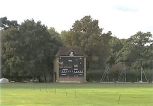
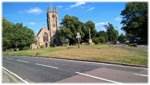
The cricket ground, which has had links to the local community for at least 150 years, was designed by W. G. Grace. The Porter family, who owned the Shenley estate in the latter part of the 19th century, asked him to replicate the dimensions of The Oval.   In June 1997 Denis Compton unveiled what is now known as the Denis Compton Oval, recognized as a major cricketing centre of excellence. Many national teams have played there including the West Indies, New Zealand, South Africa and Pakistan. The club must surely have one of the most impressive score “boxes” in the county, if not southern England.  Bigger than many cricket clubs’ pavilion it looms large over the square and is a landmark in itself.  

Follow the well-defined path skirting the fields until it starts to drop down on your left. Turn right at Red Footpath 1 sign and follow the track, initially through woodland and then on a track running behind houses, to appear in Porters Park Drive. Cross over, turn left and head towards the mini-roundabout at the junction of Porters Park Drive, Black Horse Hill and Shenleybury. Find the path across the road between the Black Horse Hill and Shenleybury road signs and turn left onto a rising bank which runs parallel to the B5378. It was at this point that the normally fool proof guide directions became ambiguous, with no signs – official or otherwise – to direct us to a cross field path. My walking companion and I pinpointed a large lone tree as described in the guidebook to break free from the undergrowth but nothing seemed clear cut. So we arbitrarily set out towards an isolated copse of trees across an uneven, scrappy and “blasted” tract of land until a largely indistinguishable ‘trodden’ track emerged from the left heading in the same direction. There was confirmation when we reached the copse and saw tell-tale pylons that we had returned to the official path.  Clearly there is a proper path further on but our route finding faculties, embarrassingly, failed.  But it was a very hot day!!

View from the track skirting the Porters Park estate.

After emerging from the trees follow the track that heads diagonally right to a farm track. Turn right along the track and then almost immediately left identifying another cross field path that continues at the same angle heading towards a hedge and prominent woodland. At a break in the hedge continue diagonally across the next field aiming for the right of the woodland (above right) where you’ll discover a disused brick building on your left. Continue up the path – a track will join from the right – and keep walking until you reach a hedge on your left and another dilapidated building on your right. Turn left following the line of the hedge to a stile which leads you into a field with a small wooded area straight ahead. Keep to the left of the woodland – I confess when we tackled this leg it was on a blistering summer day so we sought relief by walking through the wood – and locate a stile at a bend in the farm track.  Stay on the track and continue walking uphill towards Shenley Stud Farm. Look back at the view. It’s hard to think that the M25 is not far away.  All is quiet, the peace only interrupted by the sound of birdsong. After a dour build-up in the company of scrubby farmland all now is blissfully rural, a charming setting with far-reaching views. Certainly the highlight so far.

Continue up the track until your reach a large barn. Opposite in the left hand fence is a stile.  Climb that, turn right and walk to the right hand corner of the field where another stile will lead you on to Rectory Lane. Turn left and continue to the first buildings on your left. A kissing gate opposite, with its comforting HW roundel, points in the direction of the far left hand corner of a well-worn paddock. After a kissing gate walk between the hedge on your left and overhead lines on your right to another kissing gate in a narrow lane called Dovers Green. A kissing gate opposite leads you into an open field with the overhead lines pointing the way forward to a kissing gate in the far left hand corner by a small pond. Keeping the hedge line in the next field on your left pass through two more kissing gates to emerge in Packhorse Lane alongside Rabley Park Farm.

Virtually opposite, a gate leads into an open field. Bear right and find a kissing gate on your left. On entering a field turn right and follow the trees downhill to join Catharine Bourne for the first time.   Incongruously there is a memorial effectively in the middle of nowhere on this stretch (see below) supposedly built by the Dudding family to celebrate their cousin Horatio Nelson’s victory at Trafalgar.  Presumably the small obelisk had had better days before it was “re-erected in 1999.”  There is also a reference to another historical event which reads: “That the Earl of Warwick died here after the Battle of Barnet in 1471 is probably a myth.” So now you know!

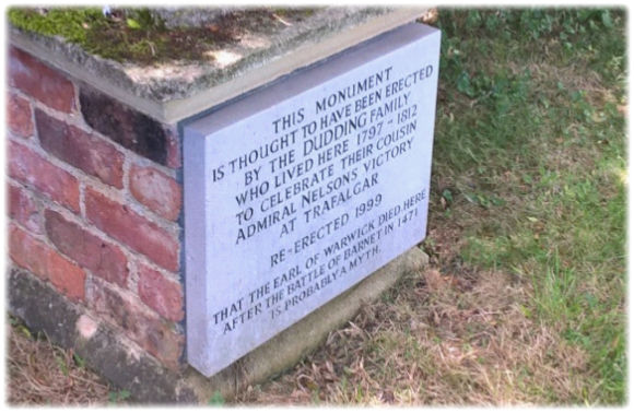
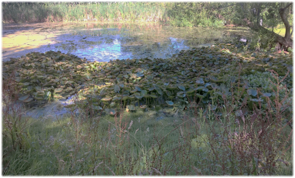
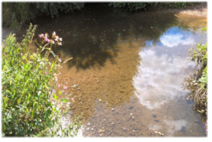
The Catharine Bourne (left) runs for a mile north east. You’ll be following its course on your right hand side to St Albans Road. From the monument the path skirts fields along the river bank. During our summer journey the path was pitted, rutted, bumpy, uneven and a menace to ankles. Sadly the brook was of little distraction being a series of intermittent trickles and isolated pools (see below) strangled by reeds and tangled undergrowth. Of all the water courses encountered on the Hertfordshire Way the weak-willed Catharine was sadly the one most worthy of sympathy. I am sure it behaves better in the depths of winter.

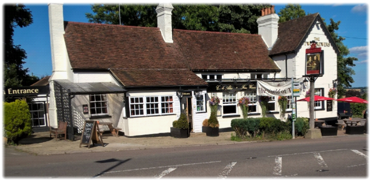
After about ten minutes walking with the brook in tow the M25 emerges from the left (top right) across the fields, those shrieking blue gantries a ubiquitous eyesore.  Go through the underpass and keep the brook on your right until St Alban’s Road. Cross over to a gap in the hedge slightly right and pick up the track with Catharine Bourne now on your left. Cross a bridge and appear between houses in Blackhorse Lane in South Mimms – believe it or not once the Holyhead road – with the welcoming Black Horse pub opposite. The pub is said to date to 1709 when it was called The Unicorn.

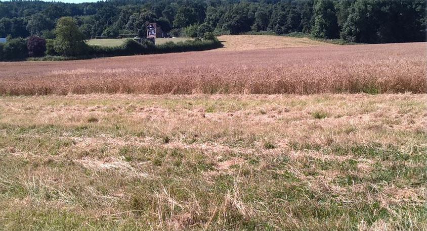
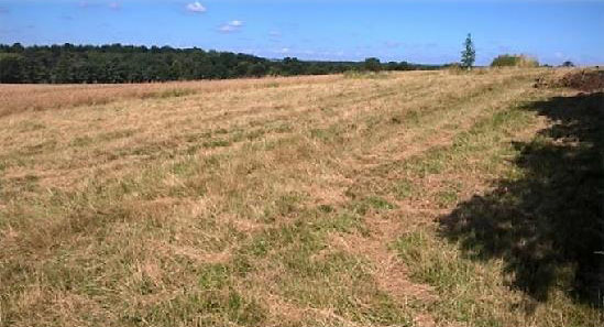
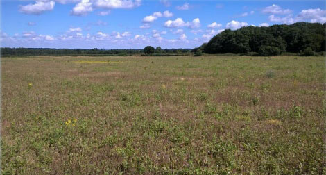
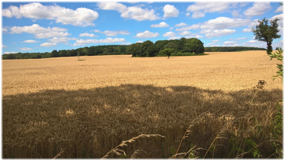
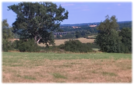
If eschewing a stop off, turn right when you emerge between the houses, cross over and walk 25 yards to discover a virtually anonymous track between houses that leads to a meeting of paths. Pinpoint a telegraph pole across a small stretch of rough grassland and head for that keeping a hedge to your right. Veer slightly left towards the pole and pick up a track which heads unerringly for the A1 (M). Once again you are now in arable country, albeit squeezed between the M25 and the A1. One aspect of walking through such countryside has always intrigued me. The isolated single trees interrupting the harvest-friendly open acres – and the oases of circular woodland that are a haven for wildlife and soften the skyline – seem to be wonderfully honoured and protected by the farmers. (see below) Are the trees and copses protected?  Or do farmers, out of respect for the landscape, ensure that heavy duty equipment assiduously avoids disturbing or damaging these precious symbols of sympathetic farming?  Seen from above trees and areas of woodland are tidily ploughed or harvested around. Wonderful.

When you reach the A1 (M) turn left and follow the path to a subway. Go under the road and on reaching Swanland Road cross and find a track slightly to the right which leads to a bridge over Mimmshall Brook at its confluence with Potters Bar Brook. Keep the brook to your left and head towards Warrengate Farm. After the first barn on your right cross the concrete bridge and, keeping the brook now to your right, follow it to the Cranbourne industrial estate.  You emerge amid a cluster of dreary warehouses, depots and small businesses. However, there is a final nod to a green pathway. Cross Cranbourne Avenue and a narrow path ahead, rubbing shoulders with neighbouring buildings, reappears a minute later in Cranbourne Road. Turn left and a sturdy metal fence at the bottom of the railway embankment leads you to a tunnel onto the former Potters Bar golf course.

The golf club, formerly the home of Tony Jacklin, shut in 2018.  As of early 2020, residents were being consulted on a range of plans to develop the land including a hotel, cycle path, conference centre, library, hundreds of homes and even a nine hole course.

Turn right following the railway until you first reach a World War II pillbox and then rejoin Potters Bar Brook which heads left in a narrow channel crossed by a number of small bridges. Follow the brook passing by another pillbox (below left).

The pillboxes were once part of London’s last line of defence against the Nazis. That heritage has become clearer after the club removed brambles and undergrowth that had covered two pillboxes for the last 20 years. The structures – built between 1940 and 1941 – were part of a defensive ring around London as the country faced the prospect of a German invasion. Around 28,000 of the concrete squat military boxes were built at strategic points across the UK of which around 6,000 still stand. It surely must have been an inactive, unheroic posting to while away the hours in a cramped overgrown prison cell overlooking the 5th fairway. The club opened in 1924 so the course would have been long established. Imagine the unsettling experience in the post war years when a grandchild asks:  “Grandad. What did you do during the war?” And having to shamefacedly admit: “I was ready to spring into action against German paratroopers in case they failed to rake the bunkers on the short 8th,”

Follow the brook past a number of bridges (see below) until a sign points you right towards a sloping path through the trees into a short drive on an up-market housing estate where you turn right and then left into Mountway.

With due respect to Potters Bar it is an archetypal, anodyne slab of commuter belt surburbia. Faux executive homes in serried ranks of manicured front gardens and block paving drives convinced me it was monied – but largely charmless.  How ironic that a former agricultural settlement that developed after the arrival of the Great Northern Railway in 1850 is often synonymous with a rail crash in May 2002 when a northbound train derailed at speed and ploughed along the platform at Potters Bar station killing seven people and seriously injuring another 11. The origin of the Potters element of the town’s name is uncertain but is generally thought to be either a reference to a Roman  pottery, believed to have been sited locally, or alternatively to the Pottere family who lived in neighbouring South Mimms parish. The Bar is thought to refer to the gates leading from the South Mimms parish into the Enfield Chase parish, or possibly from some sort of toll on the Great North Road. Apart from Hertford, Bishops Stortford and Royston, Potters Bar is one of the largest towns you will pass through,

Potters Bar has little to offer the Hertfordshire Way walker from here on in. The next 20-30 minutes are dreary and worth stepping up the pace to cover the ground as quickly as possible. Walk down Mountway to the junction of Darkes Lane and Church Road and turn left.  Walk up Church Road and take the third on the right, Quakers Lane. Walk down that to the Hatfield Road. Directly opposite you across the road in a hedge is a kissing gate with a Hertfordshire Way sign. Enter the field and identify a supposedly well-defined path which heads straight on towards a line of hedges.  I must confess we strayed off route here, failing to spot a crucial hole in the hedge. We drifted aimlessly around a large field searching for clues before a Eureka! moment. I am not sure whether the route was poorly signposted or we had been seduced by the heady delights of Potters Bar and taken leave of our senses. Either way, after passing through the gap head diagonally right across another open field – the path here was easy to spot – following the hedge on your right. Go through the kissing gate and with a small wood to your left pick up an obvious path which quickly drops down right past Northaw House, goes over a bridge and pops you out through a narrow gap in the tree line at the junction of Well Road and Judges Hill. Cross over into Judges Hill – keeping Well Road behind you – and walk a third of a mile downhill into Northaw keeping to the narrow pavement on the right. Just after the Northaw village sign a large reed and water lily smothered pond on the left welcomes visitors.

For once the pond (below) isn’t a centrepiece of village life.  Nevertheless it’s an attractive setting – ignoring the road noise – and worth spending a few minutes sitting by. 

Northaw, with such a bewitching classic English village façade, seems to be extraordinarily humble in sharing its past with the wider world via the internet if you’re keen to discover its history. Whereas other less attractive places boast of sylvan glories and a past shaped by at least four former kings, Northaw’s history, while not inconsequential, embraces all that is best about modest aggrandisement. Arguably this conservation area around its triangular village green with its church and its pub and cocktail bar/restaurant is the epitome of what romantics would undoubtedly champion as a quintessential and much-loved treasure of English life.  Part of a rural idyll that has inspired everyone from Wordsworth, Hardy and Constable to Martin Wainwright and Bill Bryson. But then we have already passed through Ayot St Lawrence, Aldbury, Letchmore Heath and Aldenham.  And there will be more such highlights to come.

Northaw is believed to be one of the original Manors granted to the monks of St Albans in 793. Northaw Woods was part of the Enfield Chase. The Grade II listed parish church of Thomas a Becket was built in 1881after a fire destroyed the previous place of worship the same year.  It was swiftly rebuilt courtesy of the benevolence of parishioners and local families and consecrated the following year.  A church has existed in Northaw since the early 13th century when the first building was erected to commemorate the murder of Thomas a Becket in Canterbury. The current church has six bells in its impressive tower.

If you seek refreshment before embarking on the final leg to Cuffley The Two Brewers (below left) is situated next to the church and Judges, a cocktail bar and restaurant – formerly The Sun pub – is opposite the church.  If not rejoin the Way on the left hand side of the church in Vineyards Road and, keeping to the friendly grass footpath on the right, continue walking until the houses on the right end on a slight bend where a kissing gate under a large tree, and next to a metal gate, leads into a field. The final stretch starts left and downhill on a well-trodden path for just over a mile to the outskirts of Cuffley.  However, if you want to see the Cuffley (correctly Soper’s) Viaduct in all its historic glory walk 50 yards into the field and admire the Victorian workmanship across the valley (see below right).

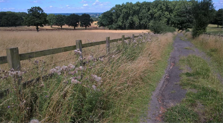
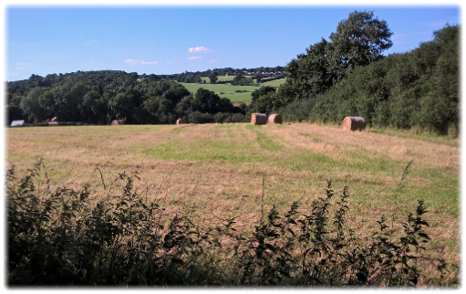
Continue on the path as it drops downhill, through kissing gates to the valley bottom where it veers right. There’s some charming scenery to be enjoyed en route (see left and below right) – the classic picture postcard English countryside. Cross a bridge where the Hempshill Brook runs parallel to the path on the right and then recross it when the Hertfordshire Way coincides with the Chain Walk. Keeping the stream on your left join a wide farm track that passes a pumping station and related cottages and then a large field that was being used for car boot sales until you emerge in Northaw Road East.  Turn left, cross over and walk for five minutes towards the welcome to Cuffley sign. Next to the King George V playground and car park, a gap to the right of a metal gate sends you down along a path and under the railway track.

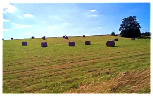
Turn left at the waymarks and follow the hedge alongside the railway and then hard right around the field perimeter to a kissing gate. Keeping the next hedge on your left aim between warehouses and a petrol station on your left and a youth centre on your right to ingloriously emerge in Cuffley Hill. Turn left to reach the station. Sadly The Cuffley pub, one of only two remaining in the 4,000 resident village, is now a Tesco Express. Ironically Tesco’s former Chief Executive Officer Sir Terry Leahy lived locally. But the trudge into a cheerless, bland shopping centre was symptomatic of a dreary anti-climax after a decent day’s walking. Cuffley is like a mini Potters Bar without the pill boxes.

Now you have a choice. To reach Hertford you can either do it in one leg or spend two days in a circuitous route which deliberately seeks to embrace the delights of the New River and the River Lee (or Lea), a tributary of the Thames which is navigable to Hertford, and the ancient woodland around Broxbourne. I decided to head for Hertford and leave the detour to another day(s).

Next: Leg 10. Cuffley to Hertford. After a disappointing start spirits lift when you reach the superb Candlestick Inn.