Distance: 11.1 miles

Start/finish: Start at the Royse Stone at the junction of King Street, Melbourn Street and Baldock Street, Royston.  Pay parking nearby.  Some streets near the heath have on-street parking.  Finish at The Street, Wallington.  Small free parking spaces by the old red phone box.

Map(s): Ordnance Survey Explorer maps 193, 194, 209

Public transport: Royston is on the King’s Cross to Cambridge Line (Thameslink and Great Northern). There are many bus routes serving the town.  There appears to be no public transport serving Wallington.  This is, effectively, a two car leg.

Pubs/restaurants: Countless outlets in Royston.  Only one pub en route, virtually half way.

Route description:  If you start the anti-clockwise 195 mile walk from Royston it should be in a spirit of exhilaration and expectation.  Because you don’t have to wait long before it reveals its first highlight, the climb over Therfield Heath to the chalk escarpment with breath-taking views back across the town with flat Cambridgeshire and The Fens stretching to the horizon.   It is a stunning introduction to the county’s varied topography – it’s not always such an indulgent eye-opener as you will quickly discover – as the route continues diving in and out of woods.  And always with that spectacular backdrop. But after such an overture there is a tiresome stretch on seemingly endless farm tracks skirting vast fields – grazed by a 50-strong herd of roe deer when I passed through – and then a steep, narrow gulley requiring a lot of huffing and puffing before you reach the pretty village of Therfield and The Fox and Duck pub, the only stop off. The second half embraces isolation, lonely paths, three churches, two villages, a proliferation of kissing gates, silent woods and verdant pastures.  This leg can legitimately be seen as a template for what is to come, juggling sublime scenery with tedious trudging along featureless farm tracks and through uninspiring woodland. And then, suddenly, you emerge – often through a churchyard – into a charming, untouched traditional English village or a hidden hamlet; or you find yourself alone in a silent historic wood or walking alongside a chalk river.  As you’ll discover on this leg, the Hertfordshire Way is never anything other than, plagiarising the Beatles, a magical, mystery tour. Even that’s an oversimplification.

Royston, at the northern tip of the county, is situated on the Greenwich Meridian which brushes the town’s eastern boundary. It grew up at the crossing of the Roman road Ermine Street and the prehistoric Icknield Way.  The county line between Hertfordshire and Cambridgeshire ran through the town east to west until the late 1800s. In 1604 James I decided to use the countryside around Royston for hunting and had a lodge built which he returned to every year. He prohibited anyone taking game from land within 16 miles of the town and an elaborate infrastructure was created to support his hunting pursuits.  His successor, Charles I, visited Royston less frequently though he was brought through the town as a prisoner of the Parliamentary Army.  Royston Golf Club is the oldest 18 hole course in England. The sport has reputedly been played in the town since 1624.  Two Cambridge University students laid out the course in 1869. For information about the Rowse Stone go to Leg 14.

Let’s leave Royston as fast as we can and head for the hills.  With your back to the Royse Stone, and the Jolly Postie pub on your left, turn left and walk up Baldock Street which rises to become Baldock Road. Just before the heath at a block of flats called Goodes Court, turn left into Royston golf club and pick up the path behind the clubhouse.  There are a myriad of intersecting paths and alternative routes criss-crossing the heath but you continue straight on keeping the trees and fences on your left. At the first rise you’ll see a dry valley with a distinctive dip ahead of you. Keep left, you’ll be accompanied by countless dog walkers, until you feel ready to descend into the dip.  Take the wide path uphill to a crossroads and identify a HW roundel at the bottom of a narrow path ahead of you.  There is another roundel on a ramshackle sign pointing out of the undergrowth.  At the tree line ahead turn right onto a clear path which switchbacks through a series of woods, with frequent drops and steep inclines, emerging every so often alongside fairways and greens.  The panorama remains superb.  The woods are old and the uneven path is disfigured by prominent and shiny tree roots which can turn an ankle or trip the walker up.  Fortunately, there is little to see confined to the tree cloaked route so it’s better to watch where you are treading.   Be careful.

Views from the escarpment back over Royston to Cambridgeshire and The Fens. On a clear day you can see Ely Cathedral 20 miles to the north

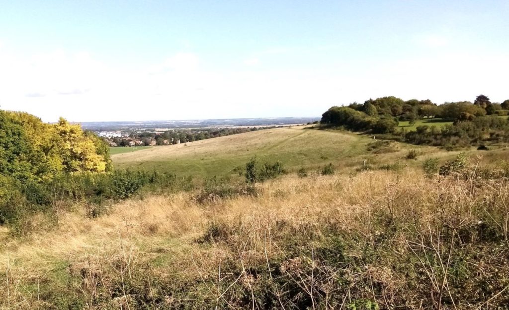
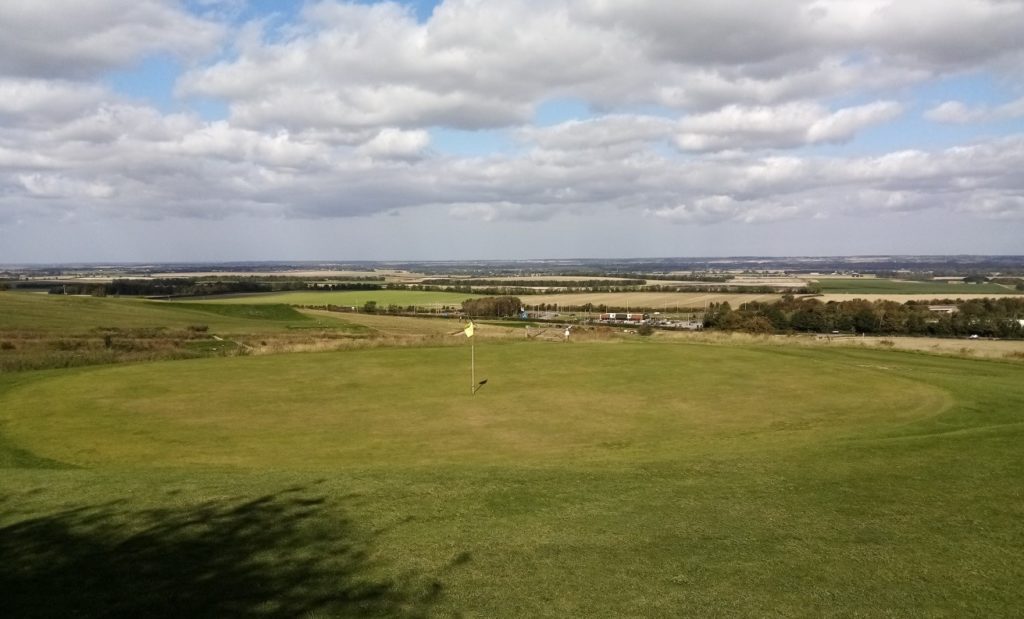
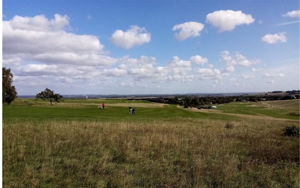
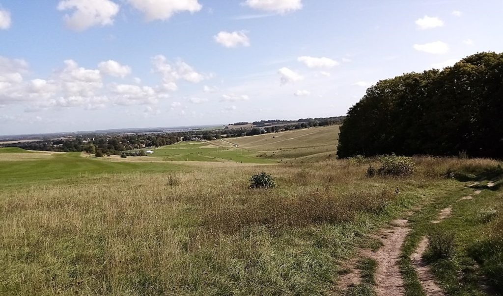
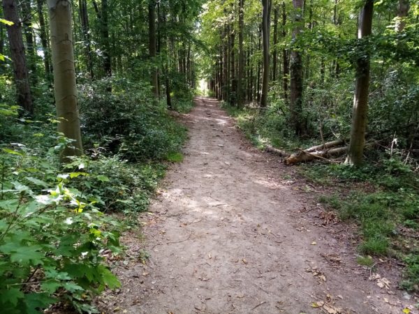
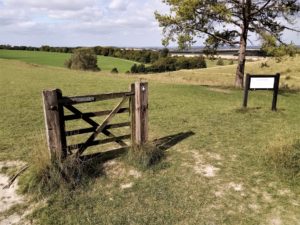
Continue on the path until – with a large cultivated field on your left behind bushes – you reach a green on the golf course with a distinctive gravel path just behind it.  Turn left on that path and skirt a steep valley.  Enter a small wood and take the right hand fork to emerge on the road to Therfield. Almost directly opposite, but slightly left, a rambler’s “scissors” gate leads you into more woodland.  After a short while on the clear track you’ll find a path on your left leading into Jubilee Wood.  Continue on down a majestic line of beech trees (see right) into Fox Covert Nature Reserve.  The secret to not being lured off route in these woods is to continually go right, particularly at a critical fork where the path on the left heads towards a wooden five bar gate.  Go right here and just through the woods on your left is a wide opening onto Church Hill.  There is a bench here, a somewhat pointless wooden gate (see below) and a warning that you are at the mercy of wayward golfers!  Walk along the crest, with a classic example of a dry chalk valley below on the left and the golf course down on the right.  And still those views.  en.wikipedia.org/wiki/Therfield_Heath

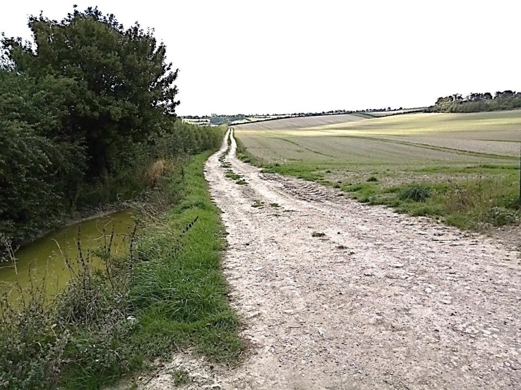
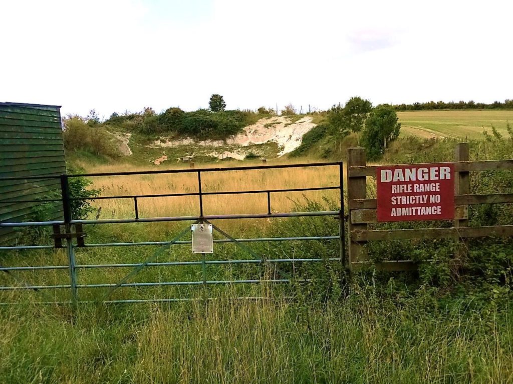
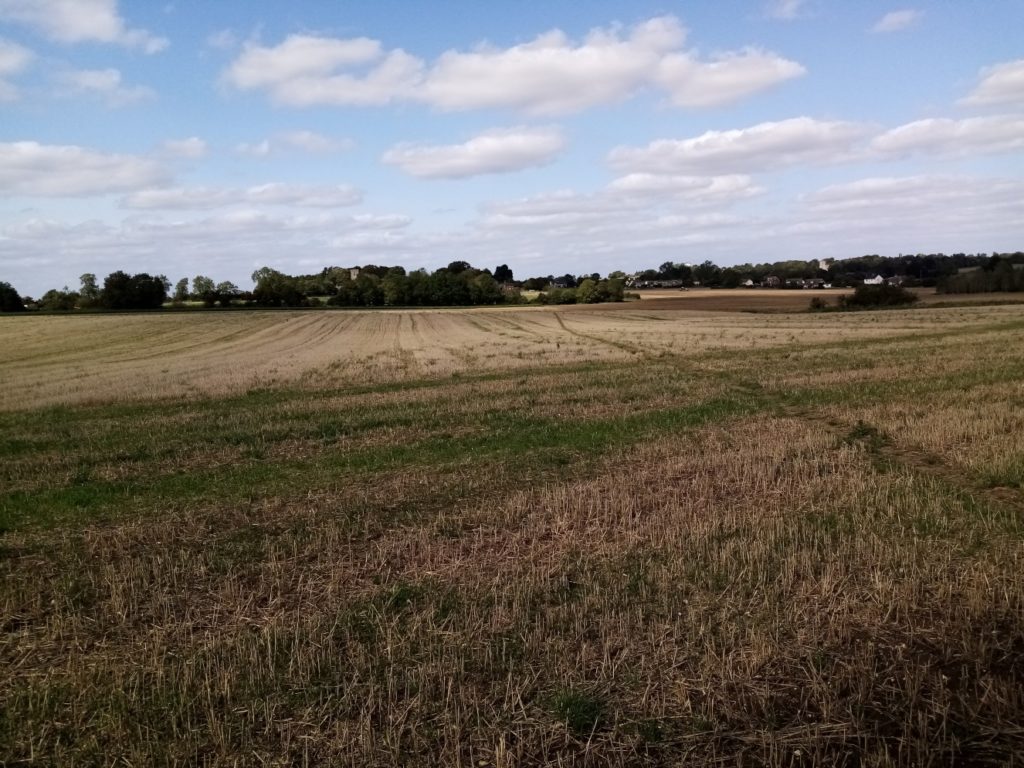
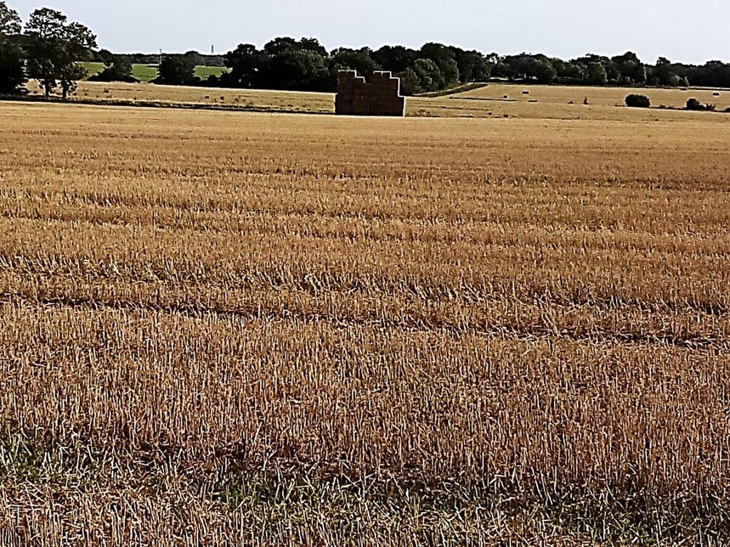
When the ridge starts to drop steeply, bear right – avoid the tempting kissing gate down on the left – and descend to another scissors gate.  Turn right and you’ll be reacquainted with the golf course after 50 yards.  Ensure you walk to the furthest hedge/tree line – don’t be suckered into turning immediately left – with a green and bunkers on your right and gallops further across the field running parallel to the A505.  Nothing else should confine you. Now follows a dreary and laborious three quarters of a mile trudge along the line of, initially a hedge, and then trees.  Until Therfield it’s all a bit uninspiring and unalluring.   Don’t worry.  You’ll be rewarded for your efforts and patience later.   Eventually there’s a gap in the treeline at some houses leading into King’s Row. Turn right and continue down to the farm entrance.  A wooden gate in a small hedge on the right leads into the yard.  Continue straight on to reach a farm track with a hedge on your left, and countless acres of open arable land on your right stretching into the distance (see below left).  The Hertfordshire Way coincides with the Icknield Way trail for the one and a half miles to Therfield. The hedge becomes a mesh fence at a junction (don’t go left). Continue on a track between open fields passing a rifle range (below left). 

It was at this point, about a quarter of a mile away, I spotted what I initially thought might be cattle or sheep. The eyes are going.  Age.  But as I drew closer it was obviously a herd of roe deer grazing on the stubble.  Possibly 50, strung out in a sedate line across the land (below).  It was only a matter of time before I was spotted, or smelt.  Alerted by a vigilant sentry with ears pricked, the herd was spooked and bolted into the distance.  But what a wonderful sight.  It certainly broke up the monotony of farm track walking. 

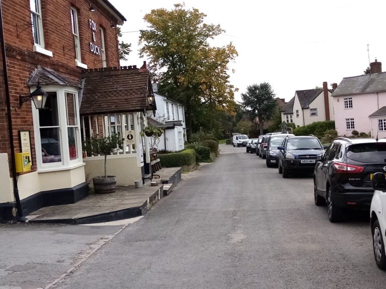
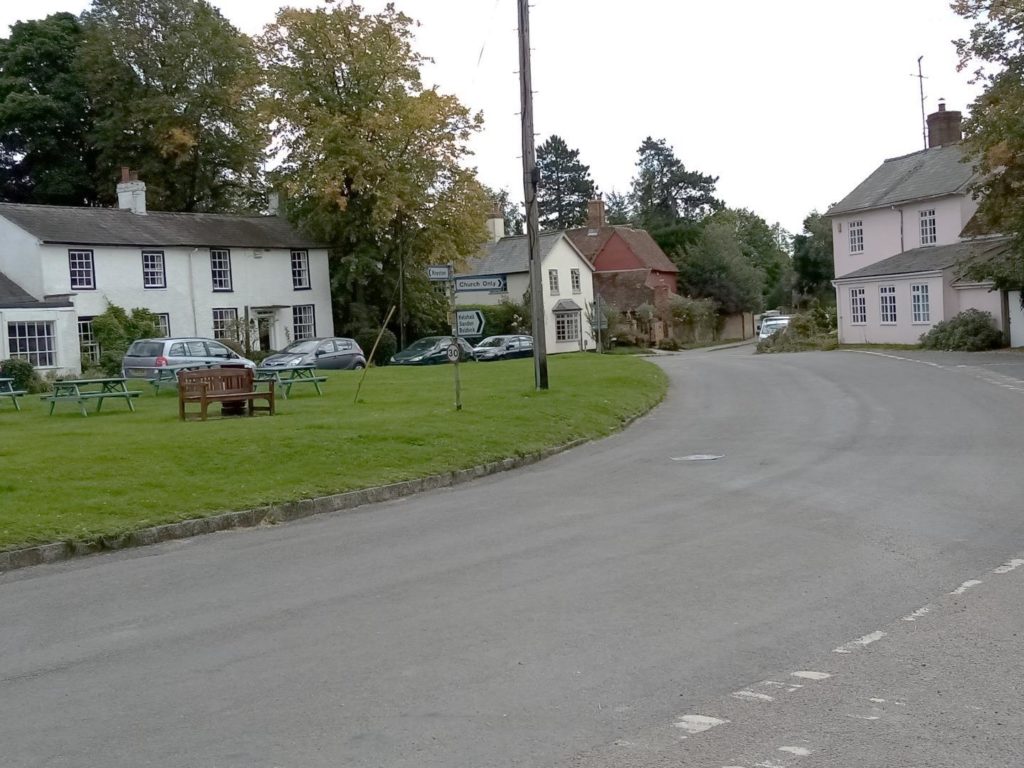
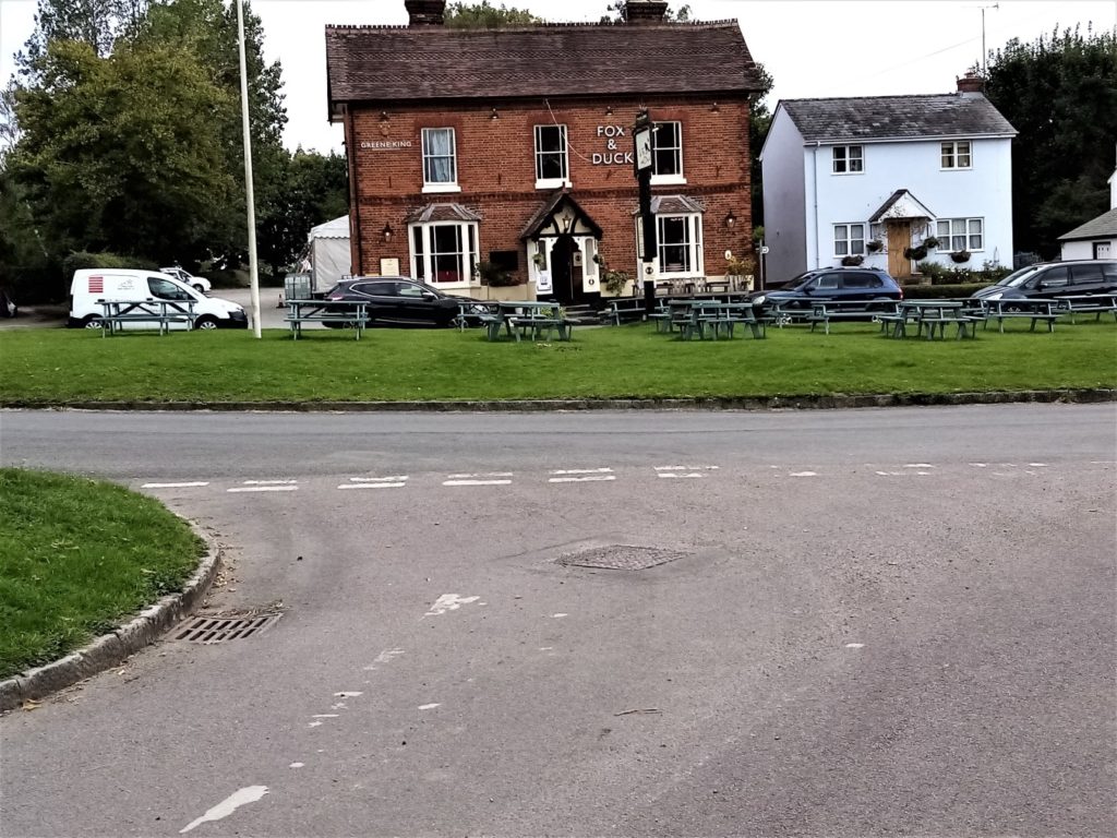
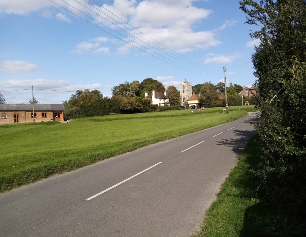
At a junction of paths, where a sign tersely prohibits moving forwards, head right across the field towards a hedge and trees, the path eventually narrowing into a tree shrouded, muddy v-shaped gully which climbs steeply and uncomfortably to emerge at a road opposite Tuthill Court.  Turn right and at the end of the hedge on the left, turn left into a rough track which leads to a water tower.  At this point on Therfield Hill you are at 551 feet, the highest point for 12 miles in every direction.   On your left there are two stiles leading to separate footpaths.  Climb the second one and enter a scrubby, lumpy, uneven field and aim for the wooden posts at its centre.  At the posts go diagonally right cutting an arbitrary route among the mounds of an ancient motte and bailey castle to a stile in the hedge on your left. Follow the path with a hedge on your left to the gravel drive of a large house. Go down the drive and turn left into Therfield village.  Your solitary stop-off for refreshments is the Fox and Duck opposite.  Take advantage of the pub tables set out on the village green (see below).

Therfield was inhabited long before the Anglo Saxons arrived as the Icknield Way runs through the village on its 110 mile journey from Ivinghoe Beacon in Buckinghamshire to Knettishall Heath in Suffolk.  Neolithic barrows have been found on Therfield Heath.  The previous church of St Mary the Virgin, which had existed since the 13th century, fell into disrepair and was replaced by the existing building completed in 1876 (below).   The tower contains six bells dating between 1597 and 1707 although for years they were never used.  Instead the call to worship was announced by the ringing of a bell dating from 1862 that hung from a tree in a nearby field. en.wikipedia.org/wiki/Therfield

You leave Therfield by the cul-de-sac Church Lane, opposite the pub.  For now on, apart from those living in or visiting the two villages en route, you are unlikely to meet anyone until you reach Wallington.  If you have a phobia about kissing gates the second half of the day’s walking will send you into paroxysms of despair.   They come thick and fast.  Most seem to be new. At the bottom of Church Lane, go into the churchyard bearing left to the obvious gate.  Turn right and continue unfailingly ahead.  There are wide ranging views either side of the path. Cross a bridge and go through a kissing gate to arrive at Kelshall. Turn left and walk down the road, passing a pond (below left) and the village hall to where the road splits at an obelisk (below right) sited on a small triangle of grass.  It was constructed to celebrate the second millennium and has a time capsule in its base. kelshallparish.org.uk/the-village/kelshall-history

Follow the road to the right and immediately veer left into a signed cul-de-sac.  Between two houses and alongside a brick wall a grass path takes you into the grounds of St Faith’s Church (upper left).  

The church was restored between 1868-70.  The ceilings are painted in a medieval style, but are recent.  The layout of the land around the church suggests that there was probably a moat at some stage.  

Go out through the main gate, cross the road and enter the field beyond through a five bar gate. Aim for the fence on the right and identify a kissing gate.  Go through it and follow the path between fences before passing through four kissing gates in quick succession to appear on the edge of a huge field.  At this point I feel obliged to criticise the normally scrupulously accurate route directions in the third issue of the FTHW guidebook.  The path heading slightly diagonally right (think of one o’clock if straight ahead is 12 (see picture on the upper middle from the opposite side of the field), supposedly takes you to a white marker post.  This is all well and good if the white paint hasn’t faded, making it virtually impossible to spot against the treeline at the other side of the field.  But the next instruction – “at the white marker post take the footpath slightly diagonally right to another white marker post on the opposite side of this large field” – is not only ambiguous but desperately confusing.  There is a metal HW sign alongside the ‘white’ post pointing right.  But all you have to do is to drop down into the bridleway behind, turn right and walk to a path on your left where two roundels and a No Horse Riding sign point the way ahead alongside Lords Wood on your left and then Philpott’s Wood on the right.  The path bears left to reach a gap in the treeline. Go through and over a stream – forget about the gate on your right – where a path on your left leads into a sunken bridleway which ends at a drive to a house.  Turn left down the drive and then right when you reach the road.  At a T-junction a sign points to ‘Wallington – 3 miles.’ Turn right and at the bend turn right onto an obvious track.  Follow the enclosed bridleway to a road.  Turn left and walk along the road to the “Sandon. Please drive carefully” sign, alongside which a path heads into the trees to emerge in the charming churchyard of the Grade 1 listed All Saints at Sandon (below). 

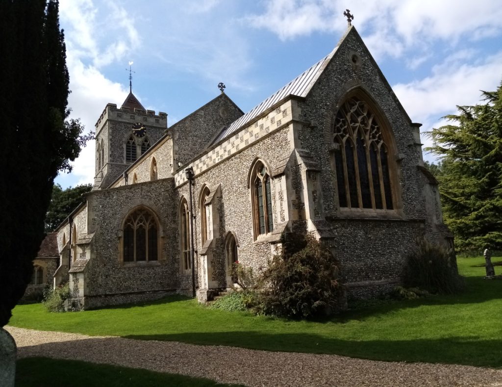
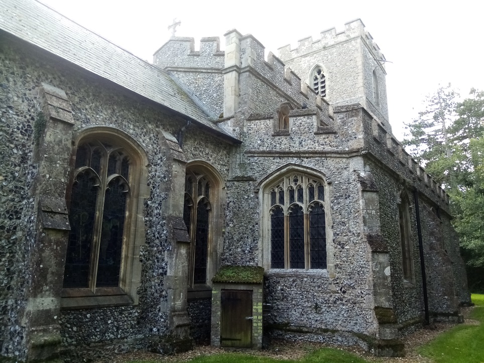
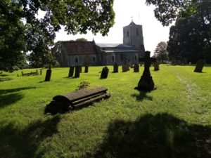
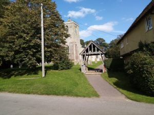
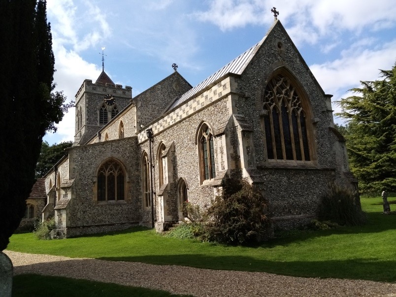
All Saints is known for its distinctive tower buttresses, constructed in the 17th century. They are now purely decorative as they are now no longer needed to support the tower.   The church was originally started in 1348, but work stopped during the Black Death restarting at the end of the century. It was greatly added to in subsequent centuries and underwent restoration in the late 19th and early 20th centuries.  Of note are the 15th century pews at the rear of the church and the chancel screen, and the 17th century pulpit. sandonchurch.org.uk

Leave All Saints by the lych gate to appear in the pretty village of Sandon (below left and right)) with its wide green, pond and impressive sign.

Sandon, which is one of the highest villages in the county at nearly 500 feet (slightly less than Therfield), has 47 listed buildings including one of Britain’s estimated 200 medieval barns, circa 1266.  At the time of the Domesday Book it was one of a number of manors in Hertfordshire which belonged to St Paul’s Cathedral, a relationship which ended in the 19th century sandonherts.co.uk

As you drop down from the church to the village, stop off at the pond (below), walk down Rushden Road past the bus stop and the school, and bear left at the bottom, looking out for a kissing gate in a hedge on the right which leads on to a cross field diagonal path heading towards two back-to-back kissing gates in a wooden fence (bottom left).

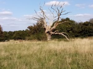
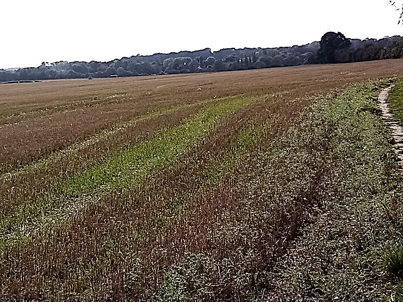
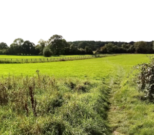
Maintain your diagonal route across the next field, pass through two more kissing gates and follow the track slightly left to –guess what – two more kissing gates divided by a track.   Continue directly ahead to another one, go through and follow the path round to the left to one more. A kissing gate that is. Follow the path beyond to another kissing gate over a small bridge out on to a road which cuts through a vast green – on the outskirts of Roe Green – which doubles as football pitches, and because of its size, probably much else besides (below left). Cross over and take the gravel path towards some houses.  Locate, on your right, a narrow footpath between houses to a field – home to a blasted oak! (above right) – and go through a kissing gate to the right hand corner of the field, through another kissing gate and over a bridge to a field perimeter track.   Turn right and with featureless and, by now, “so whattish” farmland on your left (below centre and right), walk a dreary, interminable mile to a road at Redhill. At times, hundreds of acres of harvested land can lose its appeal.

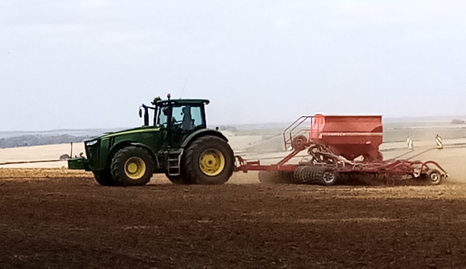
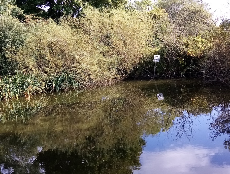
Cross over the road and head diagonally left to a wooden bridge over the quaintly named Cat Ditch.  Climb slightly right with a hedge alongside.  It was here, at an opening between trees and a confluence of paths, that a tractor appeared doing what tractors do in late afternoon. But what was most striking was the backdrop.  A huge vista across the flat Cambridgeshire countryside once again.  A sweet reminder, and a glorious ‘book end’, to the opening chapter of the day.  That climb up the chalk escarpment overlooking Royston and way beyond.  A fitting finale. At this spot, pinpoint the black silos at a farm diagonally right across a scrappy field with the path leading to a kissing gate.  Beyond it is a meadow and the finale. A last kissing gate which takes you downhill past a modest pond into Wallington.

Leg 1 started with a bang, settled into drudgery en route to Therfield, became more bullish and ended with a pastoral flourish; the latter half a utopia for kissing gate afficionadoes.  In a way it is a shape of things to come.  But your affection for the Hertfordshire countryside will grow and remain undimmed. After Leg 1 there’s about 184 miles to travel.  It’ll go quickly.  Even if you don’t.

Next Leg 2.  A probably lonely – and, therefore, peaceful and uncomplicated – walk to Little Wymondley. Distinctly rural but topographically benign.  Not to mention Jack-o-Legs!